
ASHEVILLE, N.C. (828newsNOW) — Three wildfires burning across Western North Carolina have charred almost 4,000 acres in the last few days.
Bee Rock Creek Fire (McDowell County)
McDowell County Emergency Management lifted the evacuation order for residents along Wild Acres Road on Sunday. Officials urged returning residents to remain cautious and aware of any ongoing firefighting activity in the area. Smoke and emergency vehicles may still be present.
The 1,397-acre fire (according to the North Carolina Wildfire Map) is burning in steep terrain and storm debris in McDowell County near the Armstrong State Fish Hatchery. It is 27 percent contained and has 195 personnel from the USDA Forest Service, North Carolina Forest Service, National Park Service, McDowell County and Woodlawn Fire Department working it.
The area of the Bee Rock Creek Fire between Armstrong Creek Road and the Blue Ridge Parkway for public and firefighter safety. Some sections of the Blue Ridge Parkway are also closed. Check the National Park Service website for details before visiting.
A Temporary Flight Restriction is in place over the fire area each day from 10 a.m. to midnight. See the map here. Aircraft, including drones, are prohibited from flying to provide a safe environment for firefighting. If a drone is spotted near the fire, all aircraft are grounded until the drone is clear of the area.
Sam Davis Road Fire (Swain County)
The 350-acre fire is burning in the area of Sam Davis Road, Gospel Road, Big Rocky’s Road, Dark Branch Road and Bobcat Trail 4 miles southwest of Bryson City. As of Monday morning, it was 0 percent contained.
Aircraft are assisting in protecting homes and supporting firefighters on the ground. Crews are working around the clock to protect lives, property and natural resources.
The fire area includes several narrow mountain roads. To ensure safe and efficient access for fire crews and emergency vehicles, non-resident traffic will be turned around. Some roads may be closed.
Evacuations have been ordered for the following areas: Big Rocky’s Road, Sky Cove Development and Bobcat Trail off Dark Branch Road.
An estimated 30 homes have been evacuated, though the specific number is still being verified.
Responding agencies include firefighting personnel and support from the North Carolina Forest Service, Swain County Emergency Management, Swain County EMS, Swain County Rescue, Alarka Fire Department, West Swain Fire Department, Bryson City Fire Department, Swain County Sheriff Office, Graham County Fire Department, Jackson County Fire Department, Saunooke Fire Department, Qualla Fire Department, Cherokee Fire and Rescue, Valley Town Fire Department, Cowee Fire Department, Otto Fire Department, Stecoah Fire Department, Crab Tree Fire Department, Murphy Fire Department, Martins Creek Fire Department, North Carolina Wildlife Resources Commission, BIA and U.S. Forest Service. Additional local, state and federal partners are providing critical assistance.
Do NOT fly drones in or near the fire zone. Unauthorized drone use is dangerous and will ground all air operations.
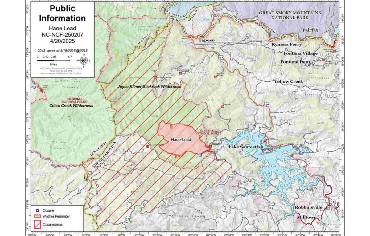
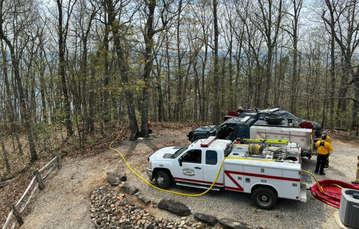
Haoe Lead Fire (Graham County)
The Haoe Lead Fire has burned about 2,043 acres within the Joyce Kilmer-Slickrock Wilderness on the Cheoah Ranger District of the Nantahala National Forest, about 7 miles west of Robbinsville and 2 miles west of Lake Santeetlah. The fire, which is 0 percent contained, is burning predominantly in hardwood leaf litter in steep and rugged terrain, much of it in the scar of the 2016 Maple Springs Fire.
A heavy helicopter has been dropping water on the most active portions of the fire. Dozer work will only be done on land outside Joyce Kilmer-Slickrock Wilderness. Aviation assets are available and will be utilized as needed.
The Haoe Lead Fire is burning entirely on National Forest System lands. There are no evacuations in effect at this time. However, the public is asked to use caution on all area roads.
The USDA Forest Service closure order for the area around the Haoe Lead Fire remains in effect for the safety of the public and fire personnel. The closed area includes the North Carolina portion of the Joyce Kilmer-Slickrock Wilderness, including the Joyce Kilmer Memorial Forest, and non-wilderness lands in the Santeetlah Road (Forest Service Road 81) area.
The following trails remain closed: Slickrock Creek (TR 42), Joyce Kilmer Memorial Loop (TR 43), Haoe Lead (TR 53), Jenkins Meadow (TR 53A), Stratton Bald (TR 54), Naked Ground (TR 55), Hangover Lead (TR 56), Wolf Laurel (TR 57) and Strawberry Knob (TR 217-H). Several of these local trails are also sections of the Benton MacKaye Trail. In addition, Santeetlah Road (FSR 81), Wolf Laurel Road (FSR 81F) and the Big Santeetlah Creek area are closed.
A Temporary Flight Restriction (TFR) is in effect for the fire area. No public aircraft of any type, including drones, are allowed within the TFR area.