

ASHEVILLE, N.C. (828newsNOW) — A few showers and thunderstorms are possible this afternoon, with better coverage expected this evening into tonight ahead of a strong cold front.
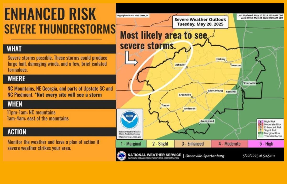
Strong to severe thunderstorms are possible after 11 p.m., beginning in the far Western North Carolina mountains and moving into northeast Georgia, Upstate South Carolina and the North Carolina Piedmont, according to the National Weather Service.
Temperatures will remain above normal through the day.
The forecast for the rest of the week, according to the National Weather Service:
Today: Partly sunny, with a high near 81. Calm wind becoming south 5 to 9 mph in the afternoon. Chance of precipitation is 30%.
Tonight: Patchy fog after 5 a.m. Otherwise, cloudy, then becoming partly cloudy toward daybreak, with a low around 61. South-southeast wind around 6 mph becoming calm in the evening. Chance of precipitation is 60%.
Wednesday: Patchy fog before 7 a.m. Otherwise, sunny, with a high near 81. Light west wind becoming west-northwest 8 to 13 mph in the morning. Winds could gust as high as 24 mph.
Wednesday night: Mostly clear, with a low around 55. West-northwest wind 8 to 11 mph, with gusts as high as 26 mph.
Thursday: Sunny, with a high near 73. West-northwest wind 9 to 17 mph, with gusts as high as 30 mph. Chance of precipitation is 30%.
Thursday night: Partly cloudy, with a low around 47. Chance of precipitation is 30%.
Friday: Sunny, with a high near 68.