
ASHEVILLE, N.C. (828newsNOW) — Nearly a year after Helene tore through Southern Appalachia, leaving behind catastrophic flooding, deadly landslides and billions in damage, the National Oceanic and Atmospheric Administration has released an interactive “story map” that retraces the storm’s path and the scars it left on the region.
The online resource, Helene in Southern Appalachia, combines maps, video, photos and scientific data to illustrate the hurricane’s rapid intensification, landfall and unprecedented impacts across Florida, Georgia, Tennessee and the Carolinas in late September 2024. It also highlights the continuing recovery and NOAA’s role in forecasting and disaster preparedness.
Helene began as a tropical disturbance in the Caribbean on Sept. 20 before exploding into a Category 4 hurricane over the Gulf of Mexico, packing winds near 140 mph. The storm made landfall near Perry, Florida, on Sept. 26, then roared north into the Appalachian Mountains, where saturated ground from earlier heavy rains fueled record-breaking flooding and landslides.
BUNCOMBE COUNTY HELENE DAMAGE POINTS DASHBOARD
By Sept. 26, forecasters were sounding urgent alarms. NOAA issued a rare “operational event” press release warning of “significant to catastrophic inland flooding,” even after the storm moved inland. That same afternoon, the National Weather Service office in Greenville-Spartanburg, issued an extraordinary bulletin:
“This will be one of the most significant weather events to happen in the western portions of the area in the modern era,” the statement read. “Record flooding is forecasted and has been compared to the floods of 1916 in the Asheville area. We plead with everyone that you take every single weather warning very seriously … as impacts will be life-threatening.”
The warning noted that landslides — including fast-moving debris flows of mud, rocks and trees — were likely in mountain valleys and could be deadly. Residents were urged to heed evacuation orders and seek shelter immediately.
Those dire predictions quickly proved true. The French Broad and Swannanoa rivers crested higher than they had during the legendary Flood of 1916. A weather station in Busick recorded 30.78 inches of rain in four days — more than five months’ worth of September precipitation. The U.S. Geological Survey documented more than 2,000 landslides, while the North Carolina Forest Service estimated 822,000 acres of timberland were damaged.
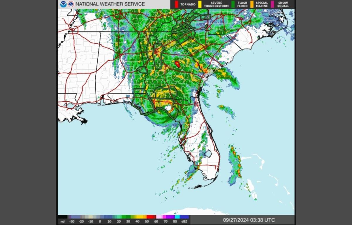
WEATHER RADAR FROM SEPT. 25-27
Entire neighborhoods were left without power, water or communications. Asheville, home to NOAA’s National Centers for Environmental Information, lost access to clean drinking water for 53 days. Interstate 40 near the Tennessee border and portions of Interstate 26 in eastern Tennessee were washed out. Hospitals in river towns were evacuated as floodwaters lapped at their doors.
In Tennessee, the Nolichucky River swelled with a force nearly double that of Niagara Falls. The Pigeon River crested at nearly 30 feet in Newport, breaking a flood record set in 1902.
By the time the storm dissipated Sept. 28, Helene and the rains preceding it had unleashed an estimated 42 trillion gallons of water — the equivalent of Niagara Falls flowing nonstop for more than a year and a half.
The toll was staggering: more than 200 lives lost, thousands of homes destroyed and $78.7 billion in damage. The storm ranks as the seventh-costliest U.S. tropical cyclone since 1980. Scientists have since called it a 1-in-1,000-year event.
NOAA officials said the story map is designed to make the science and the human cost accessible to the public.
“The effects of Helene remind us of the power and danger of these systems and emphasize the importance of preparedness and resilience in facing such extreme weather events,” the agency said. “We cannot stop these events from happening, but we can make our communities better prepared and safer for the next one.”