
ASHEVILLE, N.C. (828newsNOW) — Western North Carolina residents are being urged to prepare for a hard freeze Thursday night into Friday morning — and possibly a touch of early-season snow in the higher elevations next week.
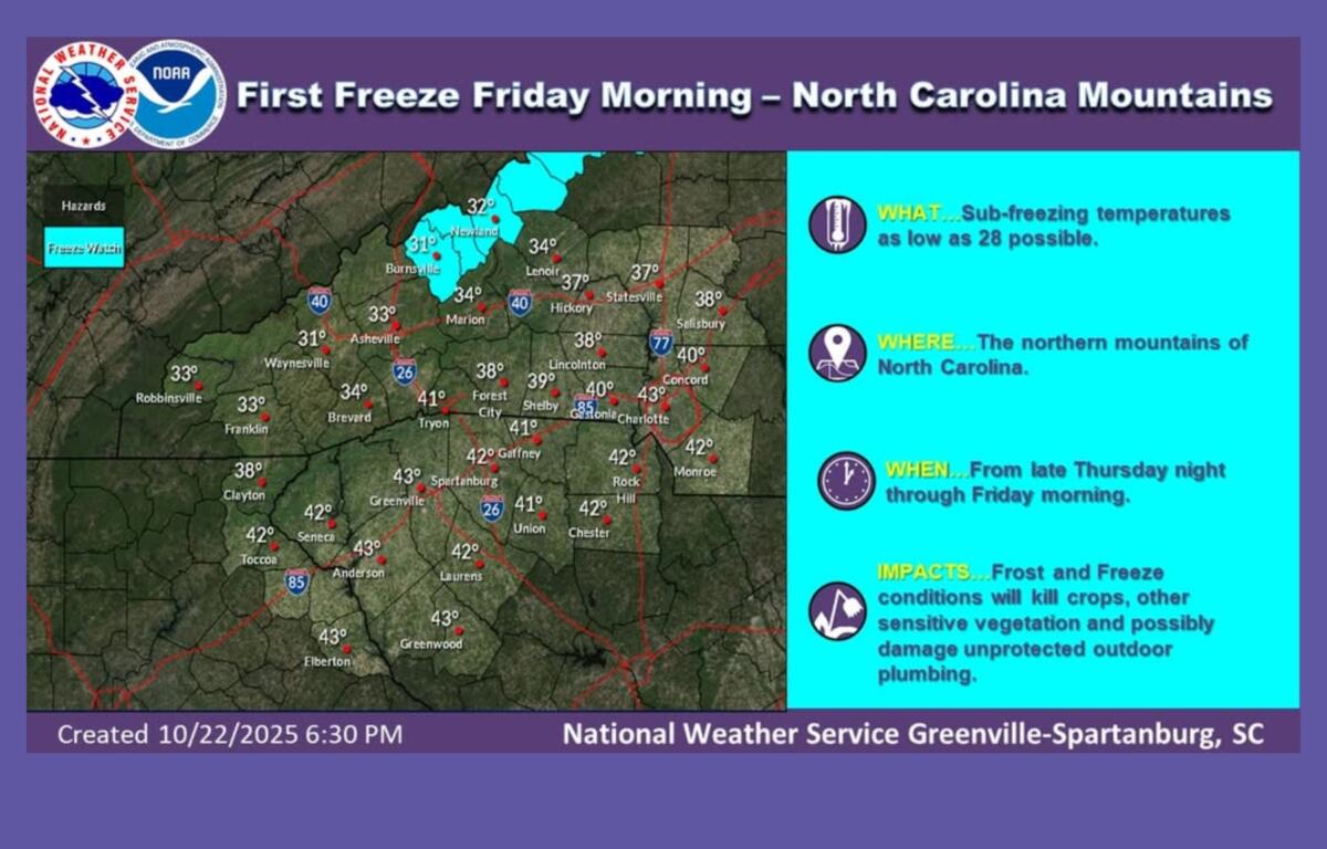
The National Weather Service in Greenville-Spartanburg has issued the first Freeze Warning of the season for several mountain counties, including Buncombe, Haywood, Madison, Swain, Macon and parts of Burke, Caldwell, Graham, Jackson and McDowell. Temperatures are expected to dip as low as 29 degrees, with the warning in effect from 2 a.m. to 9 a.m. Friday.
The weather service advises residents to protect sensitive plants and drain outdoor sprinkler systems to prevent damage from freezing.
Along with the cold temperatures, fire danger remains elevated Thursday afternoon because of dry air, low humidity and gusty winds across much of the region. A Frost Advisory is also in place for the North Carolina foothills and Piedmont.
Forecasters say dry and cool high pressure will linger through the weekend before a developing low-pressure system brings a chance of rain early next week.
The Carolina Weather Association said the approaching system could send the jet stream dipping southward by late next week, possibly producing stormy conditions Thursday and even a few snowflakes in the higher elevations.
“If these trends continue, then there could be mountain flakes,” the group said in a Wednesday evening update. “That is not completely unheard of around this time of year.”
After the system moves through, temperatures are expected to remain on the cooler side heading into the final days of October.well Mountains