
ASHEVILLE, N.C. (828newsNOW) — Western North Carolina experienced a sharp swing in temperatures over the weekend as an arctic cold front swept through the region, bringing bitter cold, gusty winds and light snow to the mountains.
Temperatures dropped from around 60 degrees Saturday afternoon to 29 degrees by early Sunday morning in Asheville, with wind chills making it feel closer to 12 degrees. The National Weather Service in Greenville-Spartanburg said a Cold Weather Advisory is in effect from 5 p.m. Sunday through 9 a.m. Monday for elevations above 3,500 feet in the North Carolina mountains because of dangerously low wind chills.
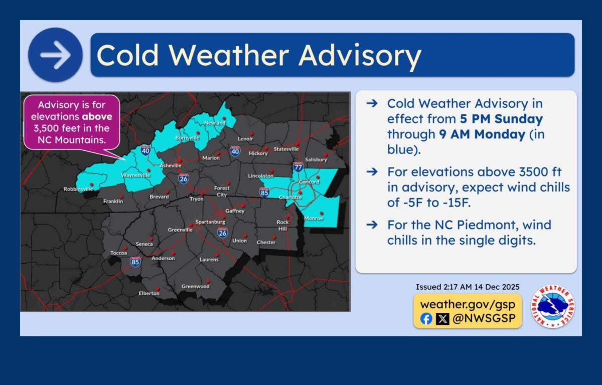
Saturday’s high reached 60 degrees, while overnight lows dipped into the mid-20s as colder air moved in. Forecasters said temperatures will continue to fall through the day Sunday behind the strong cold front, rather than warming.
Light snow accumulations were expected along the North Carolina-Tennessee border Sunday morning as northwest winds developed behind the front. Most areas along the border were forecast to see up to 1 inch of snow, though isolated spots along the highest ridges of the Appalachians could receive 1.5 to 2 inches. The weather service issued a special weather statement for border counties through 9 a.m. Sunday because of the potential for slick roads.
Gusty northwest winds were also expected across the region, particularly in the mountains. Wind gusts of 25 to 35 mph were forecast for lower mountain elevations, with gusts of 30 to 45 mph above 3,500 feet. Some of the highest peaks could see isolated gusts approaching 50 mph. East of the mountains, winds were expected to gust between 20 and 30 mph.
The coldest conditions are expected Sunday night into Monday morning as the arctic air mass settles in. Temperatures are forecast to climb above freezing Monday afternoon, with lighter winds helping to reduce wind chill concerns by Monday night.
A gradual warming trend is expected by midweek. Forecasters said temperatures on Tuesday could be 10 to 15 degrees warmer than the start of the week. Another cold front later in the week could bring increased rain chances, though temperatures are expected to rebound quickly.