
ASHEVILLE, N.C. (828newsNOW) — Strong winds and bitter cold are expected across much of Western North Carolina as a robust cold front moves through the region, prompting wind advisories and a high wind warning, according to the National Weather Service.
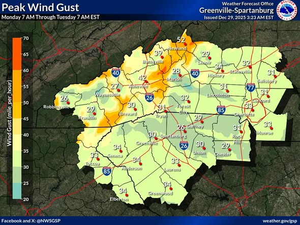
A High Wind Warning is in effect for Avery County from 1 p.m. Monday through 7 a.m. Tuesday, with wind gusts potentially reaching 60 mph. A Wind Advisory is in effect for Mitchell and Yancey counties, as well as the higher elevations of Caldwell, Burke and McDowell counties, where gusts could reach up to 50 mph.
Forecasters said very gusty winds are likely elsewhere across the mountains, particularly at elevations above 3,500 feet, where gusts of 35 to 50 mph are possible through Monday night.
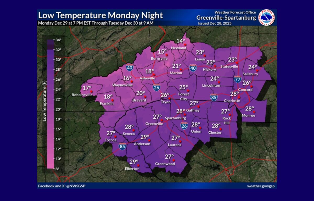
In addition to strong winds, much colder air will move in behind the front. Wind chills in higher elevations are expected to drop into the single digits, with some areas seeing values above and below zero overnight, the weather service said.
In Asheville, a chance of showers is expected early Monday morning, followed by gradual clearing by midday. Temperatures are forecast to fall through the day, reaching around 34 degrees by late afternoon. Northwest winds will increase to 17 to 22 mph, with gusts as high as 36 mph.
Monday night is expected to be partly cloudy with a low near 16 degrees and gusts approaching 40 mph. Conditions improve Tuesday, with sunny skies and a high near 35, though breezy conditions will persist. Tuesday night will be mostly clear with lows around 19 degrees.
Officials advise residents to secure loose outdoor objects, use caution while driving in high-profile vehicles and prepare for dangerously cold wind chills.