
HICKORY, N.C. (828newsNOW) — Bakers Mountain Loop is a 2.2 mile looping trail located inside of Bakers Mountain Park outside of Hickory, N.C. Well-maintained, clearly marked and lovingly detailed, the hike is a fun, moderate climb to a great mountain view.
Fast facts
- Bakers Mountain Loop is a 2.2 mile trail inside of Bakers Mountain Park that include a pitstop at the summit of the mountain
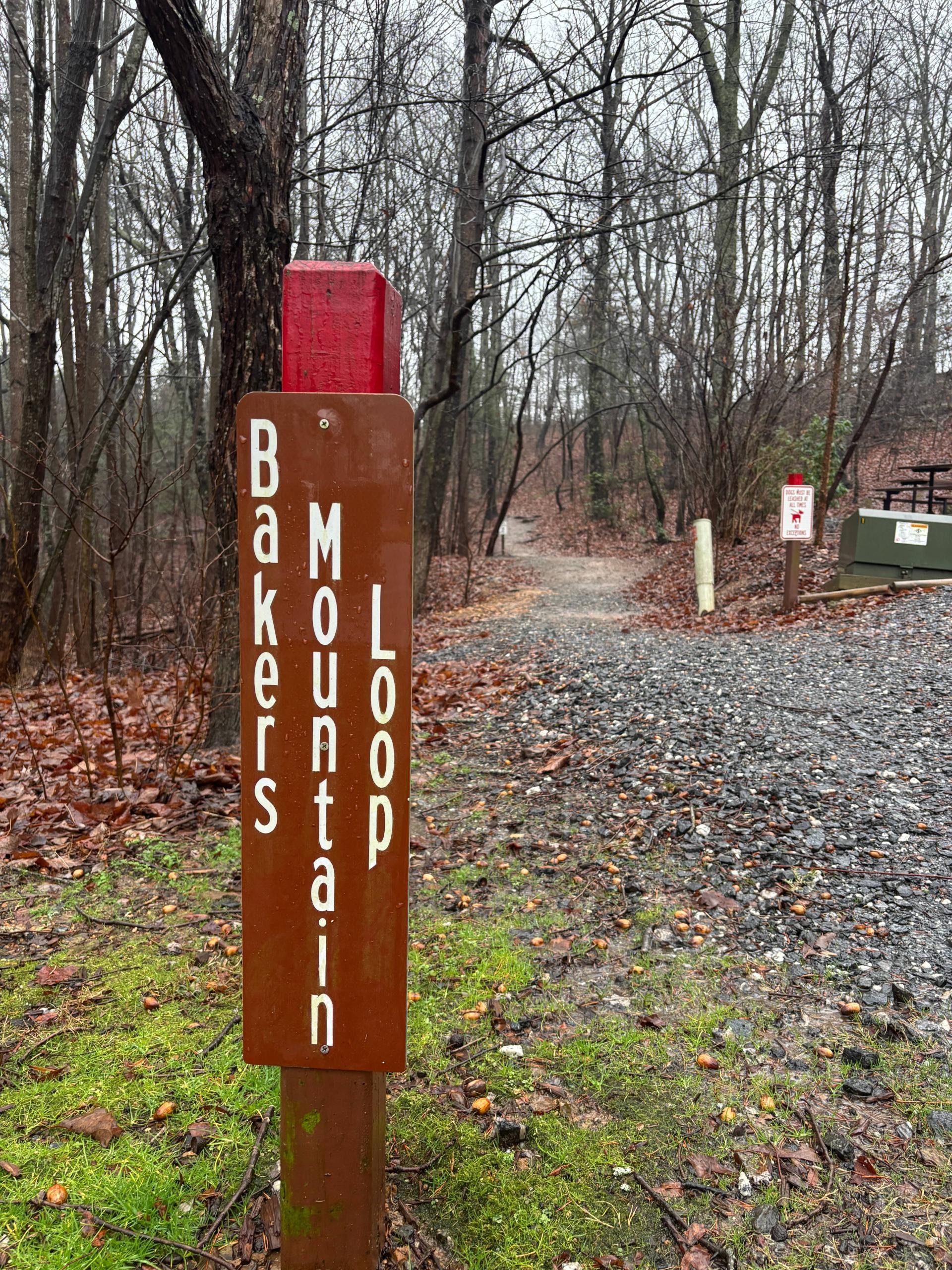
- There are several trails to follow inside the park – the Bakers Mountain Loop route is marked with wooden posts with red tops
- Bakers Mountain Park trails are only available inside of park hours, 8 a.m. to 5 p.m., seven days a week
Baked with love
Bakers Mountain Park is located just 15 minutes outside of Hickory, N.C. in a cute, well-maintained enclosure with a welcome center, ample parking and public restrooms. After parking, visit the park kiosk in the middle of the parking lot to take a look at the trail systems. There are several routes to choose from in the park, but Bakers Mountain Loop will bring you straight to the top of the peak and back down again.
")
")
To start the hike, look for the first Bakers Mountain Loop blaze: a wooden post with a red top. These posts will lead the way at regular intervals during the climb.
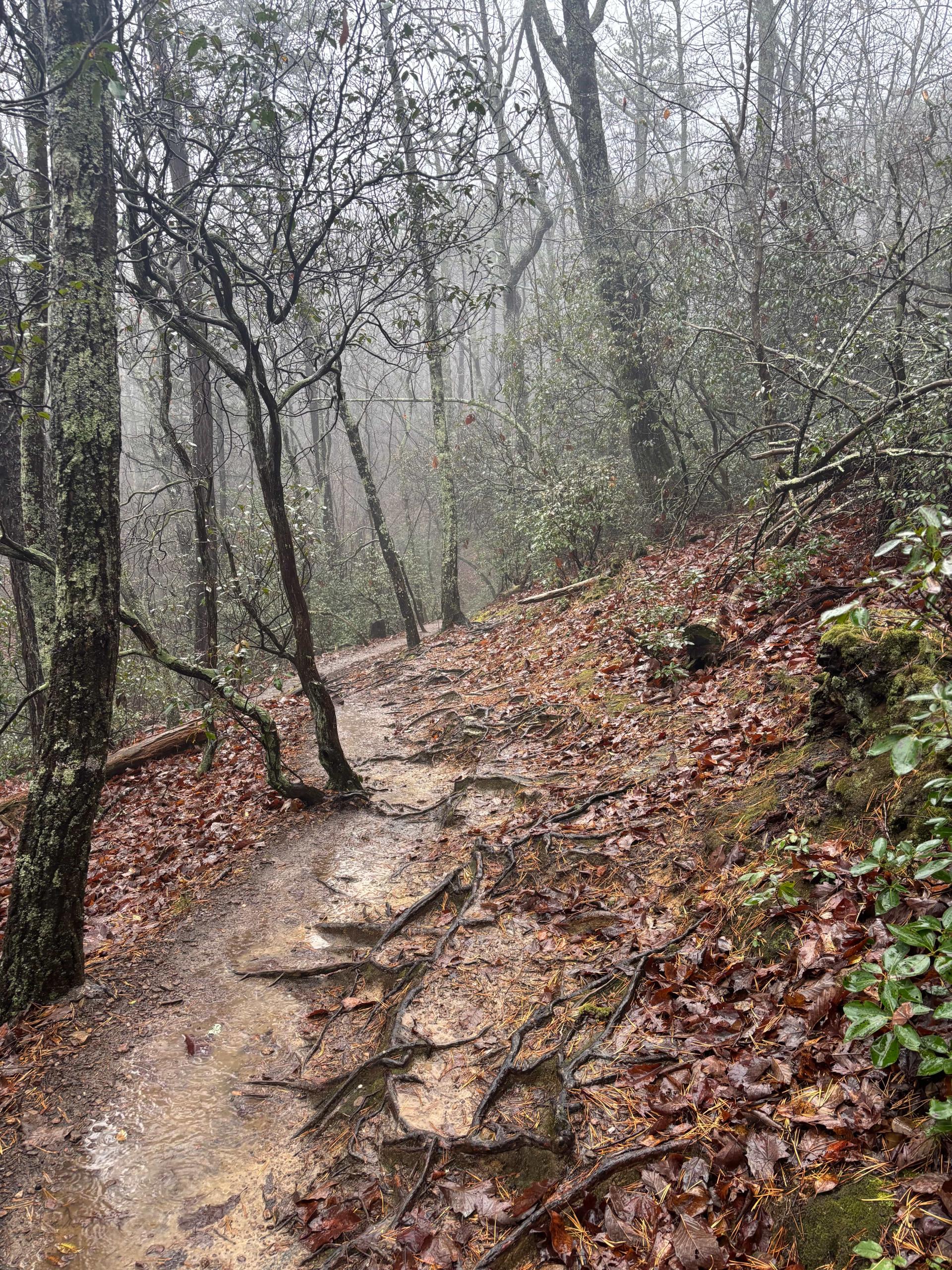
At times, Bakers Mountain Loop can be a steep trek, with more than a few breathless sections of root-snarled incline, but in keeping with its inviting base camp, there are many helpful amenities which ameliorate the climb. Early on, an enclosed trash can is ready to receive any spent trail mix bags, and there are many sturdy benches along the route for taking a quick rest break.
")
")
It felt like every inch of the Bakers Mountain Loop trail was designed with love. From bench dedications to beloved naturalists – an early bench was named for Larry Hight, a longtime member of the Catawba Valley Outing Club – to informative plaques detailing the surrounding flora, the park seemed incredibly well cared for.
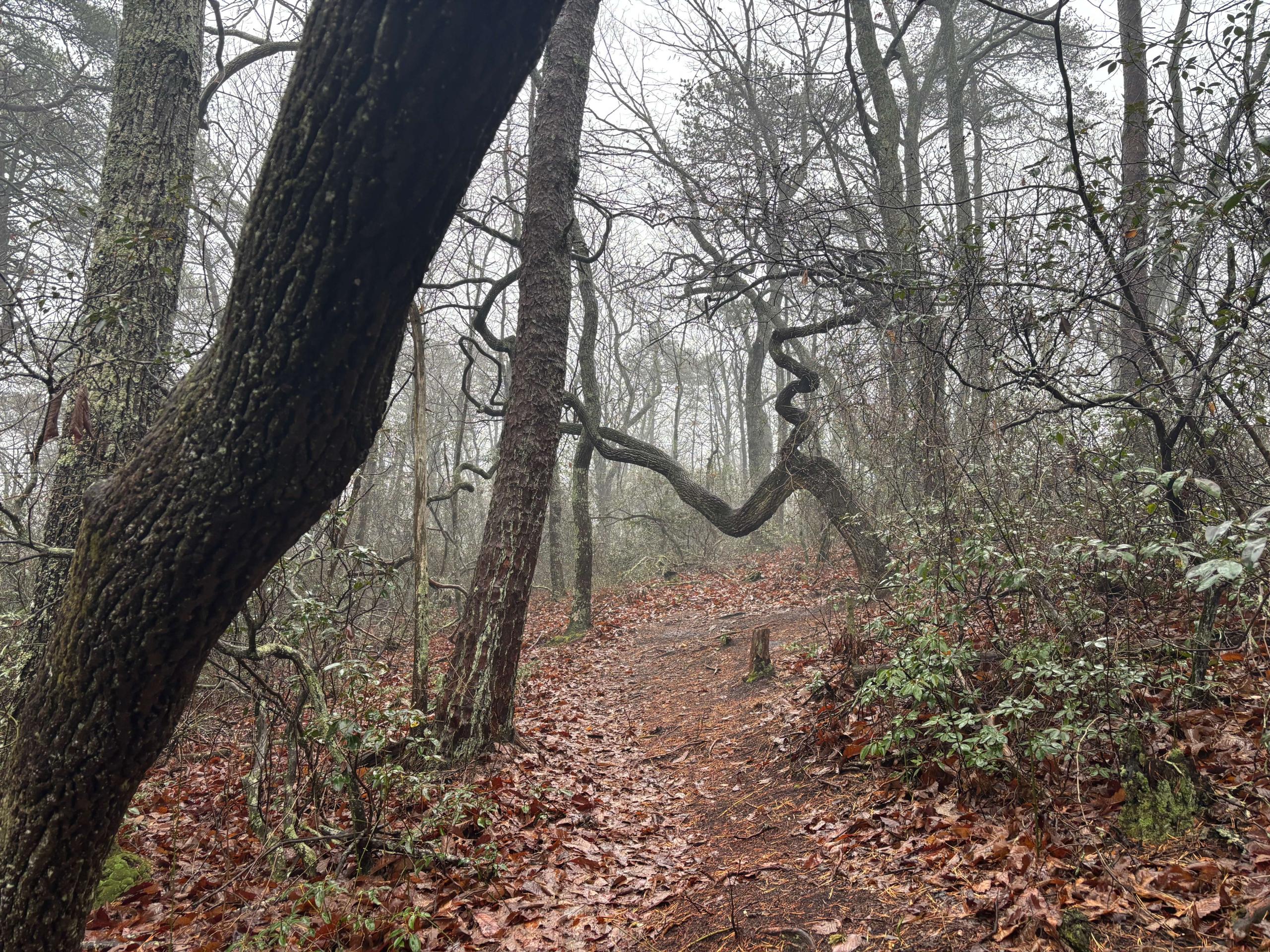
One of those plaques was about a gnarled tree in a corkscrew shape along the looping route. According to the sign, the sourwood tree is referred to as “the crooked tree” by frequent Bakers Mountain hiker Tom Abernathy, who has roamed the Bakers Mountain woods “nearly every day” since its opening in 2002.
Another interesting peculiarity of the Bakers Mountain trail was the proliferation of tree roots spanning the path in a spiderwebbing pattern. Along many portions of the trail, the roots splayed out like intersecting starfish. Make sure to watch your step.
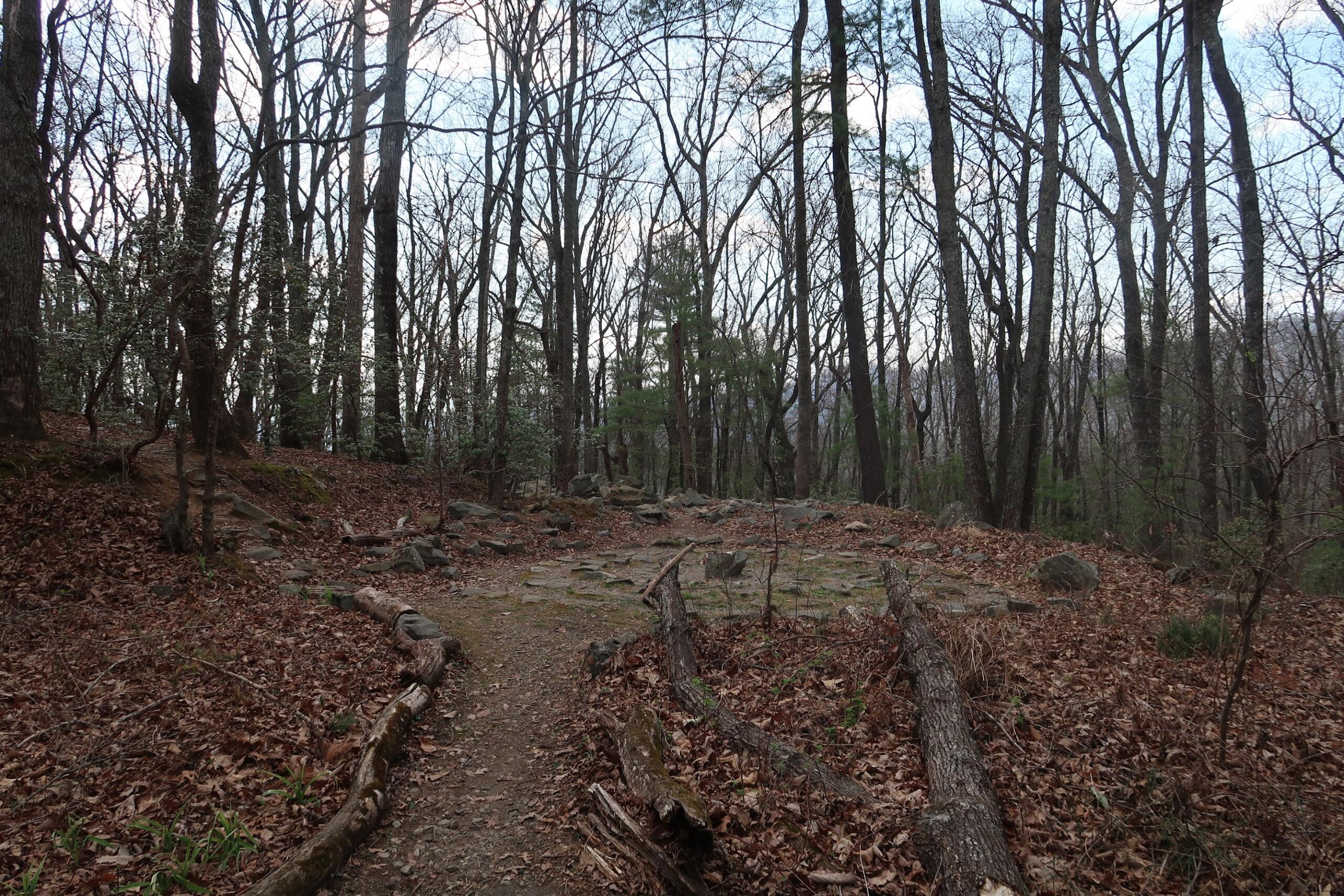
The trickiest juncture of the trail, directions-wise, is an intersection marked by the ruins of an old building, a stone, chimney-like structure. Several paths springboard from the ridge, including the orange-capped Chestnut Ridge path, but the red blazes will lead you to the next leg of our hike.
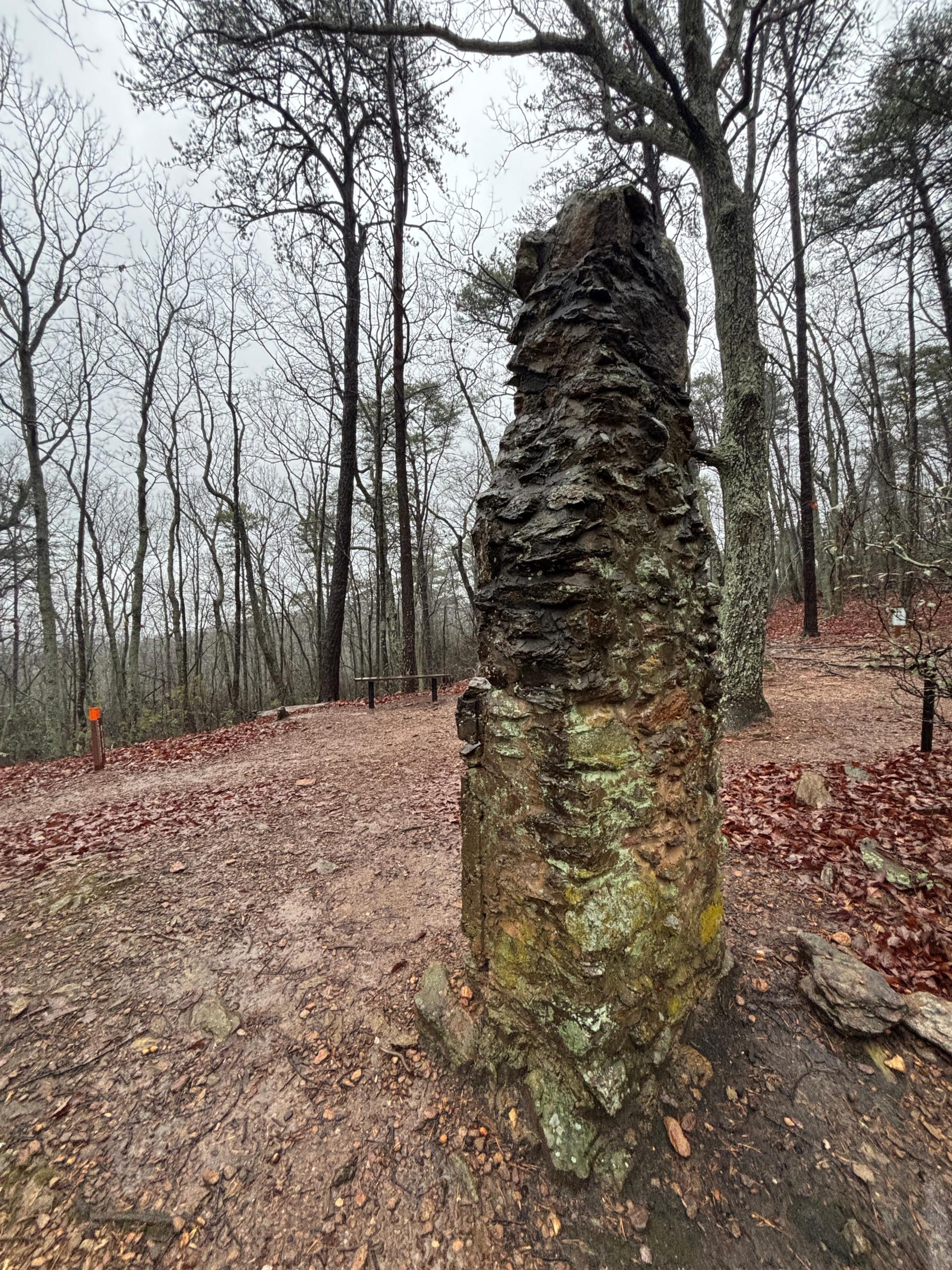
By the time you reach the ruins, if you are feeling itchy for a view, hang in there. A small green sign will advertise “MTN TOP –>” right before the continuation of the loop.
The most challenging part of the trail follows the sign. The climb gets significantly steeper, with a twisting path up the hill. Fortunately, there are regular benches to recuperate on, as well as cool, mossy boulders to explore, if you need a diversion from the ascent.
")
")
")
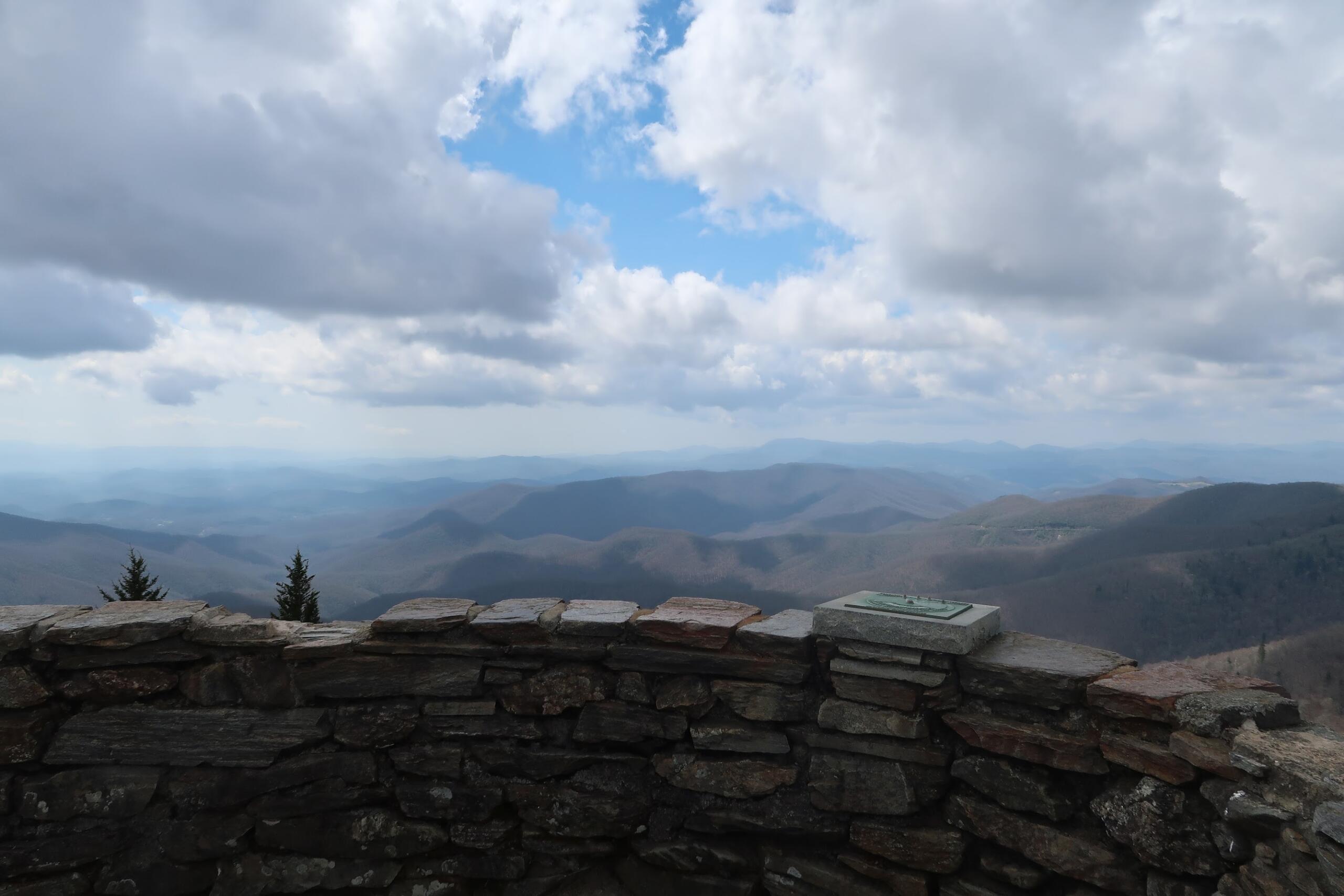
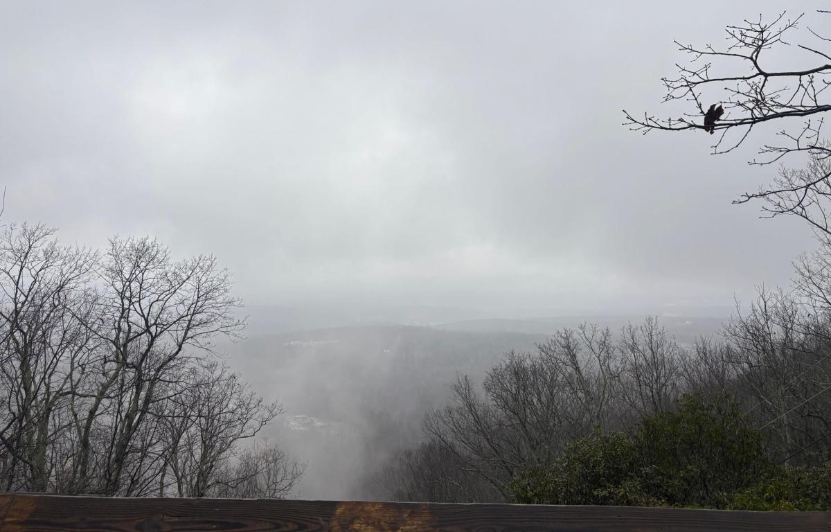
The top of the mountain is hard to miss. A spray painted blaze will show the way to the rest of the trail, but hike up from it toward a gazebo-like structure and the Bakers Mountain Observation Deck for a great view, especially on a clear day.
")
")
After luxuriating in the mountain air, it is time for the hike back down to the parking lot. While you could head back the way you came, hikers seeking loop completion can shuffle to the right. The path down is straightforward, though a bit washed out in a few places. Be careful on rainy days.
")
")
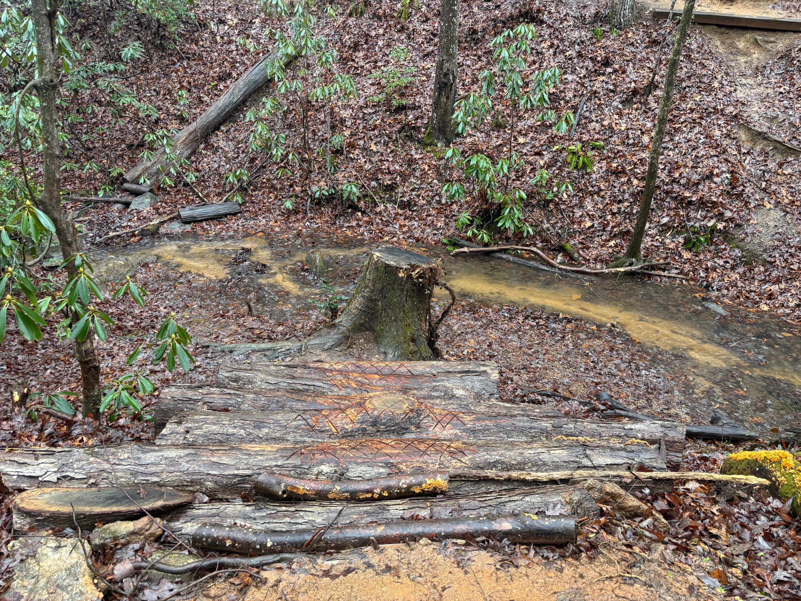
One fun feature of the second half of the Bakers Mountain Loop trail is a creekside section. The creek is accessible to hikers via a series of scored log steps, but lacking rails, necessitating sure footing.
The trail will spit hikers out in the parking lot, where they are welcome to depart on their merry way to Hickory for a post-hike lunch. That’s what I did, anyway!
-
Hikes of WNC: Lookout Trail

As peak hiking season hits Western North Carolina, trek out to Montreat outside of Black Mountain, N.C. for a climb up Lookout Trail. The technical route requires stamina and some rock scrambling, but its views of the Swannanoa Valley are unmatched.
-
Hikes of WNC: Flat Top Mountain Trail

Flat Top Mountain Trail is a rewarding trek with diverse terrain near Moses Cone Manor on the Blue Ridge Parkway. Read more in our hiking guide below.
-
Hikes of WNC: Devil’s Courthouse
Don’t let the name fool you. Devil’s Courthouse on the Blue Ridge Parkway boasts some truly angelic views, even if the hike up is hellish on the calves. Read more in our hiking guide.
-
Hikes of WNC: Fryingpan Mountain Lookout Tower
Fryingpan Mountain Lookout Tower is a decommissioned U.S. Forest Service firewatch station along the Blue Ridge Parkway. The 70-foot tower climb is one of the most iconic hikes in Western North Carolina.
-
Hikes of WNC: Bull Mountain Trail
Bull Mountain Trail may seem like a simple, unassuming walk, but there is magic to be found for those looking closely. Read our hiking guide for more.