
ASHEVILLE, N.C. (828newsNOW) — Sunshine and seasonably mild temperatures are expected across the Asheville area Tuesday, offering a brief break before a sharp turn toward much colder weather later this week.
The National Weather Service in Greenville-Spartanburg said highs will reach the upper 50s Tuesday under mostly sunny skies. Conditions will begin changing Wednesday night as a cold front moves through the region, bringing the potential for light snow in the mountains and a surge of Arctic air.
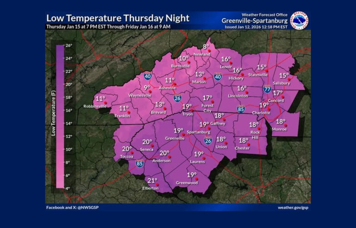
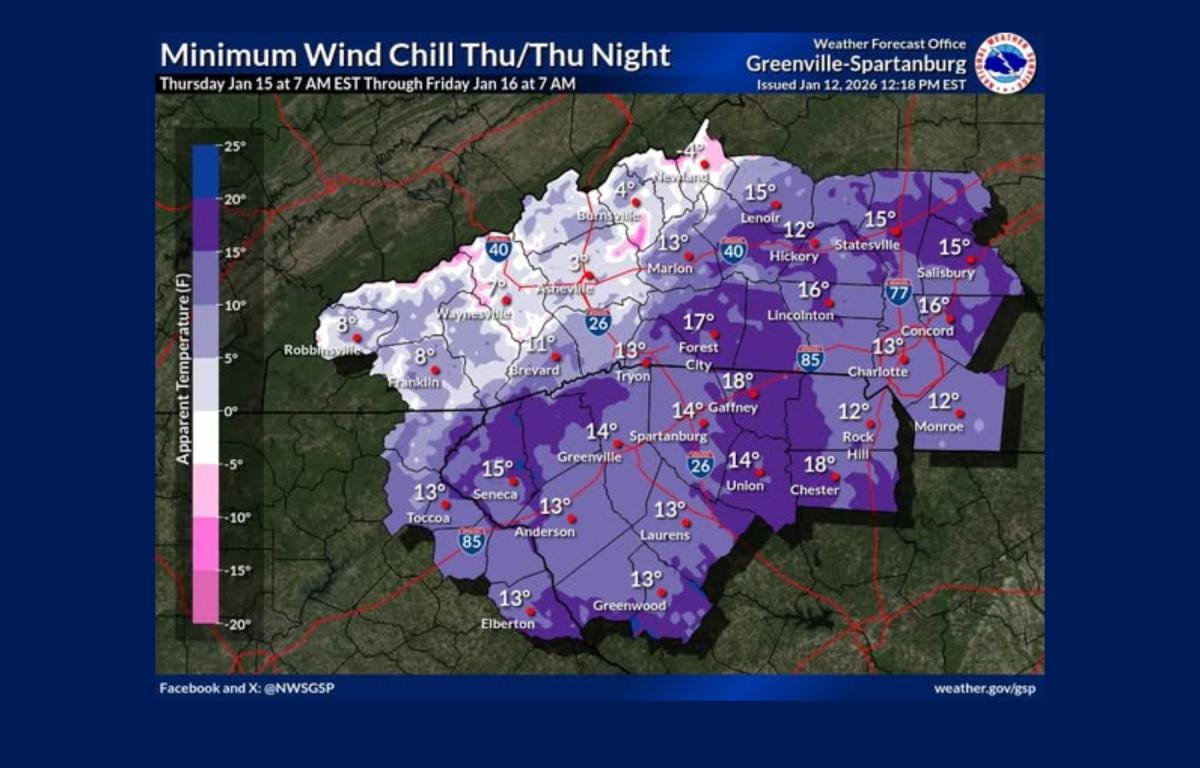
Forecasters say one of the coldest nights of the winter is expected Thursday night, with temperatures dropping into the teens and single digits across the western Carolinas and northeast Georgia. Dangerous wind chills are also possible, particularly at higher elevations.
A northwest flow snow event is increasingly likely Wednesday evening through Thursday in the North Carolina mountains. The heaviest snowfall is expected above 3,500 feet near the Tennessee border, though light accumulations could reach some valley locations. Officials caution that while snowfall amounts appear to be trending downward, travel impacts remain possible.
Gusty winds will accompany the cold air, with wind chill values becoming especially hazardous in the northern mountains Thursday night into Friday morning. Similar conditions could return late Sunday into Monday.
In Asheville, the forecast calls for a high near 58 degrees Tuesday, followed by a low around 30 overnight. Wednesday brings a 30 percent chance of rain late in the day, with a high near 53. Rain may mix with snow Wednesday night as temperatures fall to around 19, with less than a half-inch of accumulation possible.
Thursday will be mostly sunny but cold, with highs near 28 and gusty northwest winds. Overnight lows are expected to dip to around 11 degrees. Cold conditions are forecast to persist into the weekend before moderating slightly Friday, when highs are expected to reach the low 40s.