
ASHEVILLE, N.C. (828newsNOW) — Snow and bitter cold are expected to impact Western North Carolina as a strong arctic cold front moves through the region, according to the National Weather Service.
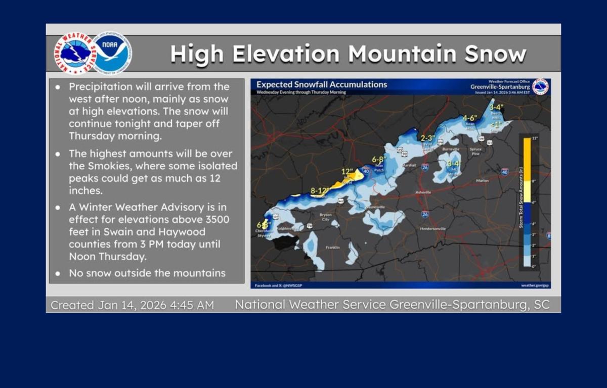
Forecasters said precipitation will reach the mountains Wednesday afternoon, with snow expected at higher elevations, particularly near the Tennessee border. A Winter Weather Advisory is in effect for elevations above 3,500 feet in Swain and Haywood counties from 3 p.m. Wednesday through noon Thursday.
The weather service said a northwest-flow snow event will bring multiple inches of snow to higher elevations along the North Carolina-Tennessee border through Thursday. Roadway impacts are possible in those areas. Lower elevations along the border could see less than 2 inches of snow, while most valley locations are expected to receive less than an inch.
Much colder temperatures are forecast to follow the snow as the Arctic front moves in. High temperatures on Thursday are expected to be well below normal, with strong winds creating dangerously cold wind chills Wednesday night into Thursday morning.
Forecasters said the coldest air mass of the season is likely to settle over the region Thursday night. While record lows are not expected, wind chills could become dangerous at elevations above 3,500 feet early Friday.
Additional light snow is possible Friday night into early Saturday, which could cause minor travel issues near the Tennessee border. Meteorologists are also monitoring the potential for winter precipitation east of the mountains on Sunday, though confidence remains low at this time.