
ASHEVILLE, N.C. (828newsOW) — Forecasters are increasingly confident a significant winter storm will impact Western North Carolina this weekend, bringing a potentially dangerous mix of snow, sleet and freezing rain that could disrupt travel and cause power outages across the region.
The National Weather Service office in Greenville-Spartanburg said confidence is high that a prolonged winter storm will affect the western Carolinas and northeast Georgia from Saturday into Sunday, though uncertainty remains about exact precipitation types, amounts and storm track.
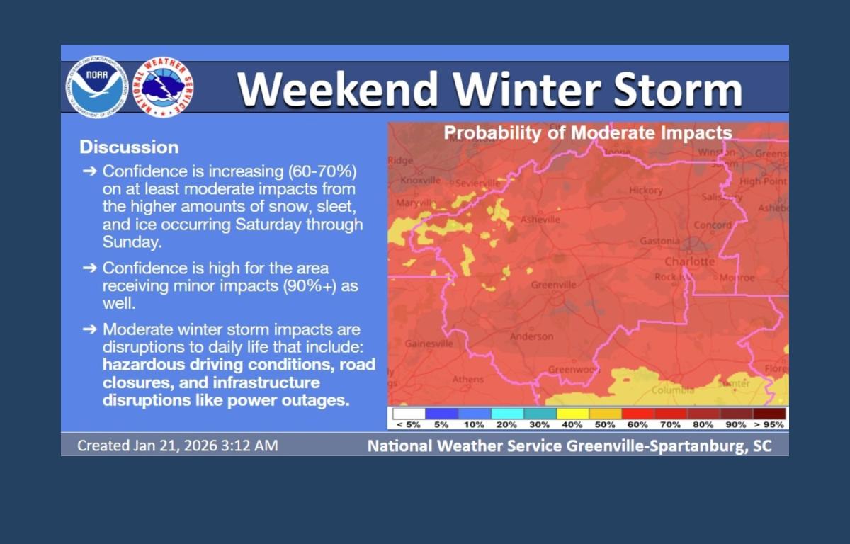
“Details regarding precipitation amounts and type remain uncertain,” the agency said, noting that hazardous travel conditions and power outages are likely and could linger into early next week.
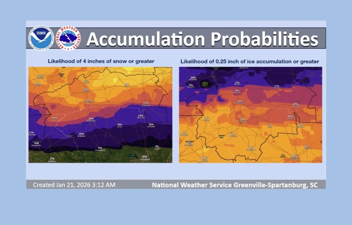
Forecast models show accumulating snow possible from Friday night through Sunday, with the highest impacts expected Saturday. Ice and sleet are also likely, particularly south of Interstate 40, where even light ice accumulations could make roads treacherous and damage power lines.
Meteorologists said probabilities for heavy snow are highest in the mountains and areas along and north of I-40, where some guidance suggests a 30 percent to 40 percent chance of 12 inches or more. Farther south, sleet and freezing rain are expected to be the dominant precipitation types, with ice accumulation probabilities of 40 percent to 50 percent Saturday night into Sunday. Current guidance shows a 50 percent to 60 percent chance of ice accumulations of a quarter inch or more south of the North Carolina-South Carolina state line.
The weather service said conditions may meet warning criteria and a Winter Storm Watch for much of the area is likely to be issued in an upcoming forecast cycle.
French Broad Electric Membership Corporation said it is preparing crews and equipment ahead of the storm, noting that ice poses the greatest threat to the electrical grid.
“A quarter to a half inch of ice can cause significant damage,” the utility said in a statement. If predicted snow totals are reached, “some of our areas will be difficult to access,” and outside line crews may not be able to assist until after the storm passes.”
Emergency management officials across the region urged residents to prepare now, including stocking food, water and medications, charging electronic devices and planning for possible extended power outages. Residents who rely on medical equipment or alternative heat sources were encouraged to confirm backup plans and ensure carbon monoxide detectors are functioning.
The National Weather Service also warned that dangerously cold wind chills may develop Monday night into Tuesday morning, increasing the risk of hypothermia and frostbite. Lingering snowpack and cold temperatures could prolong travel disruptions and power restoration efforts.
In Asheville, snow and freezing rain are expected to begin Saturday, with precipitation chances reaching 100 percent Saturday night. Overnight lows could drop into the teens by early next week.
Forecasters stressed the system remains dynamic and residents should continue monitoring updated forecasts and official alerts as the weekend approaches.