
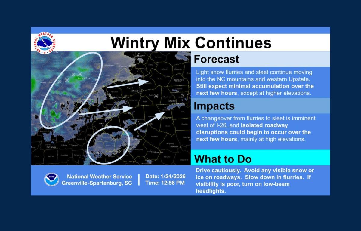
ASHEVILLE, N.C. (828newsNOW) — Light flurries and isolated sleet were reported across the North Carolina mountains and parts of the western South Carolina Upstate early Saturday afternoon as a winter storm system continued to take shape across the region.
The National Weather Service office in Greenville-Spartanburg said around 1 p.m. that accumulations were expected to remain minimal for the next several hours, except at elevations above 3,500 feet.
Forecasters continue to warn that conditions could worsen as the system develops. North Carolina’s Weather Authority said uncertainty remains in freezing rain totals, noting that ice accumulation is among the most difficult winter weather elements to forecast.
“There is a range because you can’t pinpoint a specific number,” the agency said in an update. “Freezing rain is one of the hardest things to forecast, so you prepare for the worst and hope for the best.”
Meteorologists are closely monitoring moisture flow from the Gulf of Mexico and the Atlantic Ocean, as well as a cluster of thunderstorms along the Gulf Coast that could potentially limit how much moisture reaches North Carolina. Increased sleet instead of freezing rain could also reduce ice totals, forecasters said.
“These are now-casting situations, so we will watch closely,” the update said, adding that residents should be prepared for possible power outages and cold conditions.
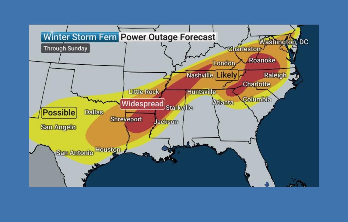
The Weather Channel reported that Winter Storm Fern is capable of producing a mix of precipitation across the region, increasing the risk of tree damage, power outages and hazardous travel. Officials warned that travel could become extremely difficult or impossible this weekend as the storm intensifies.