
ASHEVILLE, N.C. (828newsNOW) — The National Weather Service in Greenville-Spartanburg has extended a winter weather advisory for North Carolina mountain counties along the Tennessee border, including Avery, Madison, Yancey, Mitchell, Swain, Haywood and Graham counties, until 3 p.m. Tuesday.
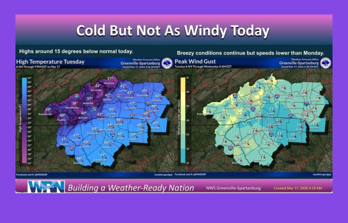
The advisory covers elevations above 3,500 feet, where snow accumulations of up to 1-2 inches are expected, with locally higher amounts above 5,000 feet. Lower elevations may see a light dusting to half an inch. Winds could gust as high as 45 mph, creating slippery roads and hazardous driving conditions. Snow showers may linger through mid- to late morning, with another brief round possible this afternoon. Any accumulation after 8 a.m. is expected to be light.
Light snow was falling in the Asheville area at 8:45 a.m. Although there were reports of some icy secondary roads, most roads were clear, and no incidents were showing on the N.C. Department of Transportation website.
Colder-than-normal temperatures will persist through Wednesday night. Highs in the mountains will range from the lower 20s to mid-20s at higher elevations and from the lower 30s to lower 40s at lower elevations. Lows each night will drop below freezing, posing risks to sensitive vegetation that has started blooming after recent unseasonably warm weather. Breezy winds will taper this evening, remaining below advisory levels.
A warming trend is expected Thursday through the weekend, with highs approaching 15 degrees above normal by Sunday. There is a slight chance of rain early next week as a backdoor cold front moves through the region.