
ASHEVILLE, N.C. (828newsNOW) — Rain chances are expected to increase across Western North Carolina beginning Friday night and continuing through Saturday, with cooler-than-normal temperatures settling in for the weekend, according to the National Weather Service in Greenville-Spartanburg.
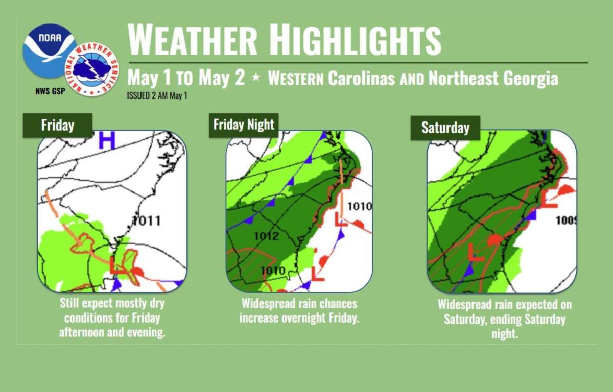
Forecasters say conditions should remain mostly dry through Friday, though clouds will build and a few light showers could develop, especially south of Interstate 85. High temperatures are expected to reach the upper 60s to low 70s.
Rain is more likely Friday night into Saturday morning as a weather system moves along the Gulf Coast, bringing moisture into the region. The highest rain chances — between 60 percent and 90 percent — are expected early Saturday before tapering off by midday. Rainfall totals are expected to remain relatively light, with most areas receiving less than a half-inch.
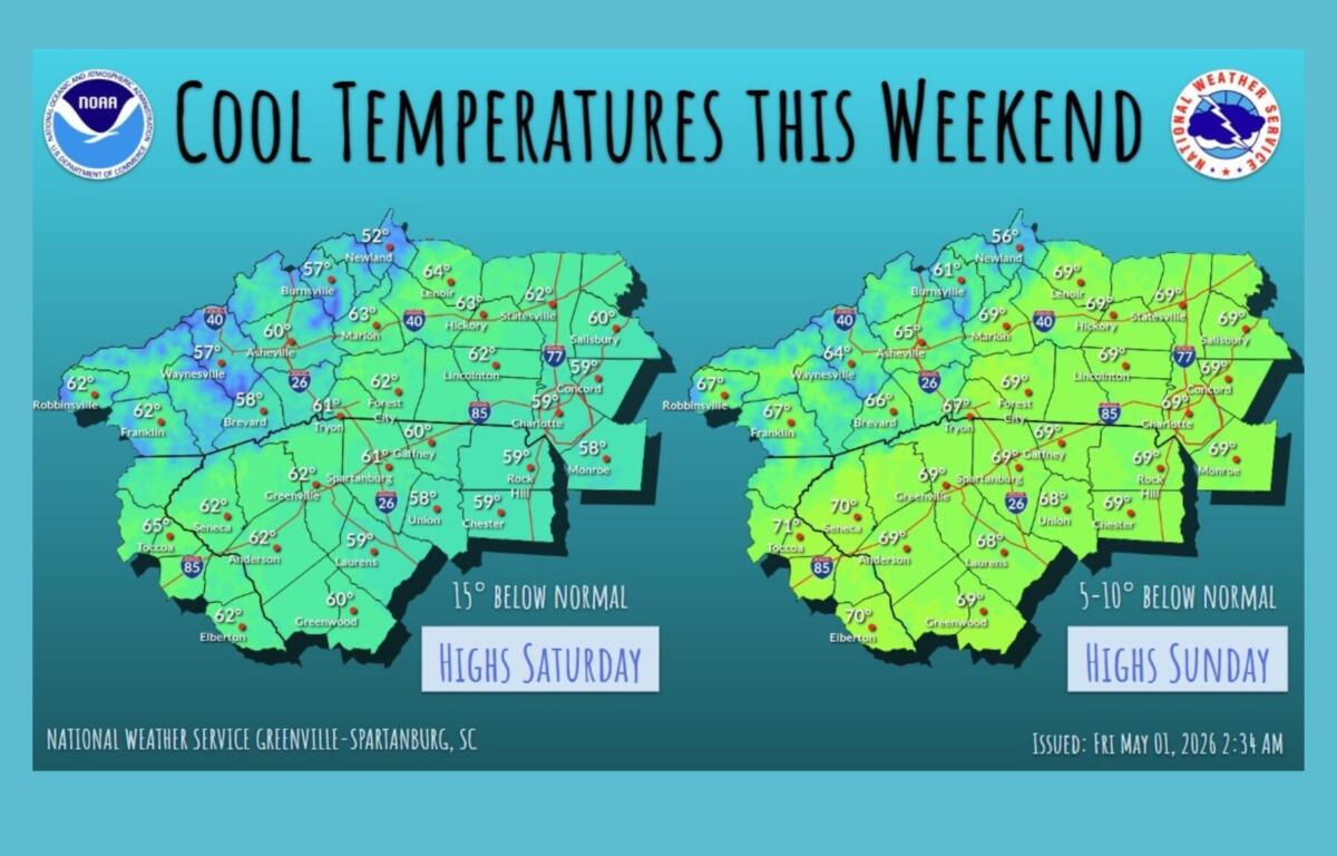
Cloud cover and precipitation are expected to keep temperatures well below normal Saturday, with highs running about 15 degrees cooler than average. Forecasters also say temperatures could drop quickly early Saturday morning as rain develops.
Cooler, drier air will move into the region Saturday night into Sunday, raising the possibility of frost in mountain valleys and near-freezing temperatures at higher elevations. The greatest risk of freezing conditions is expected in higher elevations, where the probability ranges from 50 percent to 70 percent.
Dry weather and a gradual warming trend are expected to return Sunday and continue into early next week, though temperatures may remain slightly below normal. Another cold front could bring additional rain chances by midweek, but forecasters say confidence in that system remains low.
As of the end of April, the region remains below normal for precipitation, with 8.94 inches recorded since Jan. 1 — about 6.62 inches below average.