




ASHEVILLE, N.C. (828newsNOW) — After a brief break from the summer heat, warmer temperatures are returning to Western North Carolina.
Highs are expected to climb back into the upper 80s and low 90s this week, with heat index values approaching triple digits in parts of the region.
The National Weather Service Greenville-Spartanburg office said hot conditions will return Thursday and continue through the weekend. While mountain valleys, including Asheville, are expected to stay a little cooler than areas farther east, temperatures will still run above normal.
Thursday’s forecast for Asheville calls for mostly sunny skies with a high near 90 degrees. Temperatures will increase slightly Friday, with a high near 91 and a chance of afternoon showers and thunderstorms.
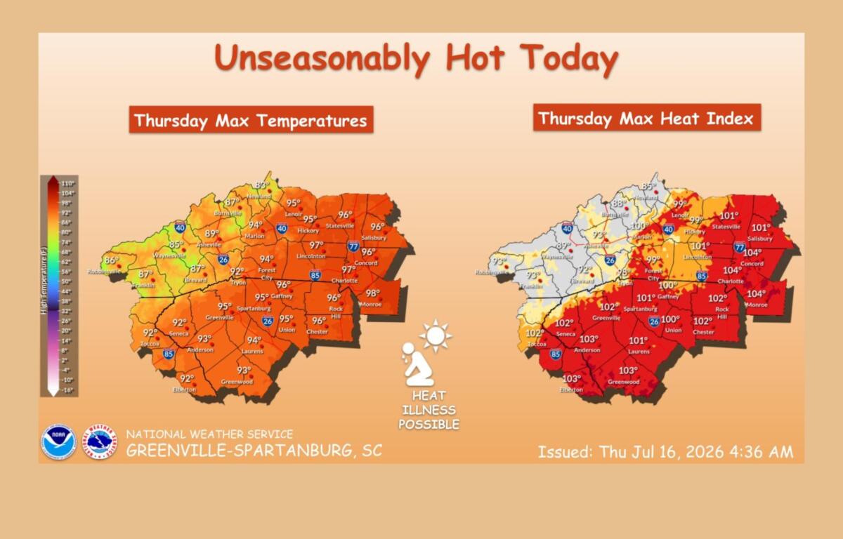
The hottest conditions are expected across the Piedmont and foothills, where heat index values could reach 100 to 105 degrees from Thursday through Sunday. Forecasters said heat advisories could become possible, especially in areas farther east.
The weather service is reminding people to take precautions during the heat, including staying hydrated, limiting strenuous outdoor activities during the hottest part of the day and checking on vulnerable neighbors and family members.
A cold front moving in from the north could bring some relief early next week.
Before then, rain chances will increase over the weekend. Asheville has an 80 percent chance of showers and thunderstorms Saturday, with additional chances Sunday afternoon. Temperatures are expected to ease slightly, with highs in the upper 80s to near 90 through the weekend.
Forecasters said storms will be most likely during the afternoon and evening hours, especially across the mountains. Some storms could bring heavy rain, gusty winds or isolated severe weather.
The return of hot weather comes as the region remembers another extreme weather event.
The National Weather Service noted that 110 years ago this week, the Great Flood of 1916 devastated parts of Western North Carolina. Widespread flooding and debris flows were reported throughout the French Broad River basin, and the state’s record for 24-hour rainfall was set when Altapass in Mitchell County recorded 22.22 inches of rain.