



ASHEVILLE, N.C. (828newsNOW) — After a cool Labor Day, warmer weather is returning to Western North Carolina this week.
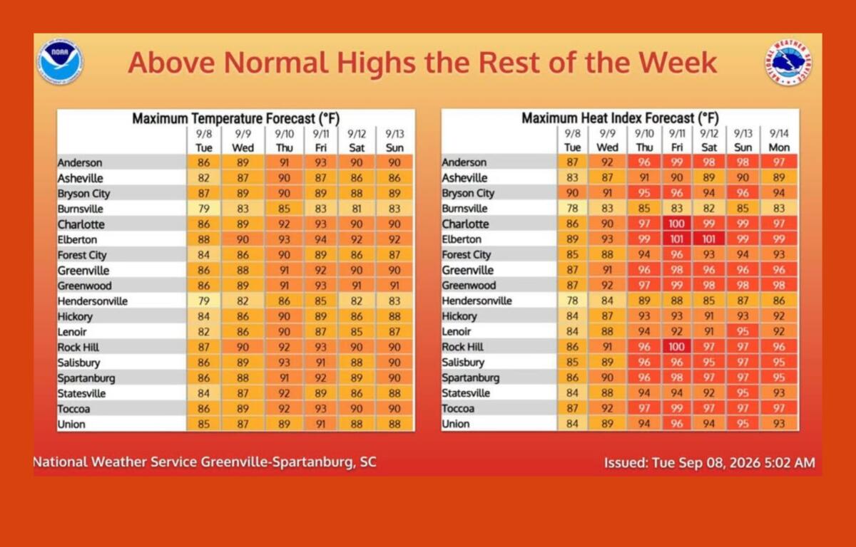
Temperatures will steadily climb through Friday, with mostly dry weather expected through Thursday. The National Weather Service in Greenville-Spartanburg says heat and humidity will increase as the week goes on, although afternoon heat index values are expected to remain below Heat Advisory criteria.
Tuesday and Wednesday should be mostly sunny and warmer, with relatively comfortable humidity for much of the day. Morning fog is possible in some mountain valleys but should clear after sunrise.
Thursday will be warmer and more humid, but most of the day should remain dry.
The pattern changes Friday as a cold front moves into the area. That will bring back chances for showers and thunderstorms, with those chances continuing into the weekend.
The front is expected to stall just south of the western Carolinas, keeping scattered showers and storms possible through the weekend. Temperatures will remain above normal despite the front moving through, as the area is not expected to see a significant change in air mass.
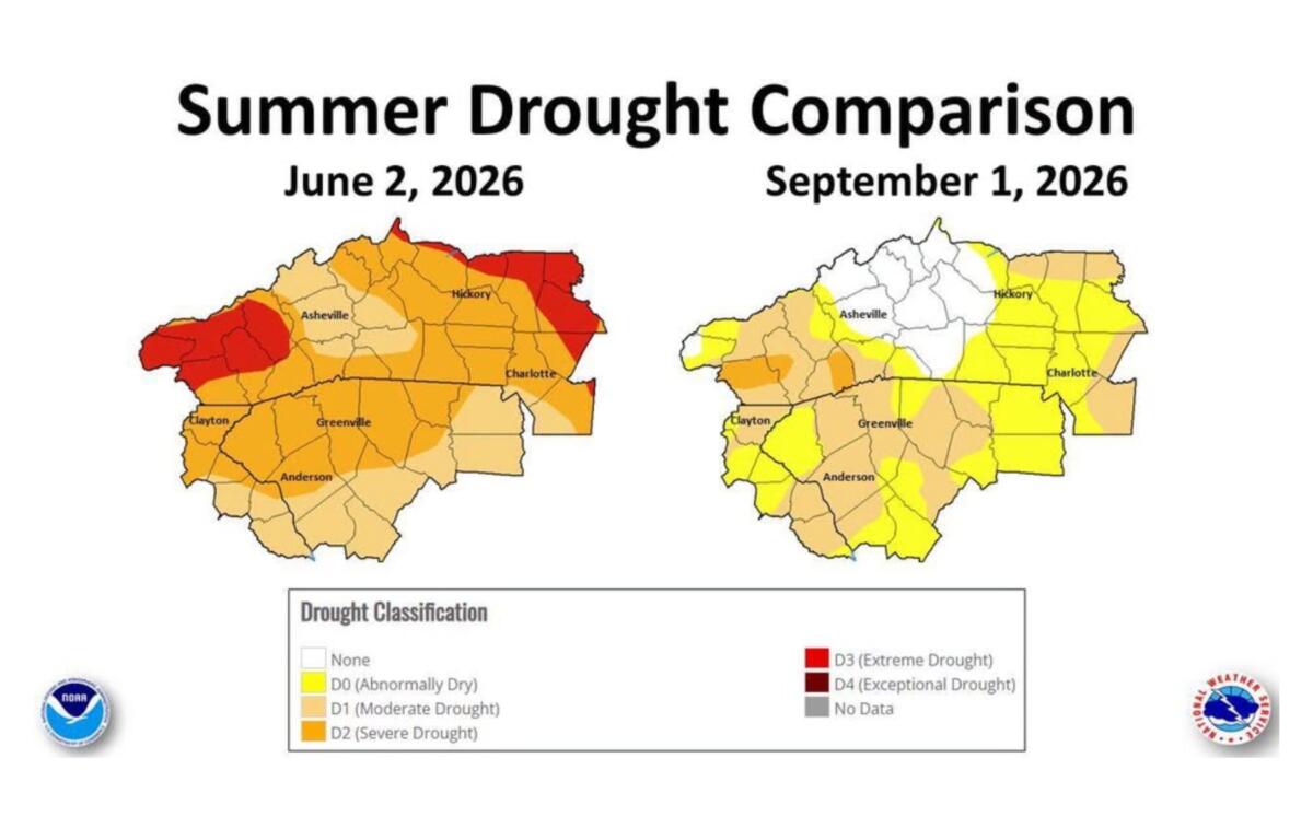
The rain could also provide some additional help after a particularly dry start to the year. Asheville and surrounding areas were in moderate drought earlier this summer, but recent rainfall has brought the area out of drought conditions. The National Weather Service says drought conditions have improved considerably across the western Carolinas and northeast Georgia since early June, although some areas in the region remain in drought.
Asheville has received 32.89 inches of precipitation since Jan. 1, which is 2.22 inches below normal. The city has recorded just 0.02 inches of rain so far in September, compared with a normal 0.92 inches.
Looking ahead to early next week, another round of showers and thunderstorms could develop, particularly across the mountains.
So, for now, enjoy the cooler start to the week — but summer isn’t quite finished with Western North Carolina yet.