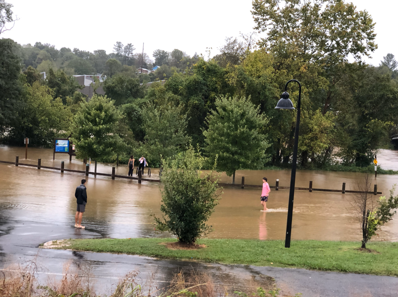

ASHEVILLE, N.C. (828newsNOW) — Heavy rainfall ahead of Hurricane Helene’s arrival has swamped many areas of Western North Carolina. According to the National Weather Service, Helene is expected to make landfall on the Florida coast Thursday evening as a major hurricane. Then, it will make its way north, adding more rainfall to the Western North Carolina region.
“Catastrophic flash-flooding is expected along numerous streams, especially in the NC/SC mountains and NE GA,” the NWS Greenville-Spartanburg office said in a social media post Thursday morning. “Flooding of mainstem rivers is expected, with major to possibly historic flooding near the Blue Ridge Escarpment. Landslides/debris flows expected through at least Friday.”
LOCAL UPDATES
CLICK HERE to watch a joint press conference with Henderson and Buncombe County and the Town of Mills River and Town of Fletcher planned for 4 p.m.
Beware and prepare: State briefing
Thursday morning, Governor Roy Cooper and state emergency officials provided updates during a press conference. CLICK HERE to watch the livestream.
The governor urged all North Carolina residents in the storm’s path to prepare for the worst as more rainfall, strong winds, flash flooding, landslides, power outages and other severe storm impacts are expected. Gov. Cooper said he has activated 175 soldiers and airmen from the North Carolina National Guard along with swift water rescue teams to help with storm efforts in the western region.
Watches, warnings, advisories & more
The National Weather Service has issued several advisories and warnings for flooding in the region. CLICK HERE to view the latest information.


828 ROAD REPORT: WNC CLOSURES AHEAD OF HURRICANE HELENE
Buncombe County officials provided an update Thursday morning. CLICK HERE to watch.
Emergency shelter information + curfews
Avery County
A curfew is being implemented during the state of emergency in Avery County between the hours of 8:00 pm and 5:00 am by the chairperson of Avery County Board of Commissioners.
Buncombe County
As Hurricane Helene approaches, Asheville City and Buncombe County officials have declared Code Purple Emergency Conditions to ensure the safety and well-being of residents. Asheville Buncombe Community Christian Ministry (ABCCM) will open emergency shelters starting at 10:00 AM on Thursday, September 26th.
The Veterans Restoration Quarters, located at 1329 Tunnel Road, Asheville, will serve as the shelter for men, while Transformation Village at 30 Olin Haven Way, Asheville, will provide shelter for women and children. These locations will be available all day and night Thursday and Friday under Code Purple conditions. ABCCM will continue to coordinate closely with city and county officials to address ongoing needs. Asheville Redefines Transit (ART) will provide free transportation to the shelters for those in need.
In addition, ABCCM Crisis Ministry locations will assist individuals and families affected by flooding. ABCCM will collaborate with the American Red Cross, which has historically provided short-term relief through motel and food vouchers. For longer-term assistance, ABCCM Crisis Ministry and local church support will be available to help any who may be displaced during the storm.
Please contact the Veterans Restoration Quarters at 828-259-5333 or Transformation Village at 828-259-5365 for those needing assistance.
—
An emergency shelter is open at Swannanoa Baptist Church, located at 502 Park Street.
After 3 p.m. Thursday, a second shelter will be opening at Trinity Baptist Church, located on Shelburne Road.
Haywood County
The Fines Creek Community Center, located at 190 Fines Creek Road in Clyde, has opened its doors as a welcome center where people can shelter from the rain, recharge and relax.
Henderson County
Henderson County will be opening an Emergency Shelter at the Athletics and Activities Center located at 708 South Grove Street, Hendersonville NC.
The shelter will open at 12:00pm on Thursday, September 26 and will remain open until it is safe for residents to return home.
Jackson County
Southern End: Cashiers Recreation Center
355 Frank Allen Rd, Cashiers NC 28717
Northern End: Department on Aging Center
100 County Services Park, Sylva, NC 28779
If you have a service animal you plan on bringing to the shelter please have a tag with a proof of registration, they will not be accepted inside the shelter without it due to limited space, thank you ‼️
We will have crates available for all animals at the shelters and transport services for them to be taken to the animal shelter in Sylva.
In Cashiers we are going to have our CAMET trailer with resources for storing animals on an off site location.
For non emergency questions please call 828-631-“HELP”


McDowell County
The McDowell County Emergency Management says citizens living near creeks, rivers or low lying areas should temporarily relocate with family or friends to higher ground until the storm passes and conditions improve. An emergency shelter is currently open at Glenwood Baptist Church located at 155 Glenwood Baptist Church Rd. in Marion.
Transylvania County
Transylvania County Sheriff’s Office will be notifying residents door to door in the affected areas. Transylvania County Emergency Management is coordinating a temporary warming station at Rosman High Cafeteria to assist those evacuating in the Town of Rosman opening at 8 PM. An Emergency Shelter with overnight capacity will be opening at the Transylvania County Recreation Center at 8 PM. If you are notified that your area is under the mandatory evacuation, be advised that public safety may not be able to provide emergency response to that location once Hurricane Helene’s most severe impacts are realized overnight and through Friday.
All citizens are asked to limit all unnecessary travel this evening through Friday. Remain alert to changing conditions that may include flash flooding, debris flows, landslides and high winds. Prepare for the potential loss of power and seek high ground for the next 48 hours.
Transylvania County is partnering with community partners, first responder agencies and leveraging our state resources to prepare for potential catastrophic impacts. Resources are being deployed across the county to respond during and after the storm arrives. Please do not call dispatch for road closure information or other non-emergency purposes. Do not attempt to wade or drive through floodwaters and take any and all precautions to remain in a safe and dry place.
Yancey County
A curfew is being put into place for Yancey County from 10 p.m. Thursday through 7 a.m. Friday.
“During this time, there will be **no non-essential travel** allowed. Please stay off the roads unless absolutely necessary to ensure everyone’s safety as Tropical Storm Helene impacts our area,” Yancey County officials said in a Facebook post.
Shelters will be available if needed beginning Friday night 9PM at South Toe Elementary and West Yancey Fire Deptartment. Please bring any necessity items with you including any medicine, medical supplies, comfort items like a pillow or blanket, change of clothes, etc.
National Weather Service forecast
The following is a message from the National Weather Service Greenville-Spartanburg office: This will be one of the most significant weather events to happen in the western portions of the area in the modern era. Record flooding is forecasted and has been compared to the floods of 1916 in the Asheville area. The impacts from this event are expected to be greater than Tropical Storm Fred from August 2021, the mountains in 2004 from Frances and Ivan, and in Upstate South Carolina the Saluda River Basin flooding from 1949. We plead with everyone that you take every single weather warning very seriously through the entirety of this event as impacts will be life-threatening and make sure to have multiple ways to receive the alerts. The protection of life and property is the overall mission of the National Weather Service, and we pledge to stand by the folks of the western Carolinas and northeast Georgia. We cannot stress the significance of this event enough. Heed all evacuation orders from your local Emergency Managers and go to a storm shelter if you do not feel safe at your current location.
Hurricane Helene will make landfall later this evening near the Big Bend of Florida. Significant to catastrophic, life-threatening flooding will occur along and near the Blue Ridge Escarpment. Historic flooding will be possible in this area as an additional 9-14″ of rainfall will be in store. Many landslides will occur as a result, with a few large and severely damaging slope failures or debris flows are likely.
Possible hurricane-force gusts in the North Carolina mountains, northeast Georgia, and the western portion of Upstate South Carolina. 60-70 mph wind gusts possible elsewhere. The combination of strong winds and super saturated soils will lead to widespread trees down and numerous power outages.
—
828newsNOW will be sharing information directly from local law enforcement and officials on Facebook, Instagram and X (formerly known as Twitter). Follow along for the most up-to-date information directly from local sources.
HELENE COVERAGE
Some Buncombe residents urged to evacuate ahead of ‘catastrophic’ flooding
Emergency numbers, websites to keep handy
828 Road Report: WNC closures ahead of Hurricane Helene
Hendersonville braces for possible catastrophic flooding
Thousands without power as heavy rain pounds area
‘Prepare and pray,’ Canton mayor says of coming storm