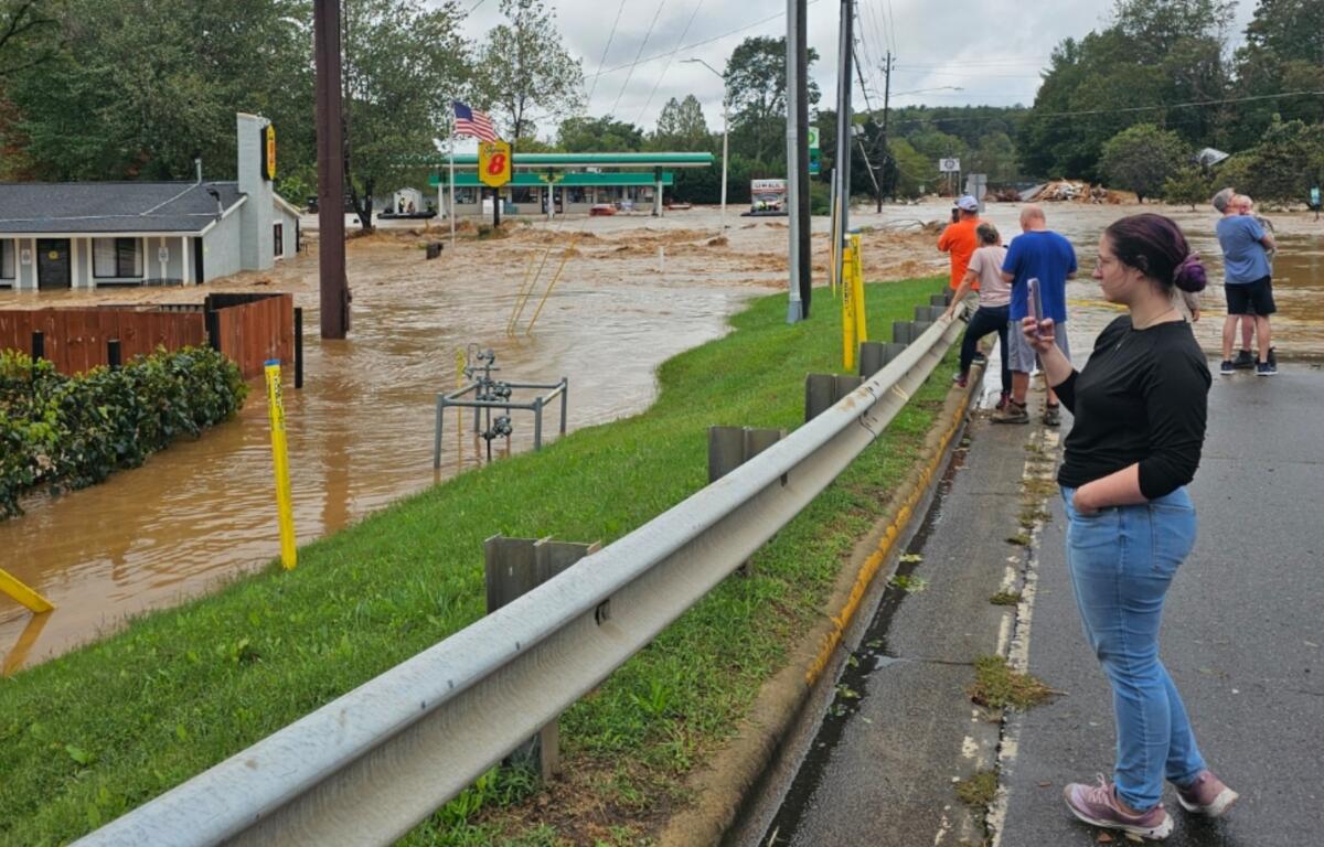

ASHEVILLE, N.C. (828newsNOW) — NCDOT crews have whittled away at the number of roads closed after Tropical Storm Helene unleashed devastating landslides and flooding on Western North Carolina in late September.
More than 1,400 roads were closed after the storm 11 weeks ago. Some 257 remain closed, including portions of major routes like the Blue Ridge Parkway, Interstate 40, U.S. 19 and several state highways such as N.C. 215 and N.C. 226, according to the North Carolina Department of Transporation website.
I-40 near Old Fort reopened after initial closures caused by mudslides. Reconstruction efforts are underway on the interstate in the Pigeon River Gorge. NCDOT is working to reopen it with one narrow lane in each direction by Jan. 1, 2025. Traffic will be reduced to 40 mph through the 9-mile segment near the Tennessee/North Carolina line. That pattern will continue for several years until the road can be rebuilt, according to the NCDOT website.
A section of U.S. 70 in Swannanoa where floodwaters swamped the bridge near Interstate 40 exit 55 also remains closed. Original estimates called for that road to reopen by the end of November. But that reopening has been pushed out to the end of January.
Other road closures in Western North Carolina include:
BUNCOMBE COUNTY
- SR 2727 (Whitson Avenue) closed near Swannanoa
- Hardesty Lane closed near Asheville
- SR 3276 (Wood Avenue) closed near Asheville
- US 74 ALT (Fairview Road) closed near Asheville
- Azalea Road East closed near Asheville
- Azalea Road closed near Asheville
- Rhododendron Road shoulder closed near Black Mountain
- Greybeard Trail Road closed near Montreat
- US 70 (Tunnel Road) closed east of Asheville
- SR 3408 (Craven Street) closed in Asheville
- Blue Ridge Parkway closed near Asheville
- Medford Drive closed in Fairview
- SR 2515 (Flat Creek Road) closed south of Black Mountain
- SR 2515 (Flat Creek Road) closed north of Black Mountain
- SR 2802 (Lower Flat Creek Road) closed near Fairview
- SR 2810 (Hollywood Road) closed near Fairview
- Azalea Road lanes narrowed near Asheville
- Hardesty Lane lanes narrowed near Asheville
- NC 63 (New Leicester Highway) closed to trucks northwest of Asheville
- NC-81 (Swannanoa River Road) closed in Asheville
These closures are expected to end Jan. 31, 2025.
BURKE COUNTY
- SR 1273 (Buggar Hollow Avenue) closed north of Morganton
- Blue Ridge Parkway closed near Morganton
These closures are expected to end Jan. 31, 2025.
CHEROKEE COUNTY
- SR 1391 (Tatham Gap Road) truck closure near Andrews
This closure is expected to end on Dec. 31.
GRAHAM COUNTY
- NC 28 (Fontana Road) truck closure northeast of Robbinsville (expected to end Dec. 31)
- US 129 (Tapoca Road) truck closure near Robbinsville (expected to end Jan. 31, 2025)
HAYWOOD COUNTY
- SR 1397 (Mount Sterling Road) truck closure near the Tennessee line (expected to end Dec. 31)
- SR 1332 (Waterville Road) truck closure near the Tennessee line (expected to end Oct. 31, 2025)
- SR 1338 (White Oak Road) truck closure north of Lake Junaluska (expected to end Oct. 31, 2025)
- SR 1395 (Cove Creek Road) truck closure north of Lake Junaluska (expected to end Oct. 31, 2025)
- NC 209 (Rush Fork Road) truck closure north of Clyde (expected to end Oct. 31, 2025)
- US 19 (Soco Road) truck closure near Maggie Valley (expected to end Oct. 31, 2025)
- NC 209 (Crabtree Road) truck closure near Clyde (expected to end Jan. 31, 2025)
- SR 1004 (Newfound Road) truck closure near Canton (expected to end Jan. 31, 2025)
- SR 1363 (Iron Duff Road) closed near Clyde (expected to end Jan. 31, 2025)
- SR 1357 (Crabtree Church Road) closed near Clyde (expected to end Jan. 31, 2025)
- NC 209 (Crabtree Road) truck closure west of Clyde (expected to end Jan. 31, 2025)
- NC 215 (Lake Logan Road) closed near Waynesville (expected to end Jan. 31, 2025)
- NC 215 (Lake Logan Road) closed south of Lake Junaluska /(expected to end Jan. 31, 2025)
- Interstate 40 closed near the Tennessee line and Canton (expected to end Jan. 1, 2025)
- SR 1364 (Coleman Mountain Road) closed northwest of Lake Junaluska (expected to end Jan. 31, 2025)
- SR 1306 (Evans Cove Road) closed near Maggie Valley (expected to end Jan. 31, 2025)
- NC 209 (Betsys Gap Road) truck closure north of Clyde (expected to end Jan. 31, 2025)
- SR 1338 (Fines Creek Road) truck closure west of Clyde (expected to end Jan. 31, 2025)
- SR 1338 (Fines Creek Road) truck closure west of Clyde (expected to end Jan. 31, 2025)
- SR 1355 (Panther Creek Road) truck closure west of Clyde (expected to end Jan. 31, 2025)
- SR 1334 (Max Patch Road) truck closure west of Clyde (expected to end Jan. 31, 2025)
- SR 1395 (Cove Creek Road) truck closure west of Clyde (expected to end Jan. 31, 2025)
- SR 1350 (Rabbit Skin Road) truck closure west of Clyde (expected to end Jan. 31, 2025)
- SR 1364 (Ironduff Road) truck closure west of Clyde (expected to end Jan. 31, 2025)
- SR 1365 (Crawford Road) truck closure west of Clyde (expected to end Jan. 31, 2025)
- Scott Drive closed east of Canton / Both Directions (expected to end Jan. 31, 2025)
- SR 1505 (Bald Creek Road) lane closed near Canton (expected to end Jan. 31, 2025)
- SR 1363 (Iron Duff Road) truck closure near Lake Junaluska (expected to end Jan. 31, 2025)
- SR 1365 (Crawford Road) truck closure near Lake Junaluska (expected to end Jan. 31, 2025)
- SR 1324 (Qualla Road) truck closure near Lake Junaluska (expected to end Jan. 31, 2025)
HENDERSON COUNTY
- SR 1836 (Pot Shoals Road) closed east of East Flat Rock
- Blue Ridge Parkway closed near Mills River
These closures are expected to end Jan. 31, 2025.
MACON COUNTY
- NC 106 (Dillard Road) closed with a detour near the Georgia line(expected to end Feb. 22, 2025)
- NC 106 (Dillard Road) closed southeast of Highlands (expected to end Jan. 31, 2025)
MADISON COUNTY
- NC 208 truck closure near the Tennessee line (expected to end Jan. 31, 2025)
- NC 212 truck closure near the Tennessee line (expected to end Jan. 31, 2025)
- US 25 truck closure near the Tennessee line (expected to end Jan. 31, 2025)
- US 70 truck closure near the Tennessee line (expected to end Jan. 31, 2025)
- SR 1576 (Bend of Ivy Road) closed near Mars Hill (expected to end Jan. 31, 2025)
- SR 1303 (Lower Shut In Road) closed south of Tennessee line (expected to end Jan. 31, 2025)
- SR 1304 (River Road) closed near Hot Springs (expected to end Jan. 31, 2025)
- SR 1203 (Redmon Road) closed near Marshall (expected to end Jan. 31, 2025)
- NC 209 — Local traffic only Hurricane Helene — truck closure near Hot Springs (expected to end Jan. 31, 2025)
- US 25 BUS (South Main Street) closed in Marshall (expected to end Jan. 31, 2025)
- US 70 BUS (South Main Street) closed in Marshall (expected to end Jan. 31, 2025)
- US 25 BUS (Main Street) closed in Marshall (expected to end Jan. 31, 2025)
- SR 1203 (Redmon Road) closed in Marshall (expected to end Jan. 31, 2025)
- Flag Pond Road truck closure near the Tennessee line (expected to end Jan. 31, 2025)
- SR 1502 (Streets Gap Road) truck closure near the Tennessee line (expected to end Jan. 31, 2025)
- Big Bald Road truck closure near the Tennessee line (expected to end Jan. 31, 2025)
- SR 1182 (Max Patch Road) truck closure near the Tennessee line (expected to end Jan. 31, 2025)
- SR 1189 (Grassy Creek Road) truck closure near the Tennessee line (expected to end Jan. 31, 2025)
- SR 1183 (Upper Shut In Road) truck closure near the Tennessee line (expected to end Jan. 31, 2025)
- Millers Gap Road closed near the Tennessee line (expected to end Jan. 31, 2025)
- SR 1203 (Redmon Road) closed near Marshall (expected to end Jan. 31, 2025)
- SR 1175 (Meadow Fork Raod) closed southwest of Hot Springs (expected to end Jan. 14, 2025)
- SR 1304 (River Road) closed in Hot Springs (expected to end Dec. 31)
- Lookout Mountain Road/Rich Mountain Road truck closure west of Hot Springs (expected to end Dec. 31)
- US 25 BUS (Main Street) closed in Marshall (expected to end Dec. 31)
- SR 1203 (Redmon Road) closed in Marshall (expected to end Dec. 31)
- Flag Pond Road truck closure near the Tennessee line (expected to end Dec. 31)
- SR 1502 (Streets Gap Road) truck closure near the Tennessee line (expected to end Dec. 31)
MCDOWELL COUNTY
- NC 80 (Buck Creek Road) closed in Marion (expected to end Dec. 31)
- US 221 (Highway 221 North) — local traffic only — truck closure north of Woodlawn (expected to end Dec. 31)
- NC 226 ALT closed north of Marion (expected to end Dec. 20)
- NC 226 ALT closed north of Marion (expected to end Dec. 20)
- US 221 (Highway 221 North) closed north of Woodlawn (expected to end Dec. 20)
- SR 1116 (Commerce Stree) closed near Marion (expected to end Dec. 20)
- NC 226 ALT (NC 226 North) closed near Woodlawn (expected to end Dec. 20)
- SR 1119 (Orchard Street) closed near Marion (expected to end Dec. 20)
- SR 1407 (Mill Creek Road) closed near Marion (expected to end Dec. 20)
- SR 1566 (Peppers Creek Road) closed north of Woodlawn (expected to end Dec. 20)
- SR 1573 (Pitts Station Road) closed northeast of Woodlawn (expected to end Dec. 20)
- SR 1569 (North Cove School Road) closed in Woodlawn (expected to end Dec. 20)
- SR 1446 (Bear Wallow) closed near Woodlawn (expected to end Dec. 20)
- SR 1103 (Catawba Avenue) closed near Old Fort (expected to end Dec. 20)
- NC 226 ALT closed north of Woodlawn (expected to end Dec. 20)
MITCHELL COUNTY
- SR 1320 (Sams Branch/Huntdale Road) closed north of Bakersville (expected to end May 1, 2025)
- SR 1002 (Crabtree Road) truck closure southwest of Spruce Pine (expected to end Feb. 7, 2025)
- SR 1122 (Tempie Mountain Road) truck closure east of Spruce Pine (expected to end Jan. 31, 2025)
- SR 1268 (Franklintown) truck closure east of Spruce Pine (expected to end Jan. 31, 2025)
- SR 1121 (Altapass Road) closed near Spruce Pine (expected to end Jan. 31, 2025)
- SR 1167 (Wing Road) closed northwest of Spruce Pine (expected to end Dec. 20)
- SR 1305 (Whitson Branch Road) closed west of Bakersville (expected to end Dec. 20)
- SR 1320 (Huntdale Road) closed west of Bakersville (expected to end Dec. 20)
- SR 1314 (Relief Road) closed north of Bakersville (expected to end Dec. 20)
- SR 1188 (Dale Hill Road) closed near Spruce Pine (expected to end Dec. 20)
- SR 1330 (Hughes Gap Road) truck closure north of Bakersville (expected to end Dec. 31)
- NC 226 truck closure south of the Tennessee line (expected to end Dec. 31)
- Blue Ridge Parkway closed near Bakersville (expected to end Dec. 31)
- NC 197 truck closure near the Tennessee line (expected to end Dec. 31)
- NC 261 truck closure near the Tennessee line (expected to end Dec. 31)
- SR 1330 (Hughes Gap Road) truck closure near the Tennessee line (expected to end Dec. 31)
POLK COUNTY
- SR 1151 (Green River Cove Road) closed near Columbus (expected to end Dec. 20)
- SR 1543 (Capps Road) closed in Tryon (expected to end Dec. 20)
- SR 1517 (Morgan Chapel Road) closed near the South Carolina line (expected to end Dec. 20)
- SR 1151 (Green River Cove Road) closed northwest of Columbus (expected to end Dec. 20)
- SR 1151 (Green River Cove Road) closed near Columbus (expected to end Dec. 20)
- SR 1543 (Capps Road) closed near Columbus (expected to end Dec. 20)
- SR 1179 (Edney Road) closed near Tryon (expected to end Dec. 20)
- SR 1331 (Abrams & Moore roads) closed near Columbus (expected to end Dec. 20) US-176 closed near Tryon (expected to end Jan. 31, 2025)
RUTHERFORD COUNTY
- US 64 closed near Chimney Rock (expected to end Jan. 31, 2025)
TRANSYLVANIA COUNTY
- SR 1207 (Barclay Road) closed near Brevard (expected to end Dec. 20)
- SR 1534 (Hart Road) closed east of Brevard (expected to end Dec. 20)
- Blue Ridge Parkway closed near Rosman (expected to end Dec. 20)
- SR 1333 (Diamond Creek Road) lane closed near Rosman (expected to end Dec. 20)
- SR 1538 (Becky Moutain Road) closed near Brevard (expected to end Dec. 20)
- Blue Ridge Parkway — local traffic only — truck closure northwest of Brevard (expected to end April 30, 2025)
YANCEY COUNTY
- US 19 closed north of Burnsville (expected to end Dec. 31)
- SR 1300 (Arbuckle Road) truck closure east of Burnsville (expected to end Dec. 31)
- US 19 closed southeast of the Tennessee line (expected to end Dec. 20)
- SR 1395 (Blad Mountain Road/Scronce Creek) closed near the Tennessee line (expected to end Dec. 20)
- Whitson Branch Road closed north of Burnsville (expected to end Dec. 20)
- SR 1411 (Little Creek Road) closed northeast of Burnsville (expected to end Dec. 20)
- NC 197 closed south of Burnsville (expected to end Dec. 20)
- SR 1153 (Hickory Springs Road) closed southeast of Burnsville (expected to end Dec. 20)
- NC 197 lanes narrowed near the Tennessee line (expected to end Dec. 20)
- US 19 closed near Burnsville (expected to end Dec. 20)
- US 19 closed south of the Tennessee line (expected to end Dec. 20)
- Rabbit Hop Drive closed northwest of Burnsville (expected to end Dec. 20)
- US 19 closed south of the Tennessee line (expected to end Dec. 20)
- SR 1114 (Dam Road) closed near Burnsville (expected to end Dec. 20)
- SR 1152 (Blue Rock Road) closed in Burnsville (expected to end Dec. 31)
- US 19 truck closure near the Tennessee line (expected to end Dec. 31)
- SR 1142 (Georges Fork Road) closed near Burnsville (expected to end Jan. 1, 2025)
- SR 1348 (Sweetwater Road) closed near Burnsville (expected to end Jan. 1, 2025)
- SR 1142 (Lower Georges Fork Road) closed near Burnsville (expected to end Jan. 1, 2025)
- SR 1114 (Dam Road) closed near Burnsville (expected to end Jan. 1, 2025)
- SR 1126 (Hortons Creek Road) closed near Burnsville (expected to end Jan. 1, 2025)
- Saddlebrook Drive closed south of Burnsville (expected to end Dec. 20)
- Indian Springs/Hawks Nest Drive closed south of Burnsville (expected to end Dec. 20)
- CC Allen Road closed south of Burnsville (expected to end Dec. 20)
- Roland Street closed near Burnsville (expected to end Dec. 20)
- Woodland Circle closed near Burnsville (expected to end Dec. 20)
- Blue Bird Lane closed near Burnsville (expected to end Dec. 20)
- Blue Ridge Lane closed near Burnsville (expected to end Dec. 20)
- Haney Creek Road closed south of Burnsville (expected to end Dec. 20)
- Edward Williams Road closed south of Burnsville (expected to end Dec. 20)
- SR 1182 (Wild Smith Road) closed near Burnsville (expected to end Dec. 20)
- SR 1101 (Sharp Top Road) closed south of Burnsville (expected to end Dec. 20)
- SR 1102 (Cattail Creek Road) closed south of Burnsville (expected to end Dec. 20)
- Pioneer Road closed near Burnsville (expected to end Dec. 20)
- SR 1106 (Pensacola School Road) closed south of Burnsville (expected to end Dec. 20)
- SR 1184 (Riverview Road) closed south of Burnsville (expected to end Dec. 20)
- Caterson Way closed south of Burnsville (expected to end Dec. 20)
- Moody Mountain Road closed south of Burnsville (expected to end Dec. 20)
- Bee Branch Road closed south of Burnsville (expected to end Dec. 20)
- SR 1139 (Ferguson Hill Road) closed near Burnsville (expected to end Dec. 20)
- Moss Drive Road closed near Burnsville (expected to end Dec. 20)
- Dove Cove Road closed near Burnsville (expected to end Dec. 20)
- SR 1112 (Toodies Creek Road) closed near Burnsville (expected to end Dec. 20)
- SR 1113 (Concord Church Road) closed near Burnsville (expected to end Dec. 20)
- Knollwood Lane closed near Burnsville (expected to end Dec. 20)
- Early Bird Lane closed near Burnsville (expected to end Dec. 20)
- Satellite Mountain Road closed near Burnsville (expected to end Dec. 20)
- SR 1179 (Powell Road) closed near Burnsville (expected to end Dec. 20)
- Paradise Lane closed near Burnsville (expected to end Dec. 20)
- SR 1437 (Mountain View Road) shoulder closed near Burnsville (expected to end Dec. 20)
- SR 1134 (Pleasant Valley Road) closed near Burnsville (expected to end Dec. 20)
- SR 1128 (Possum Trot Road) closed near Burnsville (expected to end Dec. 20)
- Riverbend Road closed in Burnsville (expected to end Dec. 20)
- Shepard Way closed in Burnsville (expected to end Dec. 20)
- SR 1381 (Langford Branch Road) closed west of Burnsville (expected to end Dec. 20)
- Smokey Rise Drive closed west of Burnsville (expected to end Dec. 20)
- SR 1411 (Little Creek Road) closed northwest of Burnsville (expected to end Dec. 20)
- SR 1159 (Rock Creek Road) closed south of Burnsville (expected to end Dec. 20)
- SR 1421 (Windy Gap road) closed west of Burnsville(expected to end Dec. 20)
- SR 1413 (Bent Creek Road) closed near the Tennessee line (expected to end Dec. 20)
- SR 1357 (Whitson Branch Road) closed northeast of Burnsville (expected to end Dec. 20)
- SR 1307 (Wyatt Town Road) closed near Burnsville (expected to end Dec. 20)
- SR 1338 (Toe River Road) closed north of Burnsville (expected to end Dec. 20)
- SR 1314 (Roses Branch Road) closed near Burnsville (expected to end Dec. 20)
- SR 1311 (Lower Doe Bag Road) closed near Burnsville (expected to end Dec. 20)
- SR 1169 (Halls Chapel Road) closed near Burnsville (expected to end Dec. 20)
- SR 1158 (Colberts Creek Road) closed south of Burnsville (expected to end Dec. 20)
- SR 1168 (Hannah Branch Road) closed south of Burnsville (expected to end Dec. 20)
- SR 1154 (Grindstaff Road) closed south of Burnsville (expected to end Dec. 20)
- SR 1115 (Bakers Creek Road) closed near Burnsville (expected to end Dec. 20)
- SR 1109 (Bolens Creek Road) closed south of Burnsville (expected to end Dec. 20)
- SR 1167 (7 Mile Ridge Road) closed near Burnsville (expected to end Dec. 20)
- SR 1369 (Green Mountain Drive) closed near Burnsville (expected to end Dec. 20)
- SR 1438 (Charlie Brown Road) closed near Burnsville (expected to end Dec. 20)
- SR 1194 (Ossie Gouge Road) closed near Burnsville (expected to end Dec. 20)
- Blue Ridge Parkway closed near Burnsville (expected to end Jan. 31, 2025)