
ASHEVILLE, N.C. (828newsNOW) — Unseasonably hot and dry conditions are expected across western North Carolina and the broader Carolinas region this week, raising fire weather concerns ahead of a sharp temperature drop early next week.
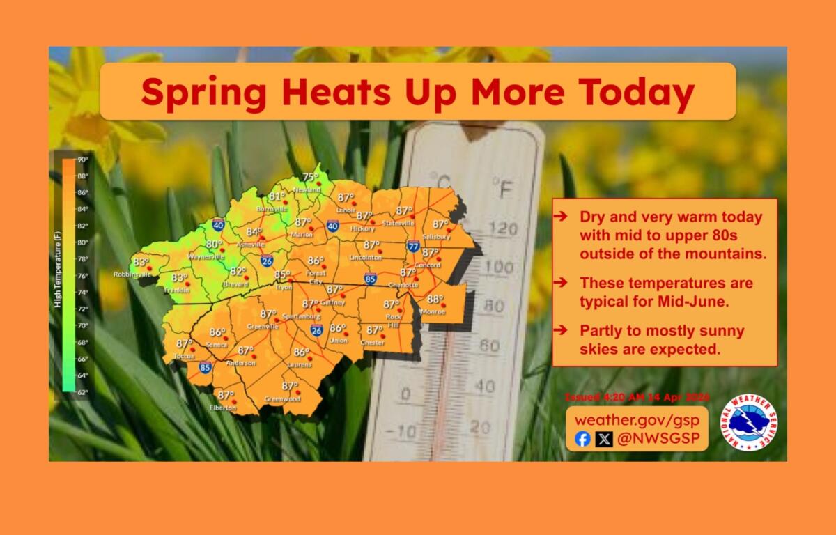
The National Weather Service in Greenville-Spartanburg said temperatures Tuesday afternoon will feel more like early summer than mid-April, with highs running 10 to 15 degrees above normal. A Fire Danger Statement is in effect from noon to 8 p.m. for parts of the North Carolina Piedmont and northeast Georgia as dry, stagnant conditions persist.
Forecasters warn the hot and dry pattern will continue through Saturday, with high temperatures approaching daily records. Some areas could see highs in the mid-90s — roughly 20 to 25 degrees above average for this time of year.
Because of the increased wildfire risk, the North Carolina Forest Service issued a statewide ban on all open burning and canceled all burning permits until further notice.
A cold front is expected to move through the region Sunday, bringing a chance of rain, though precipitation totals are expected to be limited. Near-normal temperatures are forecast to return early next week.
Meteorologists say the rapid shift in temperatures could bring a risk of frost by Monday morning, particularly in the mountains where lows could dip into the 20s. Elsewhere, overnight temperatures are expected to fall into the 30s and 40s.
The dramatic swing underscores the volatility of spring weather in the region and poses challenges for agriculture and outdoor planning, with experts cautioning that it remains too early in the season to safely plant in mountain areas.