
NOON UPDATE: Duke Energy is urging customers across the Carolinas to reduce electricity use during peak demand hours Monday morning as extremely cold temperatures strain the regional power grid.
The utility asked customers to conserve energy from 4 a.m. to 10 a.m. Monday, Feb. 2, when demand is expected to be highest. Temperatures across the region are forecast to run 10 to 20 degrees below normal, driving unusually high electricity use along much of the East Coast, including the Carolinas.
Duke Energy said limited power supplies during the cold snap increase the risk of outages if demand is not reduced.
“We take every possible action to manage the available power supply and work throughout the year to prepare for this type of constraint,” the company said in a statement. “Energy conservation can play a critical role in protecting the energy grid and avoiding temporary power outages.”
The company recommended several steps customers can take to reduce usage, including setting thermostats at the lowest comfortable temperature and wearing additional layers. Customers are also encouraged to avoid using high-energy appliances such as washing machines, dryers, dishwashers, ovens and stovetops during peak hours.
Duke Energy advised against using electric space heaters, which consume large amounts of electricity, and encouraged residents to open blinds or curtains during daylight hours to allow natural warming. Turning off unnecessary lights, appliances and electronic devices can also help lower demand.
Electric vehicle owners were asked to avoid charging vehicles in the morning and instead charge during midday hours when demand is lower.
The utility acknowledged that cutting back on energy use during extreme cold can be difficult and thanked customers for their cooperation.
—
11:45 a.m. UPDATE: Gov. Josh Stein urged residents to stay off North Carolina’s roads after a rare, statewide snowstorm blanketed all 100 counties and led to more than 1,000 traffic crashes, including two fatalities.
The storm dropped as much as 16 inches of snow in Lexington and 15 inches in Ocean Isle, with heavy accumulations across eastern North Carolina, Stein said Sunday morning.
“This is no joke,” Stein said. “For your own safety and for the safety of the people clearing the roads, please stay at home if you possibly can.”
The governor said freezing temperatures expected to persist through at least Monday will keep many roads dangerous for days, with black ice remaining a major concern. The North Carolina Department of Transportation has about 2,500 workers operating overtime to clear roadways, but officials warned that the state’s vast road network will take time to fully reopen.
More than 1,000 collisions were reported over the weekend, Stein said, including a massive pileup involving more than 100 vehicles along Interstate 85. He credited the State Highway Patrol, the North Carolina National Guard and local law enforcement with clearing the crash scene in less than three hours.
Stein also warned of dangerous cold, particularly in Western North Carolina, where wind chills could drop well below zero. He said the extreme cold could strain the electrical grid as residents increase heating use and encouraged people to conserve energy when possible.
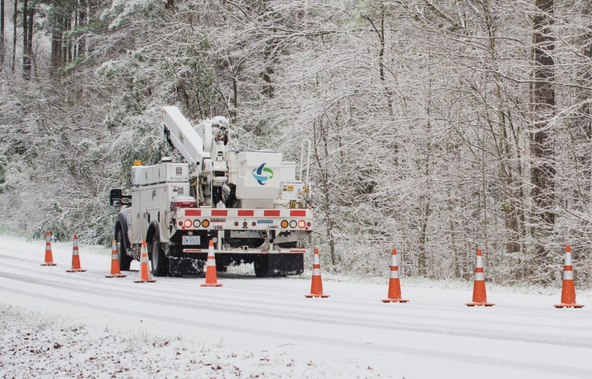
As of Sunday morning, about 10,500 power outages had been reported statewide, according to North Carolina Emergency Management.
N.C. 12 on the Outer Banks remained closed because of ocean overwash, high winds and high tides, officials said. Ferry service was also suspended for safety reasons.
North Carolina Emergency Management Chief of Staff Don Campbell said 33 local states of emergency were in effect, with 25 local emergency operations centers activated and others monitoring conditions. He urged residents to dial 911 only for emergencies and to call 211 for general information.
Campbell also warned residents to stay off frozen ponds, lakes and creeks, saying the ice cannot support the weight of people or pets and poses a deadly risk in extreme cold.
Transportation Secretary Daniel Johnson said some parts of the state experienced record snowfall and warned it could take days — and in some areas up to a week — to clear secondary roads.
“Our crews are throwing everything we have at this,” Johnson said. “But if you don’t have to drive, please don’t.”
Officials urged motorists who must travel to slow down, keep extra distance between vehicles and carry emergency supplies, including blankets, a charged phone and a full tank of gas. Drivers were also warned not to drive through floodwaters.
For the latest road conditions, officials advised residents to visit DriveNC.gov.
“This is a special day for North Carolina because we just don’t get snow like this very often,” Stein said. “Have fun, stay off the roads and stay safe.”
—
10 a.m. UPDATE: Local and state officials across Western North Carolina are urging residents to stay off the roads following a significant winter storm, as crews continue snow removal, emergency response and power restoration efforts.
The City of Asheville issued a road advisory asking drivers to remain off roadways while Public Works crews focus on clearing Priority One roads — major arterials that are addressed before minor through streets and residential areas. Officials said limiting traffic helps keep motorists safe and allows snow plows to operate more efficiently. The city’s snow removal priorities are available through its Snow Mapper.
The North Carolina Department of Transportation echoed the message, advising residents to stay home unless travel is essential or an emergency. NCDOT said crews have been working around the clock when conditions allow, prioritizing interstates and primary roads before moving on to secondary routes.
“We’re working whenever and wherever it’s safe to do so,” the agency said in a statement.
The Riceville Volunteer Fire Department also warned of hazardous conditions, including snow drifts caused by strong winds that may conceal road shoulders and drop-offs. Fire officials said road crews and utility workers restoring power need safe work zones and asked residents to avoid unnecessary travel.
“Please stay off the road unless it is an absolute emergency,” Fire Chief Tom Kelly said, encouraging residents to remain at home and allow crews to do their work safely.
In Polk County, officials thanked the National Guard for assisting in the recovery of numerous tractor-trailers stranded along the Saluda Grade. County leaders also praised NCDOT, IMAP teams, and snowplow operators for keeping Interstate 26 moving during the storm.
Officials across the region credited residents who stayed off the roads with helping emergency and road crews manage the aftermath of the winter weather.
—
ASHEVILLE, N.C. (828newsNOW) — A blast of snow, bitter cold and strong winds continued to grip Western North Carolina and much of the state Sunday, prompting urgent warnings for motorists to stay off the roads as hazardous conditions persisted.
The National Weather Service office in Greenville-Spartanburg reported numerous traffic accidents along Interstate 85 in Greenville and Spartanburg counties, attributing the crashes to snow-covered and icy roads across the region.
In the Asheville area, numerous Facebook posts also reported icy, snow-covered road conditions, underscoring the widespread travel hazards.
A winter storm warning remained in effect until 7 a.m. Sunday, while an extreme cold warning was set to continue until 1 p.m. Forecasters also kept a wind advisory in place through early afternoon, with gusts expected to reach up to 40 mph.
Sunday’s forecast called for patchy blowing snow during the morning hours, followed by gradually clearing skies. High temperatures were expected to struggle to reach 19 degrees, with wind chill values dropping as low as minus 14. Overnight lows were forecast around 5 degrees, with wind chills near minus 2.
Conditions are expected to improve gradually in the days ahead. Monday is forecast to be sunny with a high near 38, followed by milder temperatures later in the week. Rain could return Tuesday night, with a chance of a rain-and-snow mix lingering into Wednesday morning.
Across the state, snow was tapering off Sunday morning in eastern North Carolina, according to North Carolina’s Weather Authority. Despite improving skies, forecasters warned that breezy conditions and subzero wind chills in some areas would keep travel dangerous, with daytime highs remaining in the 20s and 30s.
The winter weather also caused scattered power outages. Duke Energy reported that as of 5:30 a.m., five outages were affecting 32 customers in Buncombe County, while 27 outages impacted 913 customers in Henderson County.
Officials urged residents to avoid unnecessary travel, use caution if venturing outdoors and continue to monitor forecasts as the cold snap slowly loosens its grip on the region.