


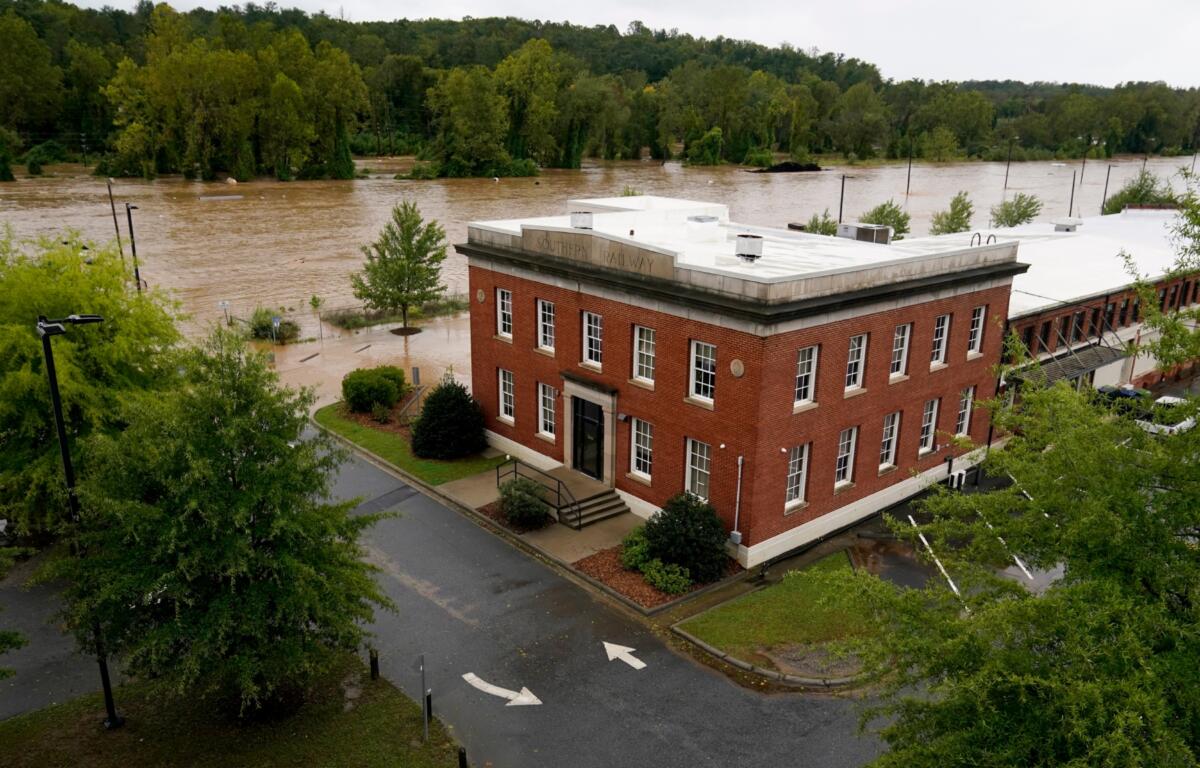

ASHEVILLE, N.C. (828newsNOW) — Asheville could receive updated floodplain maps as early as spring 2027, potentially giving property owners a new picture of flooding risks more than two years after Tropical Storm Helene.
Nancy Watford, Asheville’s stormwater plan review supervisor, told the Planning and Zoning Commission on Wednesday, Nov. 4, that the city has not yet received preliminary maps from the state.
At a recent floodplain conference, officials were told the maps could be available during the first quarter of 2027 or sometime in the spring, she said.
“We’ll see if we get preliminary maps by then,” Watford said.
Once finalized and adopted, updated maps could change which properties fall within regulated floodplains, potentially affecting construction and redevelopment requirements.
But Watford emphasized that preliminary maps would not automatically become part of the city’s enforceable regulations.
What would new floodplain maps mean?
Floodplain maps identify areas at risk of flooding and help determine where special construction requirements apply.
Asheville currently regulates development within the 100-year floodplain, an area with a 1% chance of flooding in any given year.
The city does not currently impose the same floodplain development requirements on properties solely because they fall within the 500-year floodplain, which has a 0.2% annual chance of flooding.
That distinction matters for homeowners, businesses and developers trying to determine what they can build and how structures must be protected.
Watford explained that new residential buildings in the regulated floodplain generally must be elevated at least 2 feet above the base flood elevation, the estimated height floodwaters would reach during a 100-year flood.
Commercial buildings have additional options, including designs intended to keep floodwater out of occupied portions of a structure.
Those protections can include flood barriers and other measures that must be maintained and put into place when flooding threatens.
Watford said commercial developments using certain floodproofing methods must have a flood action plan identifying who is responsible for deploying and maintaining those protections.
The city’s floodplain rules also restrict new habitable structures within the floodway, the portion of a floodplain needed to carry floodwaters.
Why build higher than required?
Even before the new maps arrive, Watford said the city is encouraging property owners and developers to consider stronger flood protections than current regulations require.
Watford said state guidance recommends considering elevations 4 feet above the base flood elevation, providing an additional margin of protection beyond Asheville’s current requirements for new residential construction.
That additional height is a recommendation, not a new city requirement.
Watford said she often advises developers to consider going higher, particularly in areas where flooding has proved especially difficult to manage.
She pointed to the Swannanoa River Road corridor as an area of particular concern.
The corridor’s floodplain is constrained in places, and adding fill to elevate a building can sometimes affect neighboring properties by changing how floodwaters move.
Watford said some projects have had to pursue other flood protection methods after studies showed that placing fill on the property could create problems elsewhere.
She also recalled projects built between earlier rounds of flood mapping that were later affected when the standards changed.
Some property owners had chosen to build higher than required and were better positioned when updated maps established new flood elevations.
Others had less room to spare.
The examples illustrated why meeting today’s minimum requirements may not provide the same level of protection under future flood conditions.
What happens while Asheville waits?
The updated maps are being developed through North Carolina’s flood mapping program, which works with the Federal Emergency Management Agency.
In the meantime, property owners and developers can consult the state’s existing flood maps and advisory flood risk information.
Watford said those advisory tools can provide additional information about potential flooding, including areas that may not appear within the boundaries of the current regulatory maps.
That is particularly important because flooding can occur outside mapped floodplains.
The city’s review process also considers whether proposed development could worsen flooding on neighboring properties, particularly when projects involve adding fill or changing drainage patterns.
Commissioners asked whether flood mitigation efforts could eventually reduce the size of mapped floodplains.
Watford explained that floodplain boundaries can expand or contract as mapping and river conditions change. She noted that some areas became smaller and others larger between previous mapping updates.
But improvements to individual properties do not necessarily change the underlying floodplain calculations.
What happens next?
The city is waiting for preliminary maps, which Watford said could arrive in the first part of 2027.
Their release would be an important step, but not the end of the process. Any changes to Asheville’s enforceable floodplain regulations would have to follow the applicable review and adoption requirements.
Watford encouraged property owners and developers to consider available flood risk information, including advisory maps, rather than relying solely on the minimum protections required under current regulations.
For residents rebuilding after Helene or considering construction in flood-prone areas, the anticipated maps could eventually provide more information about the risks their properties face.
Until new maps become effective, Asheville’s existing floodplain regulations remain in place.