
ASHEVILLE, N.C. (828newsNOW) — The city of Asheville will begin a monthslong assessment of its stormwater system March 23, with crews expected to work in neighborhoods with minimal disruption.
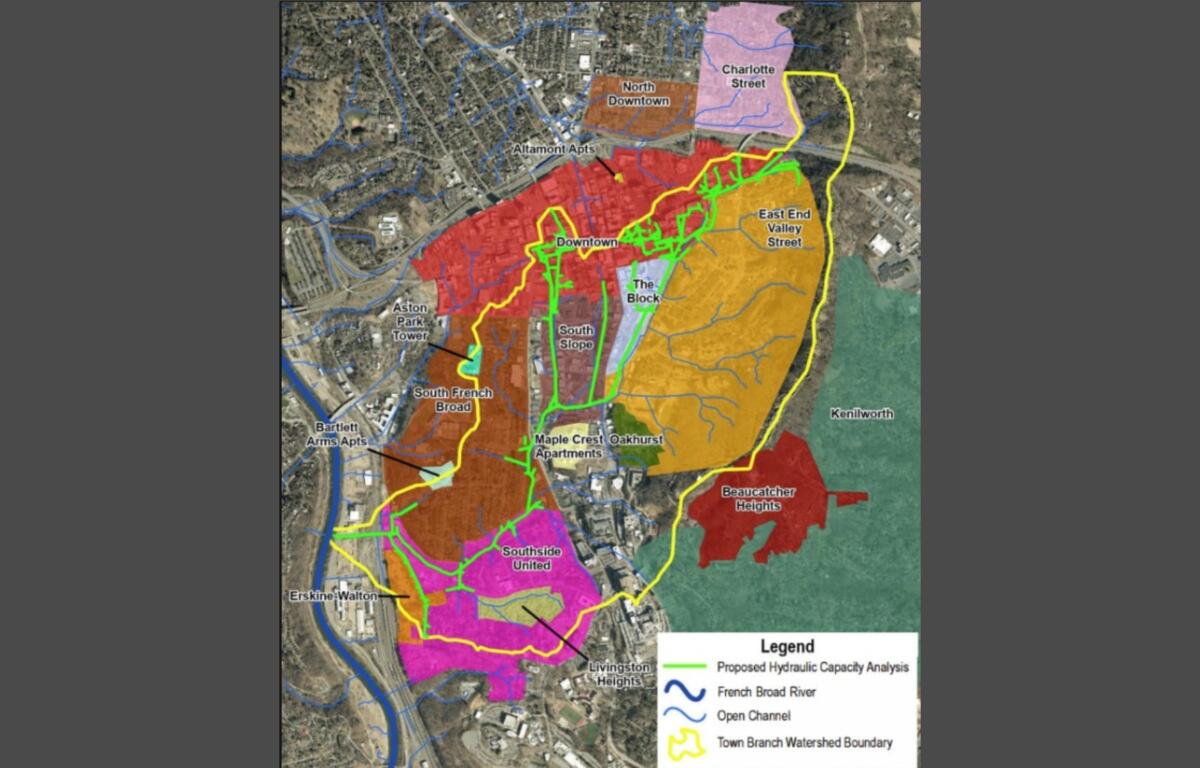
Field work will start in the Town Branch watershed, locally known as “Nasty” Branch, according to a city news release. The study area stretches from the headwaters on Beaucatcher Mountain to where the branch flows into the French Broad River near Lyman Street.
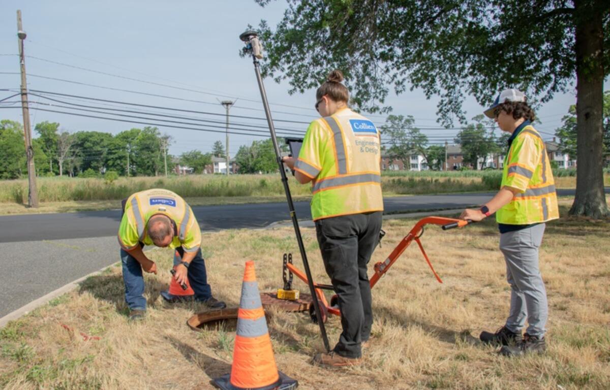
Crews will inspect storm drains, manholes and other drainage infrastructure, collecting measurements, photos, video and GPS readings. The effort is aimed at building a more complete and reliable map of the system and identifying areas prone to localized flooding and erosion.
Officials said the assessment will help determine the condition of existing infrastructure, prioritize maintenance and capital improvement projects, and guide future planning.
The project is expected to run through the end of June, with additional phases expanding to other watersheds over the next several years as the city works toward a comprehensive, citywide inventory.
Impacts to residents and businesses are expected to be minimal. Some temporary lane closures may occur, but no road closures or detours are anticipated. Residents are asked to avoid parking over storm drains and manholes to allow crews access.
Small crews from engineering firms Ardurra and Colliers Engineering & Design will conduct the work alongside city staff. Workers will wear high-visibility clothing and company identification.
The $900,000 project is funded through the city’s stormwater utility fee and a grant from the American Rescue Plan Act, a federal COVID-19 relief program.