
ASHEVILLE, N.C. (828newsNOW) — A cold front moving across Western North Carolina on Wednesday is expected to bring scattered showers and isolated thunderstorms, followed by a sharp drop in temperatures and the season’s first potential frost in higher elevations, according to the National Weather Service in Greenville-Spartanburg.
Forecasters said the front will move through the mountains by tonight, ushering in cooler, drier air as a strong high-pressure system builds in from the Great Lakes. Gusty winds up to 20-30 mph are possible overnight as the new air mass settles in.
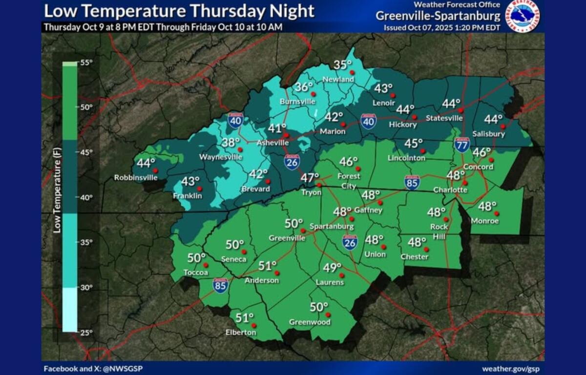
Thursday and Friday are expected to be sunny and cool, with daytime highs in the upper 60s and lows dipping into the upper 30s and low 40s. The National Weather Service said frost could form late Thursday night into early Friday morning across the northern mountains and some higher ridges west of the French Broad Valley. A Frost Advisory may be issued if winds calm enough for frost to develop.
Conditions are expected to remain dry through the weekend and into early next week, with a gradual warming trend beginning Saturday. Highs should return to the low 70s by Sunday and early next week.
Forecast at a glance
- Wednesday: Scattered showers and isolated thunderstorms, high near 75.
- Tonight: Mostly clear, low around 48.
- Thursday: Sunny and cooler, high near 68.
- Thursday night: Mostly clear, low around 40 with possible frost in mountain valleys.
- Friday: Sunny, high near 66.
- Weekend: Dry and warmer, highs in the low 70s.