
ASHEVILLE, N.C. (828newsNOW) — Winter has arrived with force in the North Carolina mountains, sending nowflakes flying in the gusty winds.
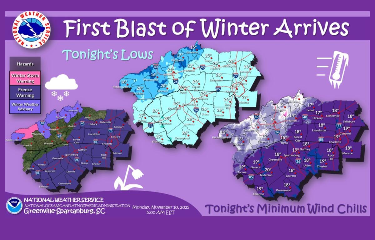
An Arctic airmass that swept in behind a departing cold front brought gusty winds, plunging temperatures and the first significant northwest-flow snow event of the season Monday, according to the National Weather Service in Greenville-Spartanburg.
Forecasters say snow began overnight along the Tennessee border, where 2 to 5 inches were possible by daybreak Monday above 3,500 feet, with locally higher totals in the Smokies. Some ridgetops could exceed a foot of snow under a Winter Storm Warning, while nearby valleys along the border fall under a Winter Weather Advisory.
Outside the highest peaks, skies cleared early Monday as west-to-northwest winds increased and temperatures dropped. Snow showers were expected to intensify again Monday afternoon and peak in coverage Monday evening as a strong upper-level disturbance crosses the region. High snow-to-liquid ratios and brief bursts of convective snow may produce locally heavy bands along the border, forecasters said.
While surrounding mountain areas may also see light accumulation, the Weather Service said the short duration of the event should limit broader impacts.
Conditions are expected to remain cold and blustery through early Tuesday, with wind gusts more than 30 mph and another hard freeze expected Monday night.
By Veterans Day, temperatures begin to rebound under sunny skies. Highs are expected to reach the mid-40s Tuesday and climb to near 60 by Wednesday as dry weather returns across the region.
Asheville area forecast
- Today: Partly sunny with a 40 percent chance of snow showers after 3 p.m. High near 33. Northwest winds 15-18 mph, gusts up to 34 mph.
- Tonight: Snow showers possible before 10 p.m. Low around 21. Gusts up to 36 mph.
- Veterans Day (Tuesday): Sunny, high near 44.
- Tuesday night: Mostly clear, low near 29.
- Wednesday: Sunny and warmer, high near 60.