
ASHEVILLE, N.C. (828newsNOW) — Dangerous winter weather is developing across the North Carolina mountains, with forecasters warning of heavy snow, powerful wind gusts and frigid wind chills through Monday night.
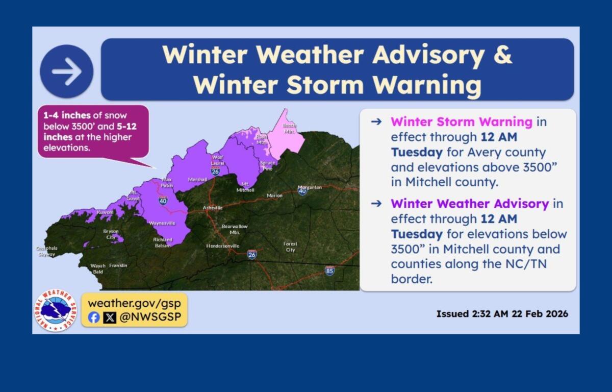
National Weather Service Greenville-Spartanburg has issued winter storm warnings and winter weather avisories for several mountain counties along the Tennessee border, where northwest flow snow is expected to create hazardous travel conditions.
Chris Justus, chief meteorologist at WYFF 4, said conditions will be especially dangerous above 3,500 feet along the North Carolina-Tennessee state line.
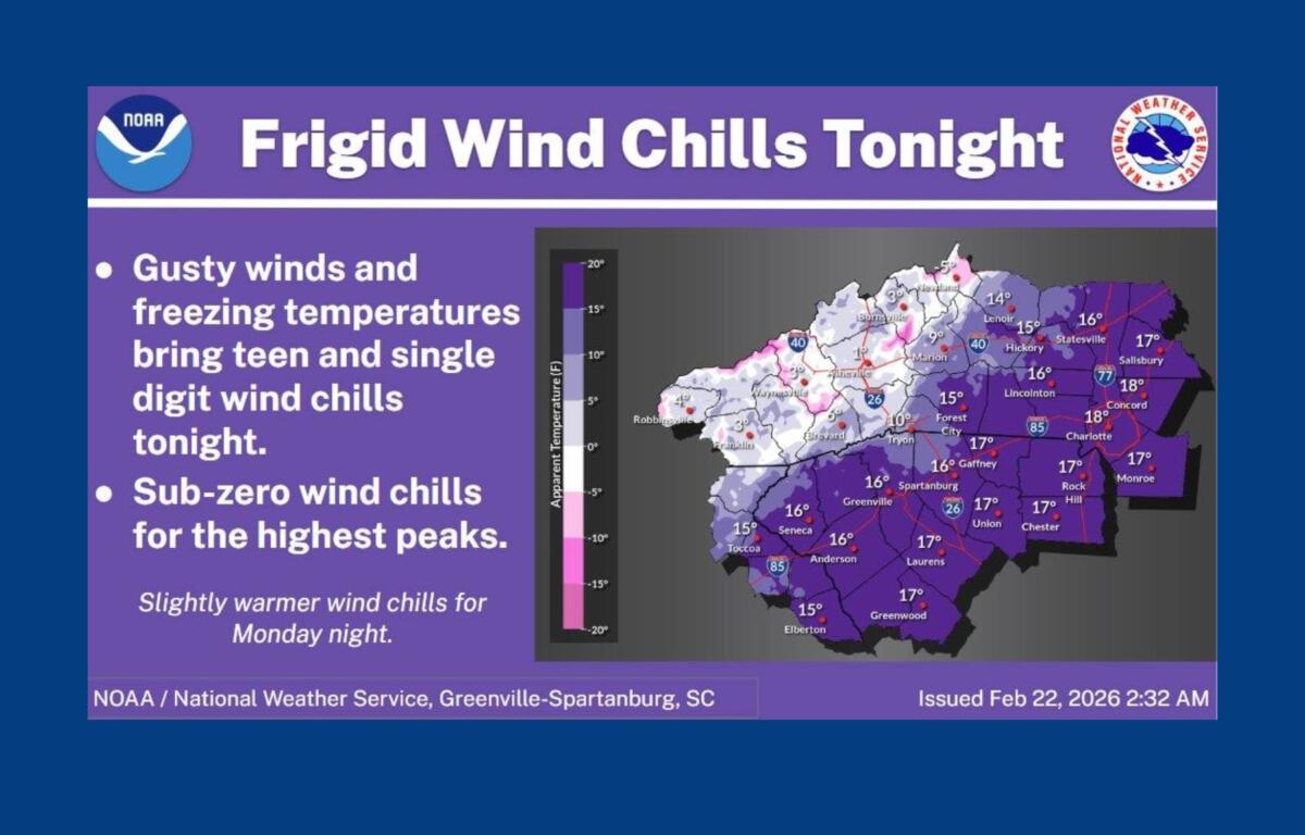
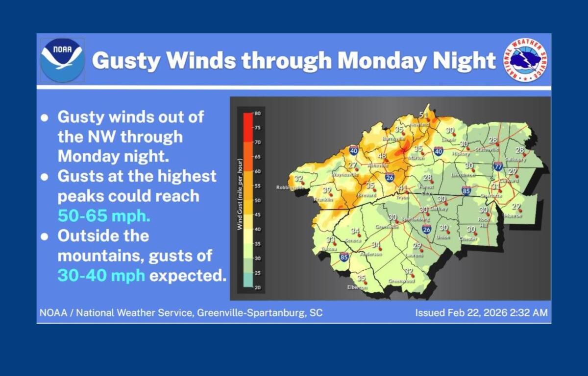
“Travel is not advised in the higher elevations,” Justus said, warning of wind chills near zero, wind gusts between 50 and 70 mph and sharply reduced visibility in blowing snow. “You do not want to be stranded in conditions like this.”
A Winter Storm Warning remains in effect until midnight Monday for Avery County, where forecasters say additional snowfall could reach up to 8 inches, with wind gusts as high as 60 mph and wind chills as low as 5 degrees below zero early Monday.
In Mitchell County, a Winter Storm Warning is in effect above 3,500 feet, with 1 to 11 inches of additional snow possible. Areas below 3,500 feet are under a Winter Weather Advisory, with up to 6 inches of snow expected. Winds there could gust up to 60 mph.
Haywood, Madison and Yancey counties remain under a Winter Weather Advisory until midnight Monday. Valley locations are expected to receive 1 to 3 inches of snow, with up to 5 inches possible in higher elevations along the Tennessee border. Winds in the highest elevations could gust up to 55 mph.
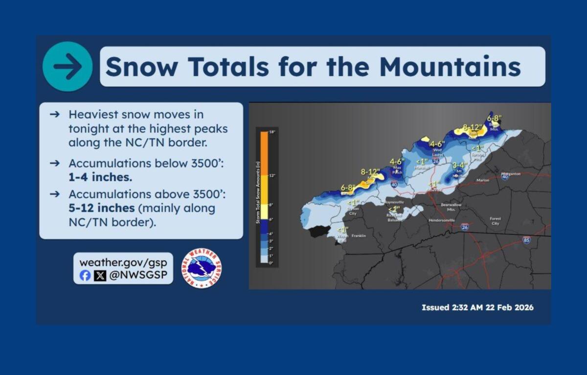
In Swain County, a Winter Weather Advisory remains in effect above 3,500 feet. Forecasters say 3 to 7 inches of snow are likely in most higher elevations, with a foot or more possible on the highest peaks of the Smokies. Valley areas beneath the Smokies could see up to an inch of accumulation.
Officials warn that heavy snow could make many roads impassable, particularly along the Tennessee border. The weight of snow combined with strong winds may bring down tree limbs and power lines, causing isolated outages. Hazardous conditions are expected to affect both the Monday morning and evening commutes.
In addition to the winter weather, the National Weather Service said near-critical fire weather conditions are expected each afternoon through Tuesday. Temperatures are forecast to remain below normal through Tuesday before warming later in the week. A cold front could bring a band of showers and possibly embedded thunderstorms Thursday into Friday.
Forecasters emphasized that significant winter storms can still occur in the mountains, even into early March, and urged residents to monitor updates and avoid unnecessary travel in affected areas.