
ASHEVILLE, N.C. (828newsNOW) — Warm, dry weather across the western Carolinas is expected to elevate fire danger Tuesday, according to multiple alerts from the National Weather Service.
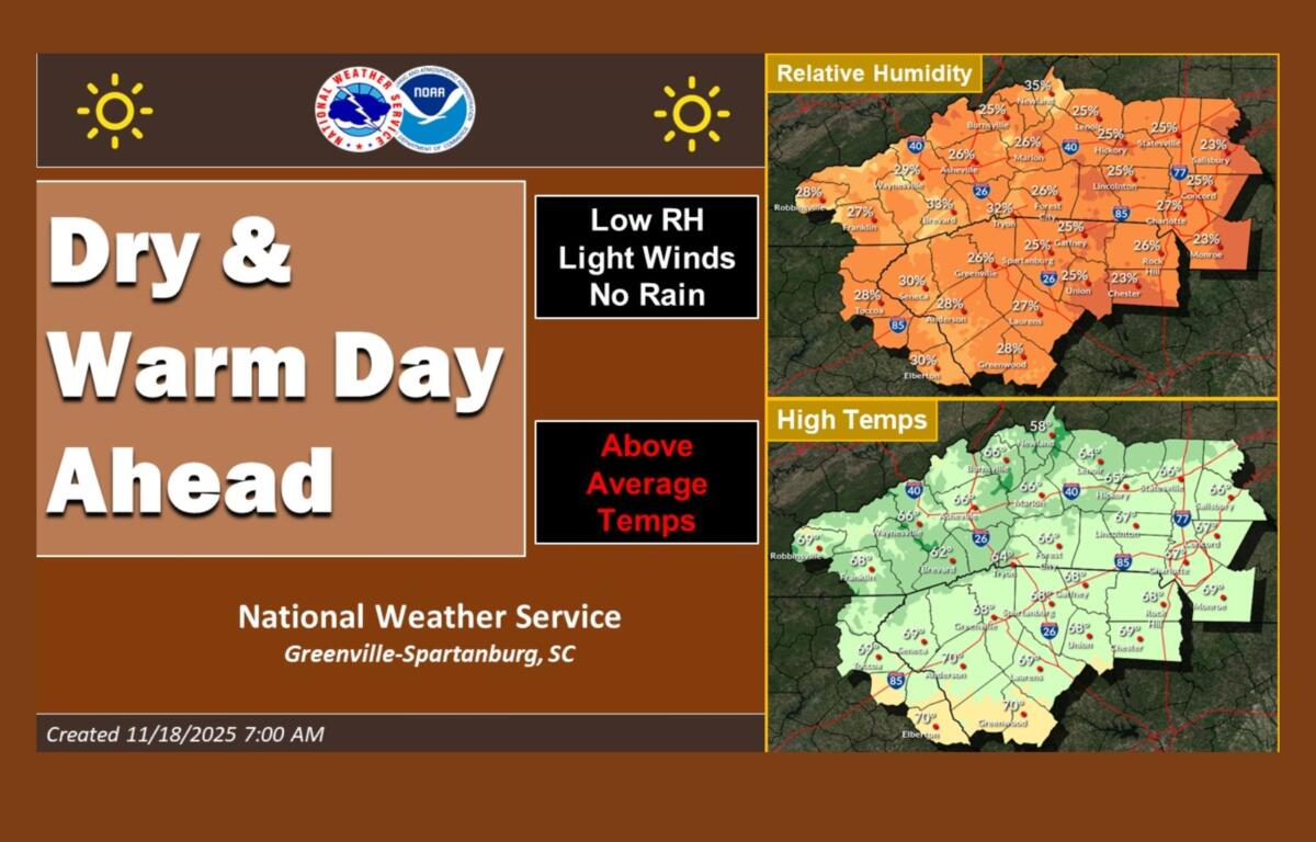
Forecasters with the NWS Greenville-Spartanburg office said temperatures will rise above normal with mostly dry conditions, though a few showers could develop overnight in the North Carolina mountains. Relative humidity levels are expected to drop below 25 percent in some areas Tuesday afternoon and evening — a key factor in increasing wildfire risk.
Officials are again urging residents to use extreme caution with any outdoor burning. “Fires can quickly get out of hand under these conditions,” the weather service said in a social media update.
A wildfire burning near Banner Elk and Beech Mountain grew to 120 acres Monday and is 50 percent contained, according to fire officials. Crews warn that another day of dry air and breezy winds could make suppression more difficult.
Two Special Weather Statements issued early Tuesday highlight similar concerns across Western North Carolina and parts of east Tennessee and north Georgia. Forecasters say wind gusts could reach 20 to 25 mph as humidity dips into the upper 20s to mid-30s, creating an environment where fires may become uncontrolled.
Areas under elevated fire danger include Buncombe, Madison, Yancey, Mitchell, Henderson, McDowell, Polk and several surrounding counties.
Dry leaf litter and brush have become increasingly flammable after several days of low humidity and breezy weather, forecasters said.
The weather service said warm temperatures will continue into the weekend as a warm front moves through. Rain chances are expected to increase later in the week as low pressure develops to the west.