ASHEVILLE, N.C. (828newsNOW) — Rain began falling across the Asheville area Sunday and is expected to linger for several days.
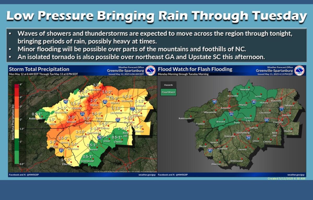
A slow-moving storm system will bring multiple rounds of showers and thunderstorms through Monday night, according to the National Weather Service. Forecasters said runoff from moderate to heavy rainfall could lead to flooding, though it is not expected to reach the levels seen during Tropical Storm Helene.
With the region still recovering from Helene, meteorologists warned minor mudslides are possible.
The heaviest rainfall and greatest risk of flash flooding is forecast along the Blue Ridge Escarpment and the south- and east-facing slopes of the mountains in Western North Carolina. Rainfall totals of 3 to 5 inches are expected, with isolated amounts between 4 and 6 inches possible, the weather service said.
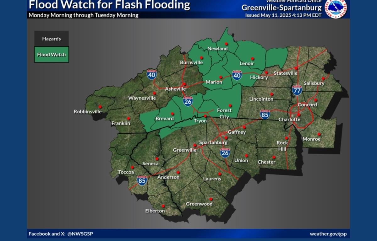
A Flood Watch is in effect until 8 a.m. Tuesday, May 13, for Avery, Alexander, Yancey, Mitchell, southern Jackson, Transylvania, Henderson, Caldwell mountains, greater Caldwell, Burke mountains, greater Burke, McDowell mountains, eastern McDowell, Rutherford mountains, greater Rutherford, Polk mountains, and eastern Polk.
The forecast for the week, according to the National Weather Service:
- Today: Showers and possibly a thunderstorm. Some of the storms could produce heavy rainfall. High near 69. Southeast wind around 10 mph, with gusts as high as 22 mph. Chance of precipitation is 90%.
- Tonight: Showers and possibly a thunderstorm before 5 a.m., then a chance of showers. Some of the storms could produce heavy rainfall. Patchy fog. Low around 60. Southeast wind 5 to 7 mph, with gusts as high as 18 mph. Chance of precipitation is 90%.
- Tuesday: A chance of showers, then showers and possibly a thunderstorm after 8 a.m. Patchy fog before 10 a.m. High near 73. Calm wind becoming south-southeast 5 to 7 mph in the morning. Chance of precipitation is 90%.
- Tuesday night: A chance of showers and thunderstorms. Patchy fog after 5 a.m. Otherwise, mostly cloudy, with a low around 55. Light south-southeast wind. Chance of precipitation is 50%.
- Wednesday: Showers and thunderstorms. Patchy fog before 8 a.m. High near 74. Light and variable wind. Chance of precipitation is 80%.
- Wednesday night: Partly cloudy, with a low around 58. Chance of precipitation is 30%.
- Thursday: Mostly sunny, with a high near 85.
- Thursday night: Mostly cloudy, with a low around 63.
- Friday: A 50 percent chance of showers after 8 a.m. Partly sunny, with a high near 86.
- Friday night: A 50 percent chance of showers and thunderstorms. Mostly cloudy, with a low around 63.
- Saturday: Showers likely. Partly sunny, with a high near 83. Chance of precipitation is 70%.