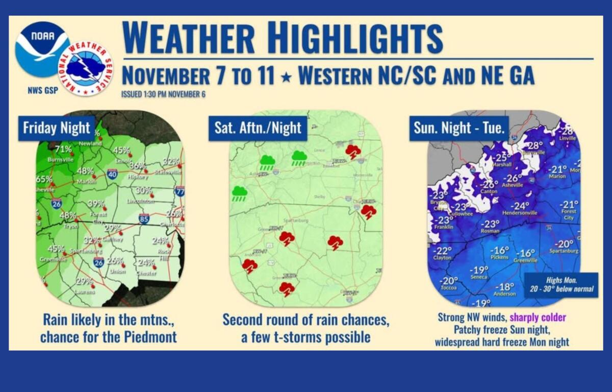

ASHEVILLE, N.C. (828newsNOW) — Western North Carolina will see a dramatic shift from mild to wintry conditions this weekend, with temperatures set to plunge and the first flurries of the season possible by Monday, according to the National Weather Service in Greenville-Spartanburg.
Forecasters say a strong cold front will move through the region Sunday, bringing periods of rain followed by sharply colder air. Asheville could see temperatures drop by as much as 30 degrees between Sunday afternoon and Monday morning.
A warm start before the chill
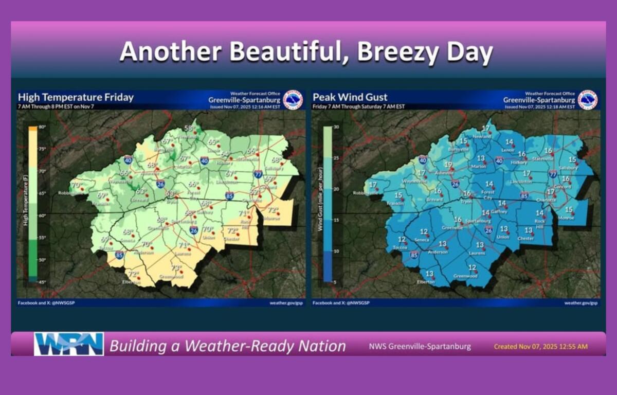
Friday will bring partly sunny skies with areas of morning fog and a chance for a late-day shower. Highs will reach near 69 degrees, with lows around 50. Saturday is expected to remain mild, topping out near 68 under partly sunny skies before cooling into the mid-40s overnight.
Cold front Sunday, possible flurries Monday
Sunday will turn cloudy with scattered showers as the cold front pushes in from the west. Highs are expected around 66 degrees before temperatures plunge overnight to near 29.
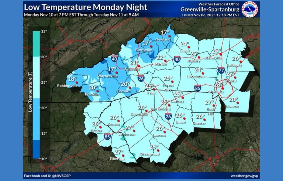
By Monday, the weather will feel more like midwinter. Forecast highs will struggle to reach the mid-30s, with lows in the low 20s. The NWS says a few flurries could fall across the Asheville area, with light snow possible at higher elevations in the Smokies and Balsams.
Gusty winds are also expected, especially along ridgetops, though only higher mountain areas are likely to meet Wind Advisory criteria.
Prepare for the freeze
Widespread freezing temperatures are expected Monday night, likely ending the growing season across much of the region. It will be the coldest night since early March, forecasters said.
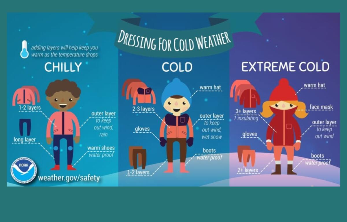
The National Weather Service advises residents to dress in layers, stay dry and take precautions to protect pets, plants and pipes from the hard freeze.
Temperatures are forecast to slowly moderate through the middle of next week, with sunshine returning by Tuesday.
For cold-weather safety tips, click here.