
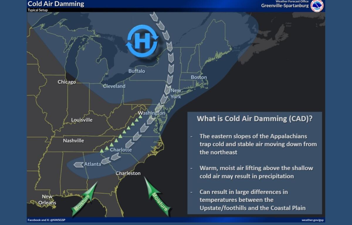
ASHEVILLE, N.C. (828newsNOW) — Western North Carolina is starting the week under a familiar fall pattern — cold, gray and wet — as a cold air wedge settles across the region.
According to the National Weather Service in Greenville-Spartanburg, a phenomenon known as Cold Air Damming, or CAD, is keeping temperatures well below normal and fueling widespread showers across the mountains and foothills.
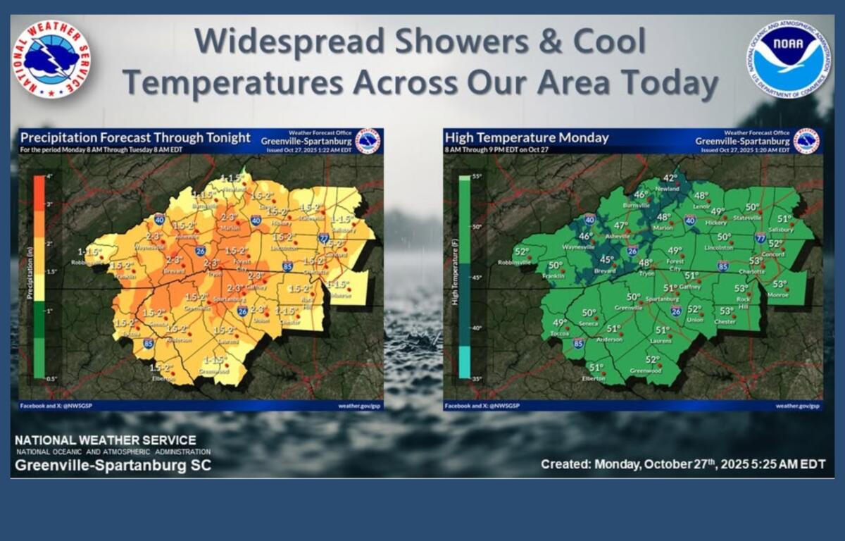
Highs Monday are expected to struggle to get out of the 40s in many areas, with steady rain and patchy fog throughout the day. Rainfall could total 1 to 2 inches across the Piedmont by early Tuesday and up to 3 inches or more along the Blue Ridge Escarpment.
The weather service said flooding is not expected, despite locally heavy rainfall, because of recent dry conditions. A rumble of thunder may occur in parts of Upstate South Carolina and northeast Georgia.
The cold wedge pattern is expected to linger through Wednesday, keeping skies cloudy and conditions damp. Rain chances will gradually decrease late in the week, though temperatures are forecast to remain cooler than normal into the weekend.
Forecast at a glance:
- Monday: Steady rain, fog and highs near 48.
- Tuesday: Scattered showers, highs near 52.
- Wednesday: Periods of rain, highs near 51.
- Thursday: Morning showers tapering off, highs near 51.
- Friday: Mostly sunny, highs in the mid-50s.