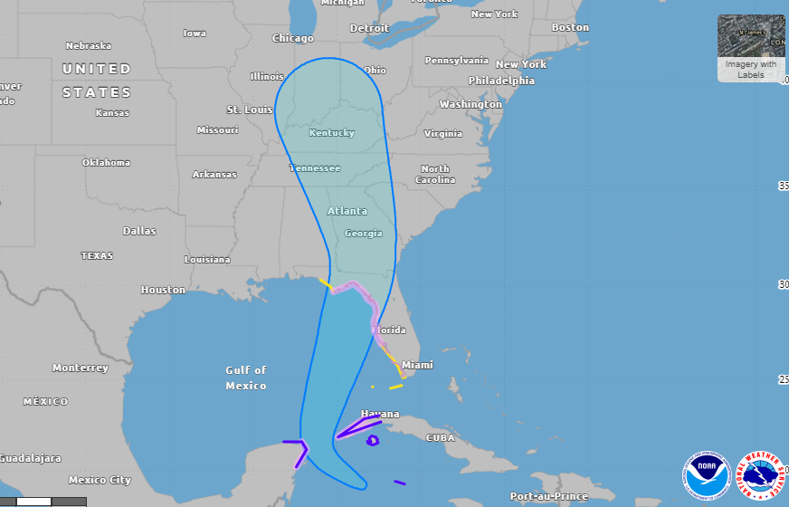

ASHEVILLE, N.C. (828newsNOW) — All eyes are on the tropics once again as a storm approaching the Florida coast is expected to intensify into a strong hurricane and bring heavy rain to Western North Carolina later in the week.
According to the National Weather Service, Tropical Storm Helene, which officially formed Tuesday morning, is expected to intensify into a major hurricane before it approaches the northeastern Gulf Coast on Thursday.
The storm is expected to bring heavy rainfall, likely resulting in locally considerable flash and urban flooding across portions of Florida, with isolated flash and urban flooding possible across the Southeast, Southern Appalachians and the Tennessee Valley Wednesday through Friday. Minor to isolated moderate river flooding will be possible.
The National Weather Service’s storm total precipitation shows areas of Western North Carolina could receive anywhere from 4 to 8 inches of rain from Wednesday afternoon through Saturday morning. In one area, around Henderson and Polk counties, the NWS predicts there could be up to 10 inches of rain collected.
Widespread rainfall will increase the possibility of landslides for Western North Carolina. According to weather officials, rainfall amounts of 5 inches or more in a 24-hour time period increases the risk for landslides.
Isolated tornadoes cannot be ruled out as a possibility from the storm as well.
“This is a very large storm and residents are urged not to focus on the ‘cone’ as impacts will extend well beyond the shaded cone area,” the National Weather Service wrote in a recent update.
These models and tracks will likely change and be updated as the storm moves closer to making landfall.
Power outages
Click here to view Duke Energy’s power outage portal, which includes areas of the website where you can view power outages, report them and tips for how to prepare for severe storms.
Preparing for the storm
Click here to see the North Carolina Emergency Management’s Hurricane Guide.
—
CLICK HERE to check out storm updates.