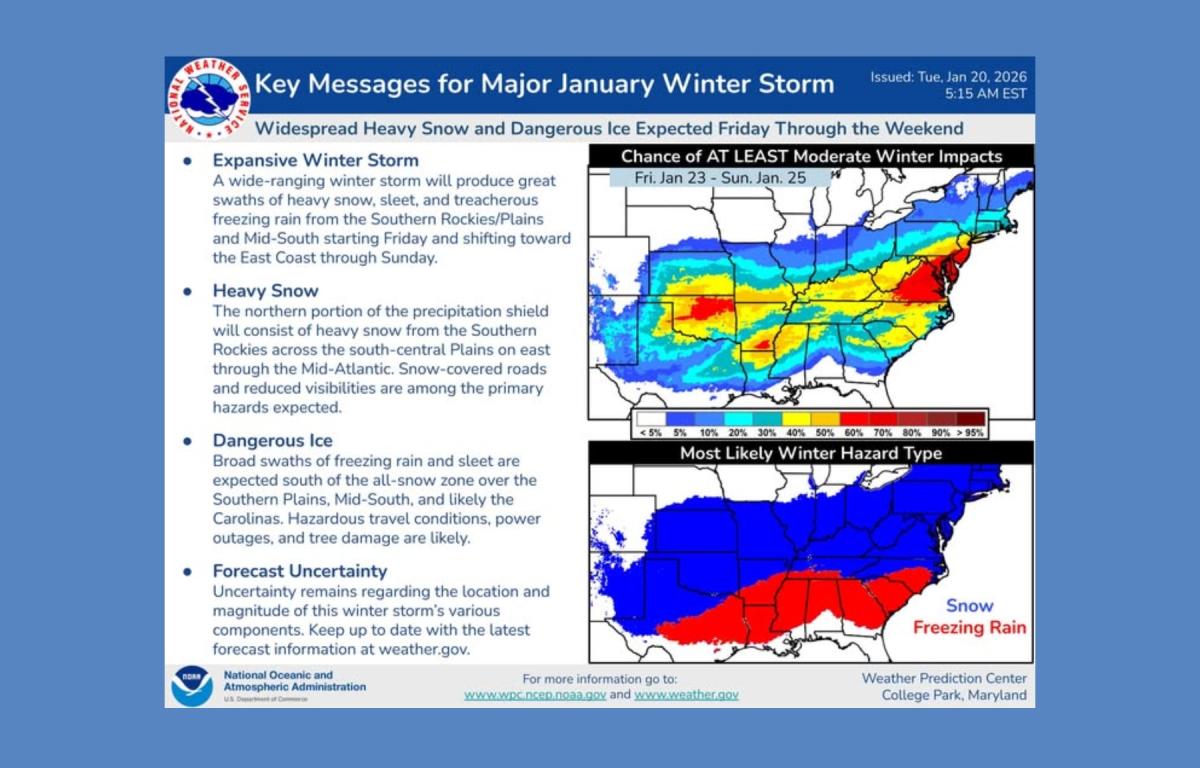

ASHEVILLE, N.C. (828newsNOW) — Forecast confidence is increasing that a winter storm could affect Western North Carolina this weekend, though significant uncertainty remains about the type and severity of precipitation, according to the National Weather Service and regional meteorologists.
The National Weather Service office in Greenville-Spartanburg said a low-pressure system is expected to move near the western Carolinas and northeast Georgia, with temperatures cold enough to support wintry precipitation across much of the region. Forecasters cautioned that details are still evolving, including whether areas see snow, sleet, freezing rain or a mix.
“Model guidance is signaling the potential for a winter storm over the weekend,” the weather service said, noting uncertainty about where the transition zone between snow and ice will set up — a key factor in potential impacts.
In the meantime, dangerous cold conditions continue in the mountains. Wind chills below zero were possible early Tuesday across northern North Carolina mountain counties, with a Cold Weather Advisory in effect through noon for Avery County and elevations above 3,500 feet in Yancey and Mitchell counties. Very low humidity is also expected Tuesday afternoon, increasing fire danger across mountain valleys and foothills.
Several forecast models are showing differing scenarios for the weekend system. Some indicate heavier snowfall across Western North Carolina, while others suggest a greater risk of sleet and freezing rain. The National Weather Service said there is also a low chance the storm track could shift far enough south to significantly reduce precipitation locally.
Local and regional meteorologists are urging residents to monitor forecasts closely. Asheville-based meteorologist Hunter Ward said recent model runs show the potential for a high-impact snowstorm, with some simulations depicting more than a foot of snow across much of the region.
“It is far from certain,” Ward said, “but I have to believe the models are giving us warning shots. This needs to be taken seriously, and you need to get a plan in place for an extended power outage.”
WYFF 4 Chief Meteorologist Chris Justus said ice may be the primary concern, noting that multiple model runs show a significant ice signal extending into the Carolinas. Even small amounts of ice can cause widespread power outages, he said.
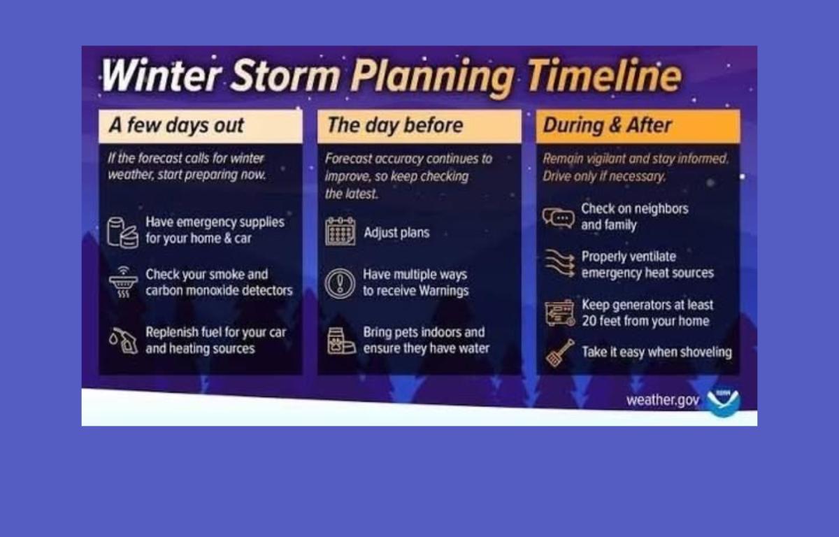
Emergency management agencies across the region echoed calls for preparation. McDowell County 911 and Emergency Management encouraged residents to check emergency supplies, refill medications and assist neighbors who may need help preparing for winter weather.
The current Asheville forecast calls for increasing clouds midweek, with slight chances of freezing rain and rain Wednesday night through Friday. Snow chances increase late Friday into the weekend, with snow likely Saturday and Saturday night and potentially heavy at times. Highs are expected to remain in the 30s, with lows dropping into the teens and single digits by Sunday night.
Forecasters stressed that impacts will become clearer over the next several days as the storm system develops. Residents are advised to stay informed and prepare for the possibility of hazardous travel, power outages and prolonged winter conditions.