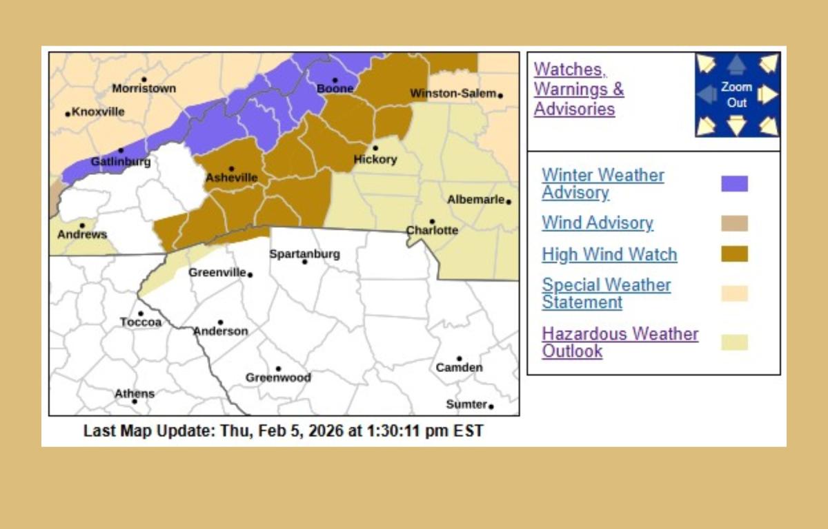

ASHEVILLE, N.C. (828newsNOW) — A high wind watch has been issued for much of Western North Carolina and parts of Upstate South Carolina, with forecasters warning of potentially damaging winds beginning Friday evening and lasting through Saturday evening.
The National Weather Service office in Greenville-Spartanburg said northwest winds of 20 to 30 mph are expected, with gusts that could reach up to 65 mph, particularly in the mountains.
The watch covers a wide area, including Buncombe, Henderson, Transylvania, Mitchell, Yancey, Avery, McDowell, Rutherford, Polk and Caldwell counties, along with neighboring mountain areas of South Carolina.
Forecasters warned that the strong winds could bring down trees and power lines, leading to scattered or widespread power outages. Travel may become hazardous, especially for high-profile vehicles such as trucks and buses.
In addition to the wind threat, the weather service said the gusty conditions will produce dangerously cold wind chills across the mountains early Saturday morning. Some blowing snow is also possible near the Tennessee border.
Residents are urged to prepare for potential power outages and to secure or shelter loose outdoor objects ahead of the strong winds. Officials advised staying tuned to NOAA Weather Radio or other reliable weather sources for updates as the system approaches.