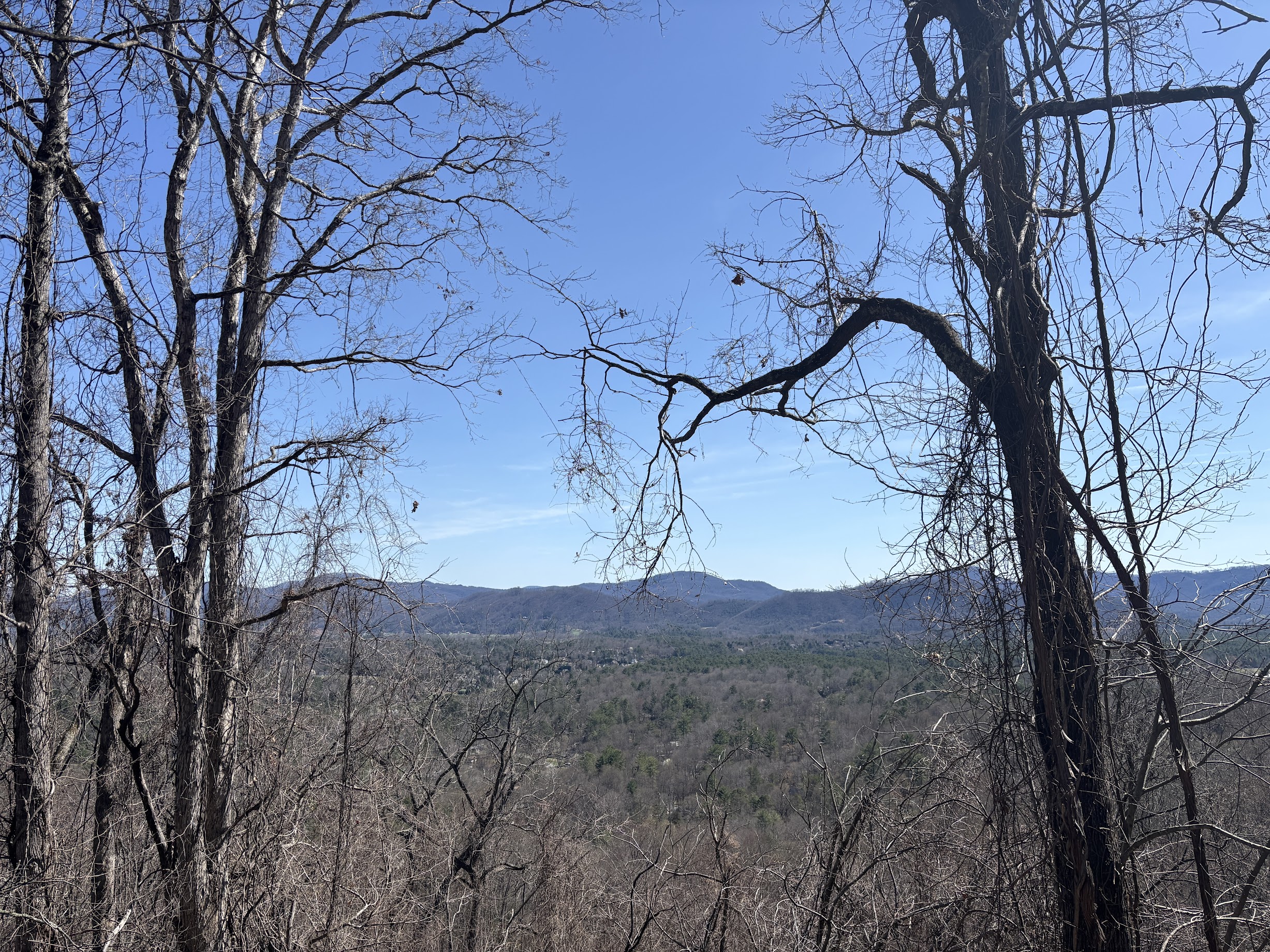

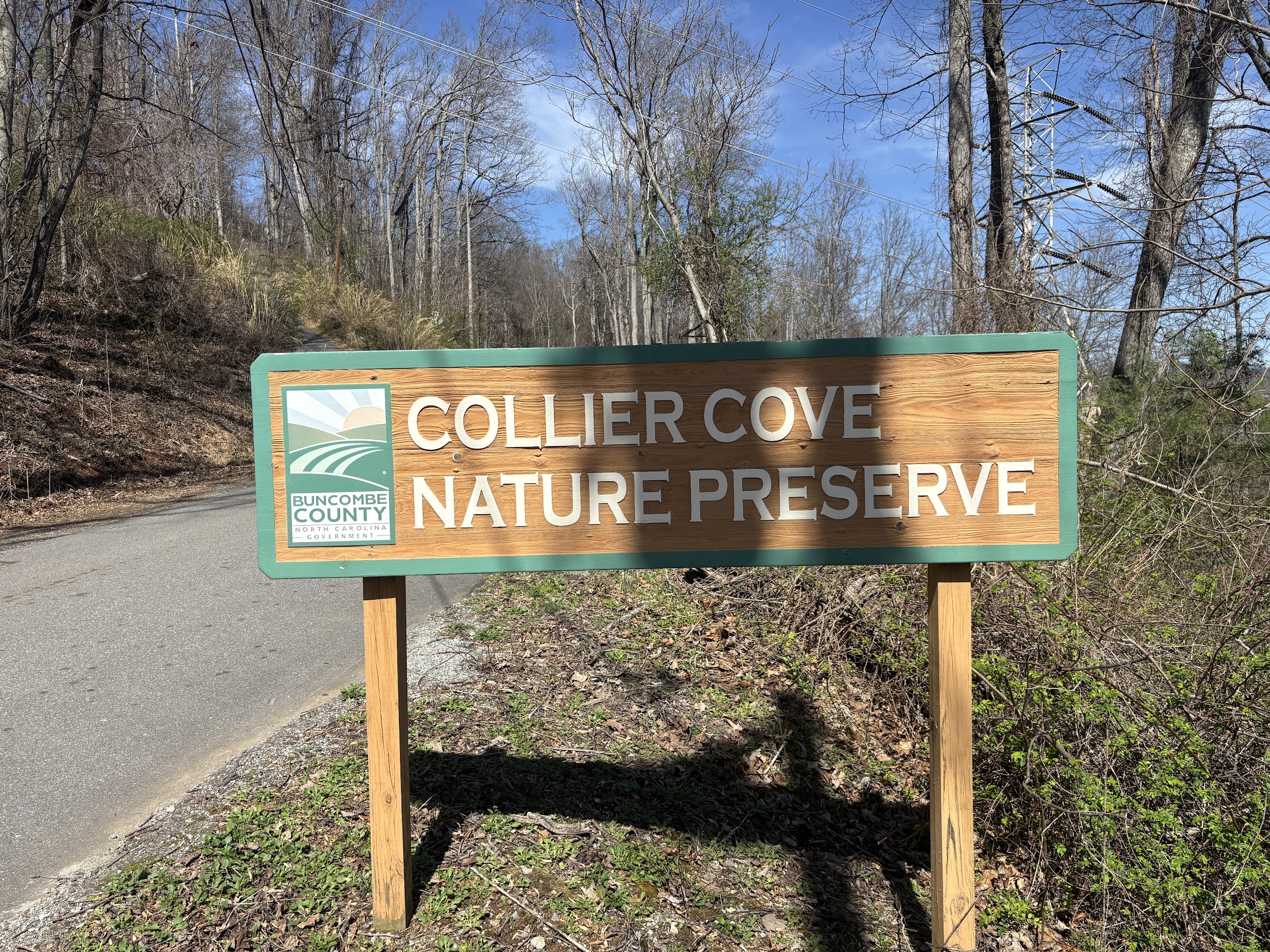
ARDEN, N.C. (828newsNOW) — How about a hard one this week? Collier Cove Nature Preserve is a Buncombe County park perched on an Arden mountaintop. Trails on the preserve may not be long, but they are about as steep as they get.
Fast facts
- Collier Cove Nature Preserve is a public park located at 194 Rhododendron Dr. in Arden. Like the trails in the park itself, the road to get up to Collier Cove is steep, narrow and a little precarious. Drive with caution.
- Dogs are permitted, but must be leashed.
- The park closes after dark, so plan your trip accordingly.
- The network of trails in Collier Cove can be a little confusing, but with our route, you can expect a 1.2 mile hike with a 300 foot elevation gain.
Down, down, down, up, up, up
After the mildly distressing ascent to Collier Cove Nature Preserve, it is nice to have such an easy time parking. There are a good number of parking spots in a gravel area just inside property gates. The nearby electrical tower also serves as a great vantage for beholding the task before you: far below is the bell curve bottom of the park trails.


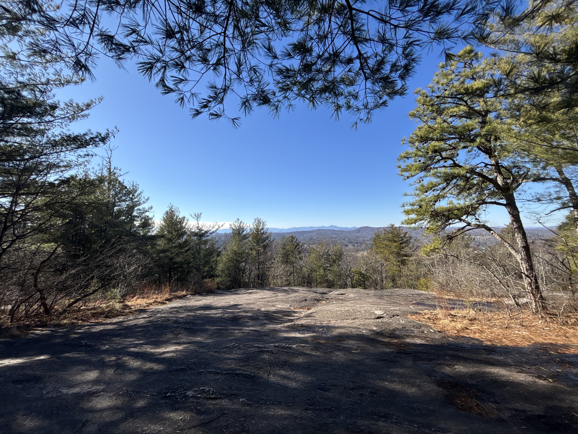
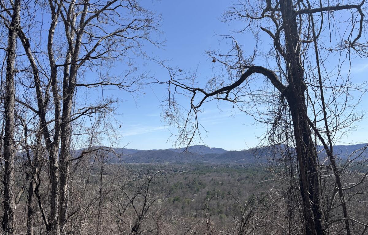
Check out the park rules on the kiosk to the far left of the parking lot, and then pick your poison. For my hike, I chose to trot along a primrose path, otherwise known as Walnut Way. There are numerous wooden signs indicating the direction of the trail, but head straight forward. After a short distance, you will be treated to a seat on a wooden bench – also prevalent, precious presences throughout the park – and a view of the mountains of Arden.
After that sojourn, there is a long, long, long descent. Walnut Way is designated with orange blazes, ensuring you will not stray off the path, but the route is unmistakable.
Down.


However, Walnut Way is not forever. At the bottom of the slope, the route intersects with Sassafras Circle. Attempts to hike to the right will be precluded by a trail closed sign, so head to the left around the meadow, instead. Sassafras Circle is marked with blue blazes.


Eventually, Sassafras Circle will spit you out along the same electric line as the parking lot, which you can spot far away through the tall yellow grass. There is an option here to take a branch onto Hickory Hike, but that route exits to a different trailhead. To return to the parking lot, you must take the Herculean route of returning from Sassafras Circle to Walnut Way, which in turn leads back to the beginning.


All of this, of course, uphill.
I can’t stress enough how difficult (and rewarding) this final leg of the hike will be. At the bottom of the slope, you will have hiked around .9 miles. To return to the top, it is a scant .4 mile push, but almost exactly 300 feet of climbing inside of that distance.


There are benches along the way, which help, but it does not get easier. Until the final step back onto the parking lot plane, you will be making a push. Your calves, meanwhile, will have never looked better!
Collier Cove Nature Preserve has indeed preserved the difficulty and beauty of the best of North Carolina hiking. Just be prepared before heading in.
-
Hikes of WNC: Collier Cove Nature Preserve

How about a hard one this week? Collier Cove Nature Preserve is a Buncombe County park perched on an Arden mountaintop. Trails on the preserve may not be long, but they are about as steep as they get.
-
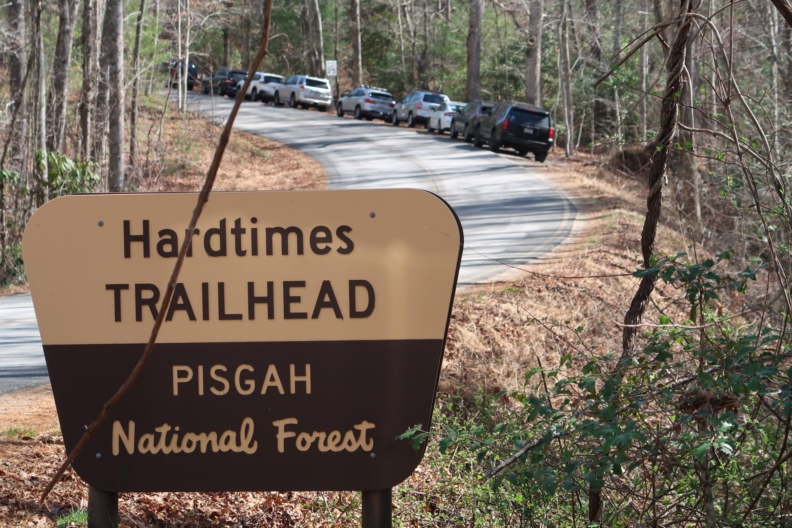
Hikes of WNC: Hardtimes Connector Trail in Bent Creek Experimental Forest

Bent Creek Experimental Forest has a wealth of hiking trails. One that is an especially good time is the Hardtimes Connector Trail, which connects with Deer Lake Lodge Loop for a solid 2 mile hike.
-
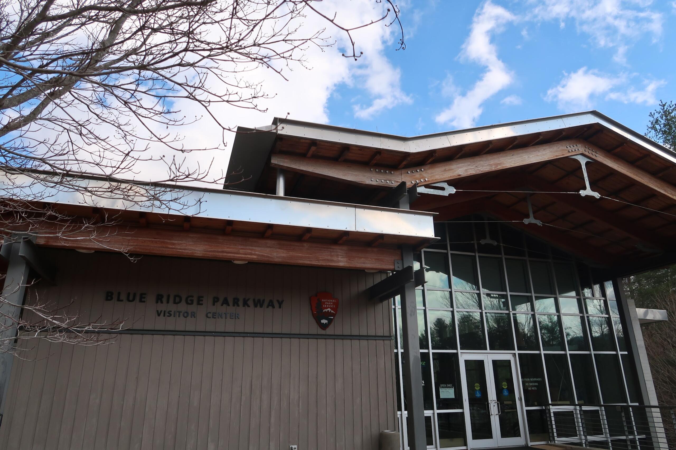
Hikes of WNC: Blue Ridge Parkway Visitor Center Loop
The Blue Ridge Parkway Visitor Center is one of Asheville’s lesser-known treasures. In addition to an interactive museum, an information desk and a gift shop, the visitor center is home to a 1.2 mile trail loop, complete with a road crossing on the parkway itself.
-
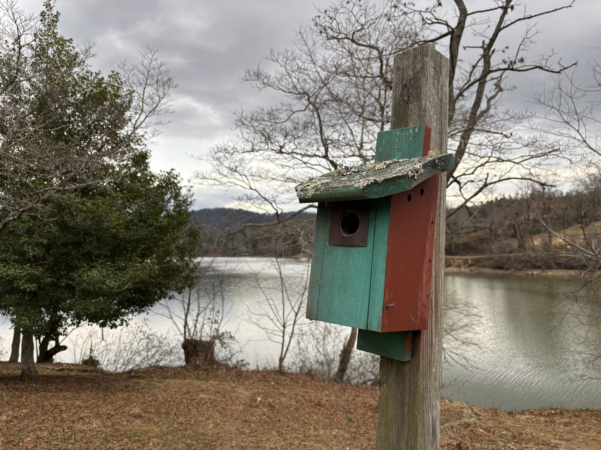
Hikes of WNC: Beaver Lake Perimeter Loop
One of the most popular outdoor recreation spots in town is Beaver Lake. The North Asheville lake features a 2 mile trail around its perimeter, a popular, simple and scenic walk for all ages.
-
Hikes of WNC: Glassy Mountain at the Carl Sandburg Home
Glassy Mountain is the resident peak of the Carl Sandburg Home National Historic Site, the preserved farm and house of the famed poet located in Flat Rock, N.C. A beautiful network of trails eventually leads to a steep, but worthwhile, climb to Glassy Mountain Overlook.