GERTON, N.C. (828newsNOW) — Strawberry Gap Trail, located just over the mountain from Hickory Nut Gap Farm, is a steep climb filled with unique natural structures and a couple terrific views.
Fast facts
- Looking for the entrance to Strawberry Gap Trail? It’s located immediately after the “Welcome to Gerton” sign
- Strawberry Gap is an out-and-back hike, spanning 5.1 miles total, or roughly two-and-a-half miles both ways
- There is a steep climb on the way up. Bring plenty of water and potentially a hiking stick
- Strawberry Gap is located inside of the Southern Appalachian Highlands Conservancy, which means dogs are not allowed and transportation modes like horses and motorcycles are prohibited
Minding the gap
Unlike other hikes in the area, Strawberry Gap requires a little more preparation before hitting the trail. For one, it’s located inside of the Southern Appalachian Highlands Conservancy, privately owned land dotted with publicly-accessible trails maintained by Conserving Carolina. That means there are a couple more rules to follow: no dogs, no horses, no camping and absolutely no trekking off-trail. However, the trail is a beautiful climb, making the extra attention well worth the effort.
After parking in the sizable gravel lot, hikers can read about Strawberry Gap and other nearby trails at a kiosk, before dipping behind the wooden fence and beginning their walk uphill.


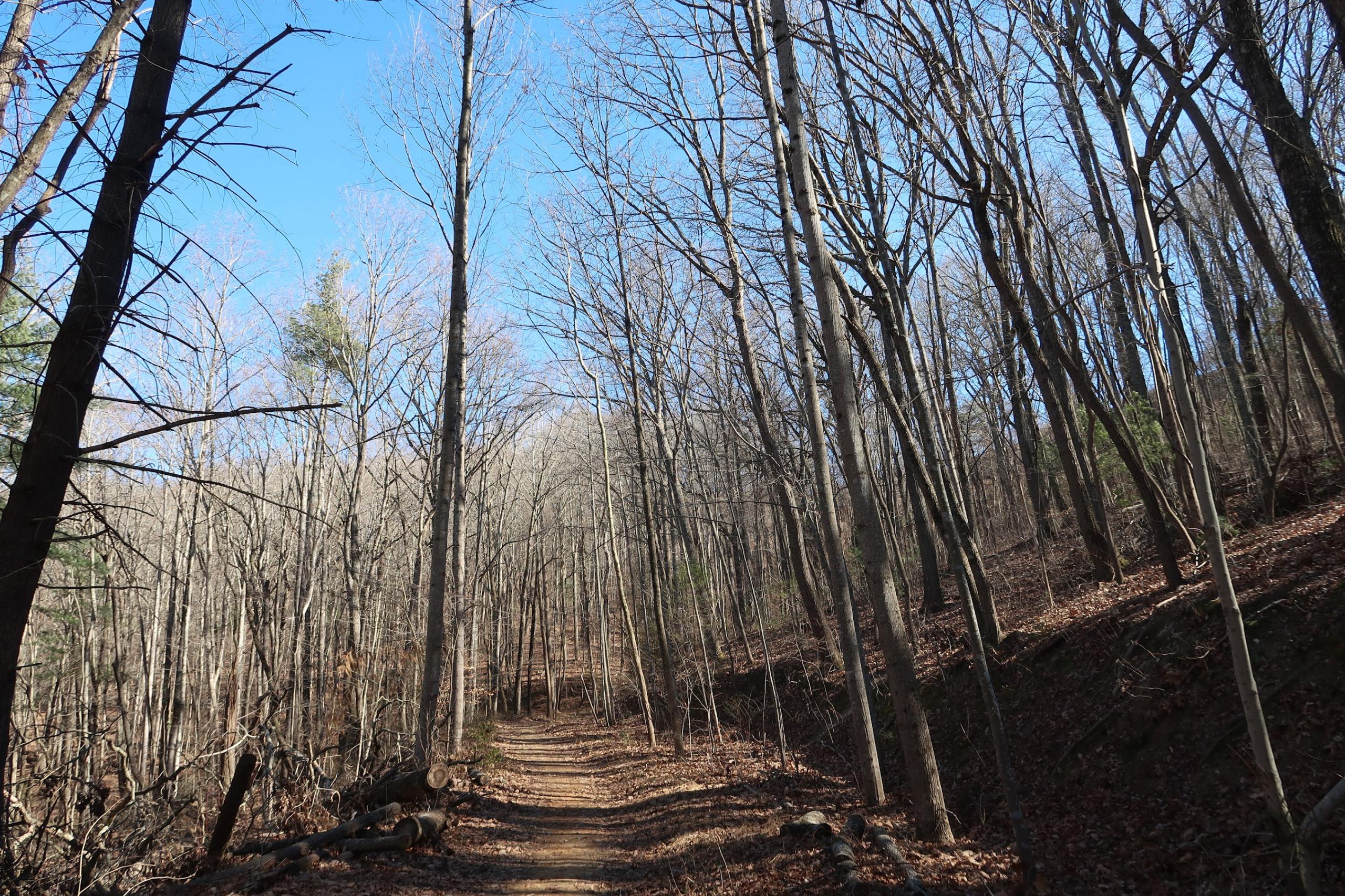
The Strawberry Gap route is well-maintained but fairly narrow, making for a single-file hiking experience if adventuring in a group. For the first leg of the journey, the trail is a smooth ride, if at a bit of a breathless incline. Water is a must.
Because it runs through private land, Strawberry Gap Trail is often intersected by private trails. No need to worry about confusing one of these for the right path, though. Each intersection is well-marked with warning poles. Additionally, Conserving Carolina has marked the Strawberry Gap route with their blazes, small, blue discs nailed into the trees.


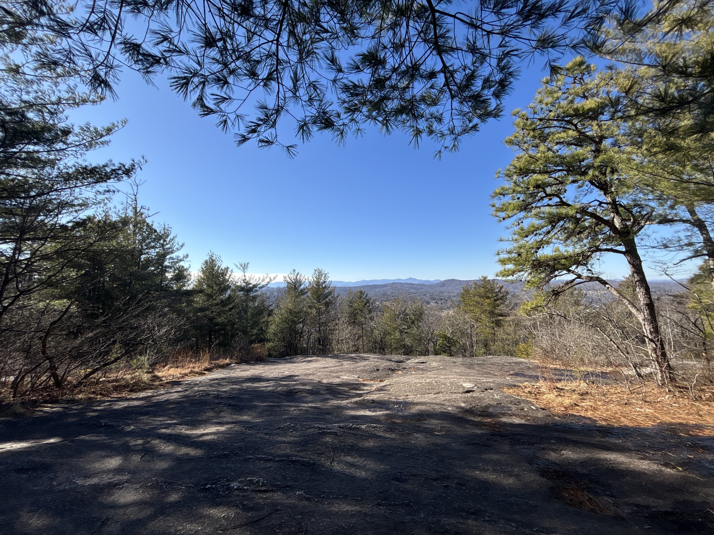
While on a clear day, hikers might associate their Strawberry Gap hike with fetching, far flung views of the Blue Ridge Mountains, foggy days on the trail have their own bits of magic. Along the path, interesting tree shapes and moss-covered boulders create an otherworldly feel to the surrounding flora, like a walk through an alien jungle.


Like many hikes in Western North Carolina, Strawberry Gap was not immune to the effects of Tropical Storm Helene. Be careful around one muddy slope, which tore apart trees, rocks and earth in dramatic, erosive fashion.

One particularly picaresque leg of the trail is a flat, tree stump-dotted clearing near the summit of the hike. Though it may look like a perfect camping site, that is against SAHC rules. Use your imagination and admire the Blue Ridge views, instead.

The turn-around point for Strawberry Gap hikers will be preceded by several wooden fences, each marked with a Conserving Carolina badge. These serve as borders for Blue Ridge Pastures, a panoramic field which connects Strawberry Gap Trail to the nearby Trombatore Trail, an extra leg for the hiker seeking extra credit.


After all the celebratory frolicking your heart desires, it is time for the second half of your Strawberry Gap hike. Simply turn around and head back the way you came.
One additional landmark of note: Next to the kiosk at the start of the trail is a memorial marker honoring Susie Skinner Clarke Hamilton (Dec. 3, 1946 – March 8, 2020). The land Strawberry Gap runs through was acquired over a century ago by Hamilton’s grandparents. The trail is now dedicated to her memory.
“For the beauty of each hour/of the day and of the night/hill and vale and tree and flower/sun and moon and stars of light/Lord of all to thee we raise/this our hymn of grateful praise,” Hamilton’s marker reads.

-
Hikes of WNC: Blue Ridge Parkway Visitor Center Loop

The Blue Ridge Parkway Visitor Center is one of Asheville’s lesser-known treasures. In addition to an interactive museum, an information desk and a gift shop, the visitor center is home to a 1.2 mile trail loop, complete with a road crossing on the parkway itself.
-
Hikes of WNC: Beaver Lake Perimeter Loop

One of the most popular outdoor recreation spots in town is Beaver Lake. The North Asheville lake features a 2 mile trail around its perimeter, a popular, simple and scenic walk for all ages.
-
Hikes of WNC: Glassy Mountain at the Carl Sandburg Home
Glassy Mountain is the resident peak of the Carl Sandburg Home National Historic Site, the preserved farm and house of the famed poet located in Flat Rock, N.C. A beautiful network of trails eventually leads to a steep, but worthwhile, climb to Glassy Mountain Overlook.
-
Hikes of WNC: Beaucatcher Mountain Trail
Beaucatcher Mountain Trail is a popular hiking spot just outside of downtown Asheville. The network of branching trails is located behind Memorial Stadium and McCormick Field, making the hike a perfect outing for tourists and Tourists alike.
-
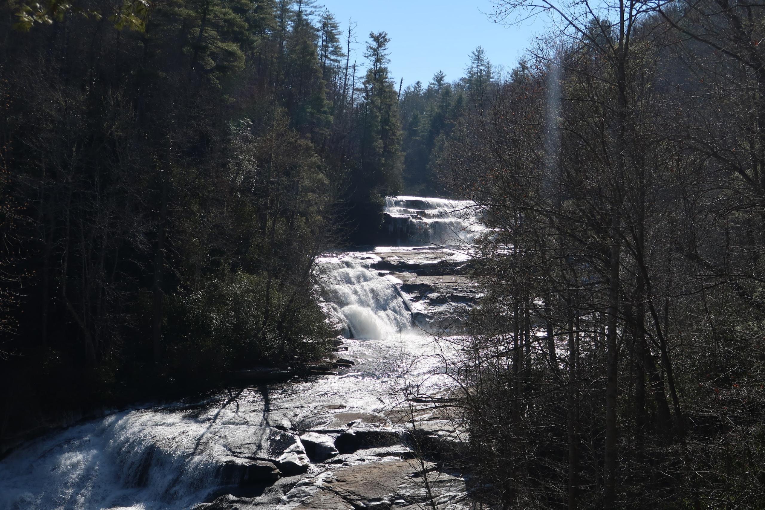
Hikes of WNC: Triple Falls Trail
Located in the hiking bounty of DuPont State Recreational Forest and captured on the silver screen in movies like “The Hunger Games,” Triple Falls Trail leads to a beautiful waterfall view, three times over.