



ASHEVILLE, N.C. (828newsNOW) — Western North Carolina will squeeze out one more round of scattered afternoon showers and thunderstorms Thursday as a cold front moves through the region, according to the National Weather Service in Greenville-Spartanburg.
Forecasters say most of the activity will develop during the afternoon hours, with the best chance for rain across the mountains, foothills and areas near the North Carolina/South Carolina line. The activity is expected to remain hit-or-miss, but a few storms could briefly become strong before tapering off Thursday night.
Behind the front, conditions are expected to dry out briefly, with cooler and less humid air filtering in for Friday. That break won’t last long.
Moisture is expected to return late Friday night into Saturday, bringing another round of rain chances across the mountains and foothills. Forecasters say the weekend pattern remains unsettled, though widespread heavy rainfall is not expected at this time.
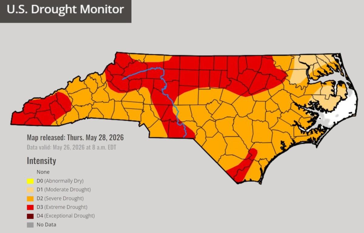
At the same time, there is some gradual improvement in long-term drought conditions across North Carolina.
North Carolina’s Weather Authority reports that the “exceptional drought” category has been removed statewide, marking a step forward after months of dry conditions. Extreme drought is also shrinking in coverage, including in parts of Western North Carolina, though many areas remain under drought designation.
Officials caution that recent heavy rain has been uneven and, in some cases, too intense to fully benefit soils and waterways. Short bursts of heavy rain can lead to runoff and localized flooding rather than soaking into the ground to replenish streams, creeks and reservoirs.
Still, forecasters say measurable progress is being made, particularly in parts of the mountains and foothills where recent rainfall has helped improve moisture levels.
Looking ahead, weather models suggest additional rounds of light to moderate rain could linger into the weekend before a potentially drier pattern develops early next week. A secondary cold front is expected to push through Sunday or Monday, which could finally bring a more sustained stretch of drier air to the region.
For now, Western North Carolina remains in a familiar spring-to-summer transition pattern: brief dry windows, scattered storms and a slow, uneven climb out of drought conditions.