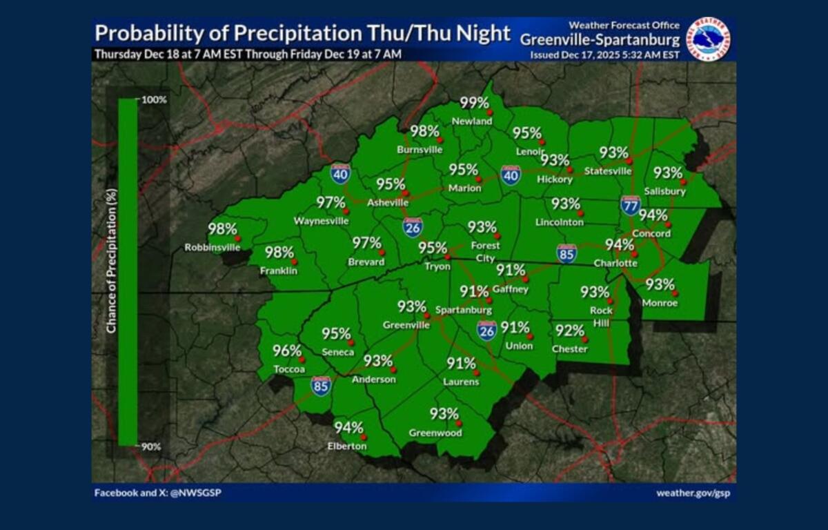

ASHEVILLE, N.C. (828newsNOW) — Rain is expected to return to Western North Carolina on Thursday as a cold front moves through the region, bringing periods of showers and cooler temperatures, according to the National Weather Service in Greenville-Spartanburg.
Forecasters said overnight low temperatures will continue a recent warming trend, rising to above normal for the first time in several days as deeper moisture spreads across the western Carolinas. Rain is expected to develop Thursday afternoon and continue through Thursday night.
The National Weather Service said rainfall will likely occur in two to three waves, with the first arriving by midafternoon Thursday, followed by additional rounds during the evening and early overnight hours. While flooding is not anticipated, officials warned that brief ponding on roadways and reduced visibility could occur at times.
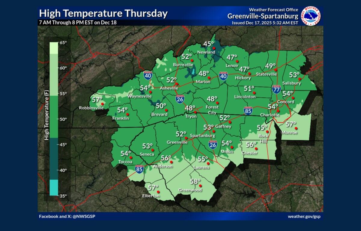
Temperatures on Thursday are expected to reach the upper 40s to mid-50s before cooler air arrives behind the front. By early Friday, the cold front is forecast to move east of the area, allowing lingering showers to end around or shortly after sunrise.
Drier conditions are expected to return Friday and continue into the weekend as high pressure builds in from the northwest. Gusty winds are forecast on Friday, with northwest winds potentially reaching 30 mph during the day.
In the Asheville area, skies will be mostly cloudy tonight with lows around 37 degrees. Rain is likely Thursday, mainly after 5 p.m., with highs near 55. Rain will continue into Thursday night, with total rainfall amounts ranging from a quarter to a half inch.
Friday is expected to be sunny but cooler, with a high near 47 and breezy northwest winds. Temperatures will drop into the upper 20s Friday night under mostly clear skies.