

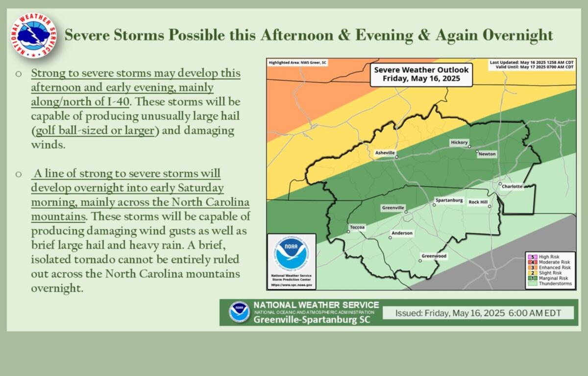
ASHEVILLE, N.C. (828newsNOW) — Isolated strong to severe thunderstorms may develop Friday afternoon and early evening across Western North Carolina, particularly along and north of Interstate 40, according to the National Weather Service.
These storms could produce golf ball-sized hail or larger, damaging wind gusts and possibly a brief tornado.
A line of showers and thunderstorms is expected to move across the North Carolina mountains overnight. There is some uncertainty about the timing and intensity of the system, as storms are expected to gradually weaken as they move east. Damaging wind gusts will be the primary threat, though large hail and heavy rainfall are also possible. A brief, isolated tornado cannot be ruled out, especially across the mountains.
The storm line is expected to move east of the mountains by Saturday morning. While weakening is expected, forecasters say brief, isolated strong to severe storms remain possible east of the mountains. However, confidence in severe weather for those areas is low.
Forecasters describe the overall setup as a complex and evolving situation, with multiple rounds of potentially severe weather from Friday afternoon through early Saturday.
The weekend forecast, according to the National Weather Service:
- Saturday: A 30 percent chance of showers and thunderstorms, mainly before 8 a.m. Cloudy through mid-morning, then gradual clearing, with a high near 84. West wind 6 to 13 mph, with gusts as high as 25 mph.
- Saturday night: Partly cloudy, with a low around 62. West northwest wind 6 to 9 mph, with gusts as high as 21 mph.
- Sunday: A 20 percent chance of showers after 3 p.m. Partly sunny, with a high near 82. Northwest wind 5 to 8 mph.
- Sunday night: Partly cloudy, with a low around 59.