
ASHEVILLE, N.C. (828newsNOW) — Western North Carolina could see a mix of dangerous heat and strong thunderstorms heading into the Fourth of July holiday weekend, according to the National Weather Service.
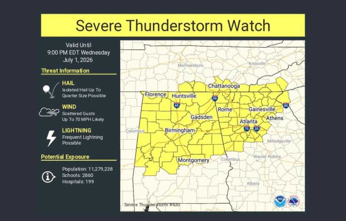
Forecasters on Wednesday issued a severe thunderstorm watch for portions of the North Carolina mountains, including Cherokee, Clay, Jackson and Macon counties, through 8 p.m. Isolated to scattered storms developing across the mountains could quickly become severe, with damaging wind gusts posing the primary threat and large hail also possible.
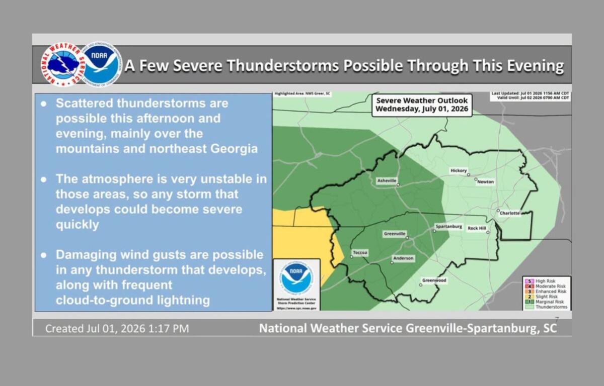
The National Weather Service office in Greenville-Spartanburg said a highly unstable atmosphere has developed across the mountains and parts of north Georgia, creating conditions favorable for strong storms through the afternoon and early evening.
While the greatest severe weather threat Wednesday is focused west of Asheville, forecasters say isolated strong to severe storms remain possible across the mountains over the next several days.
At the same time, a prolonged stretch of dangerous heat is expected to continue through the holiday weekend.
Forecasters say heat index values could exceed 105 degrees across portions of the North Carolina foothills and Piedmont through at least Saturday as an unusually strong upper-level ridge settles over the Southeast. Actual air temperatures are expected to climb into the upper 90s and low 100s in many lower-elevation communities, while mountain valleys could see highs in the low to mid-90s.
A Heat Advisory has already been issued for parts of the region, and additional advisories may be needed through the weekend.
“Precautions should be taken if spending time outdoors as this heat will be dangerous with quick onset of heat illness,” forecasters said.
For Asheville, the forecast calls for mostly sunny and hot conditions through Saturday, with daily chances of afternoon and evening thunderstorms.
Wednesday’s high is expected to reach about 93 degrees, with a 30 percent chance of showers and thunderstorms late in the day. Temperatures will climb to around 94 degrees Thursday and 95 degrees Friday and Saturday.
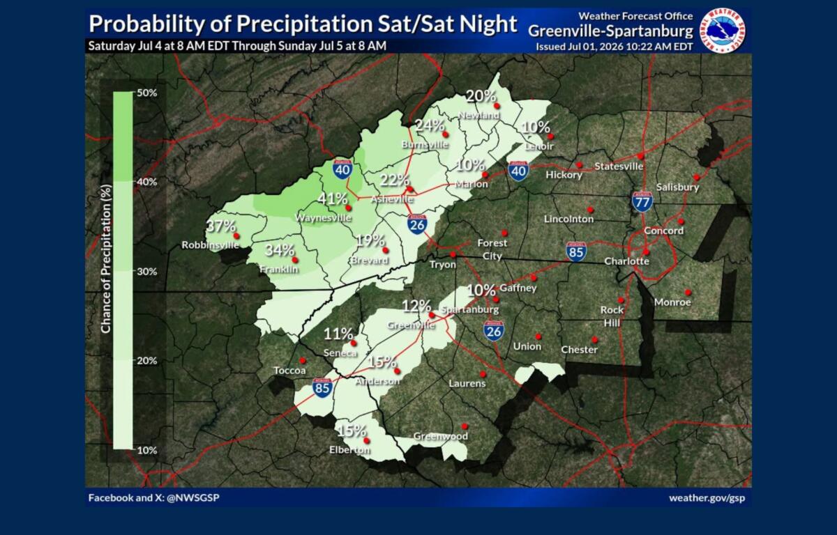
Those planning Independence Day celebrations should be prepared for summer heat but generally favorable weather. Saturday is expected to be sunny and hot with a high near 95 degrees, though isolated thunderstorms cannot be ruled out.
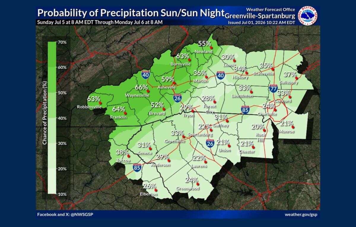
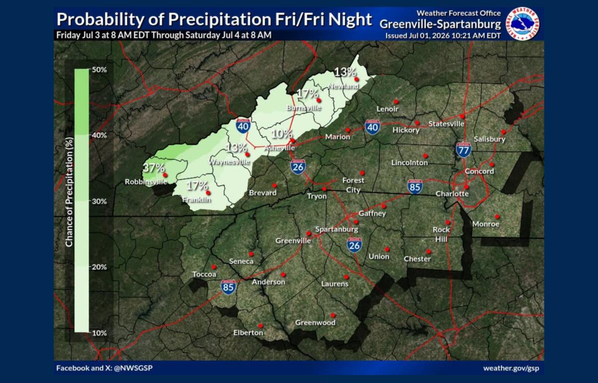
Rain and thunderstorm chances increase later in the weekend. Sunday’s forecast calls for a 60 percent chance of showers and thunderstorms, mainly during the afternoon and evening, with a high near 92 degrees.
Forecasters expect the intense heat to gradually ease by late Sunday and early next week as a more typical midsummer weather pattern returns, bringing seasonable temperatures and daily chances for afternoon thunderstorms across the mountains and foothills.
Residents are encouraged to stay hydrated, limit strenuous outdoor activity during the hottest part of the day and remain weather-aware for rapidly developing thunderstorms throughout the holiday weekend.