
ASHEVILLE, N.C. (828newsNOW) — Springlike weather has arrived across Western North Carolina, bringing unseasonably warm temperatures, dry conditions and an increased wildfire risk heading deeper into March, forecasters said Wednesday.
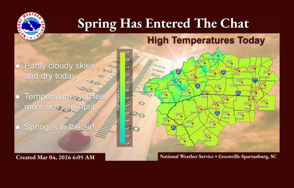
The National Weather Service in Greenville-Spartanburg said temperatures this week will feel more like late April than early March. Highs are expected to run 10 to 15 degrees above normal through the end of the workweek under mostly sunny to partly cloudy skies.
In Asheville, Wednesday’s high is forecast near 75 degrees with light winds. Temperatures are expected to climb into the upper 70s by Thursday and Friday, with mild overnight lows in the upper 40s and 50s.
While recent, well-timed rainfall has helped keep wildfire danger low across the Southern Appalachians and Piedmont, forecasters said the outlook for March is shifting. Record warmth combined with periods of dry weather is expected to dry out vegetation, increasing the potential for significant wildfires.
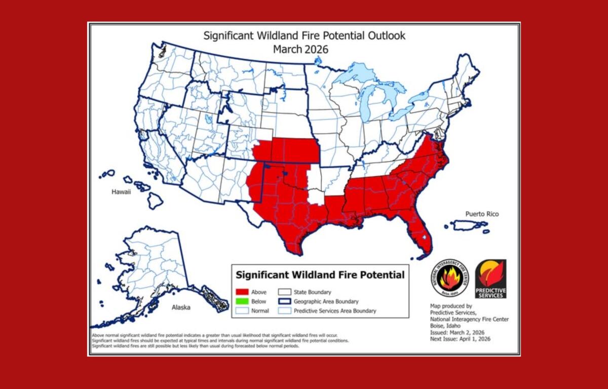
The fire risk is compounded by ongoing drought conditions and lingering timber damage from Tropical Storm Helene, which left downed trees and debris that can serve as fuel.
Rain chances are expected to increase over the weekend into early next week as a cold front approaches. Forecasters said a few showers and possibly thunderstorms could develop Friday afternoon, though precipitation chances remain around 20 percent. More widespread showers are possible over the weekend.
In addition to the warm weather, residents across North Carolina are being urged to participate in the annual statewide tornado drill scheduled for 9:30 a.m. Wednesday as part of Severe Weather Preparedness Week.
The drill, coordinated by the National Weather Service in cooperation with local broadcasters, will be conducted through a Required Monthly Test on NOAA Weather Radio and the State Emergency Alert System. No actual tornado warning will be issued.
Officials said some NOAA Weather Radio receivers may not sound an audible alarm during the test but may instead display a visual alert. Schools, businesses and families are encouraged to practice their tornado safety plans during the drill.
Forecasters cautioned that patchy morning fog and low clouds are possible over the next several days, but conditions are expected to remain largely dry and warm until the weekend system moves in.