
ASHEVILLE, N.C. (828newsNOW) — A stretch of mild, dry weather will give way to a wet and potentially disruptive start to the Thanksgiving travel period before a sharp blast of cold air settles over Western North Carolina later this week, according to the National Weather Service in Greenville-Spartanburg.
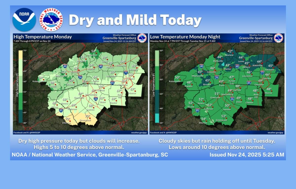
Forecasters say Monday will remain mostly sunny with highs near 64 degrees — about 5 to 10 degrees above normal — before clouds build overnight. Lows will remain unseasonably warm, around 46 degrees.
Rain is expected to move in Tuesday morning, with an 80 percent chance of showers and highs near 60. Widespread showers and a few thunderstorms are likely Tuesday night as a moist cold front crosses the region. Lows will hover around 52 degrees, roughly 20 degrees above what is typical for late November.
Showers should taper early Wednesday, leaving mostly sunny skies and a high near 65. Winds will turn northwest and become gusty, with gusts up to 24 mph possible as colder air begins pushing in. By Wednesday night, temperatures will drop sharply, falling to about 29 degrees.
Thanksgiving Day is expected to be sunny but cold, with a high near 45. Overnight lows could dip to about 24 degrees. The coldest air of the week arrives Friday, when temperatures are forecast to top out near 43 degrees — 10 to 20 degrees below seasonal norms in what forecasters describe as a short but intense cold blast.
The National Weather Service warns that Tuesday could be troublesome for holiday travelers because of rain and occasional thunderstorms. Shoppers heading out for Black Friday should prepare for breezy and sharply colder conditions.
Temperatures are expected to gradually moderate over the weekend, returning closer to normal by Sunday.