
ASHEVILLE, N.C. (828newsNOW) — Rain is expected to move into Western North Carolina late Wednesday, bringing steady showers through Thursday before drier conditions return for the weekend, according to the U.S. National Weather Service in Greenville-Spartanburg.
Forecasters say rain will increase from west to east late Wednesday afternoon into Thursday morning as a cold front moves into the region and stalls, creating a stationary boundary across the southern Appalachians. Moisture flowing northward into the Tennessee Valley and mountains is expected to enhance rainfall, especially along west- and southwest-facing ridges.
Rain chances climb to between 50 percent and 80 percent overnight into early Thursday across much of the forecast area. Lows will remain 10 to 15 degrees above normal, keeping all precipitation in the form of rain.
Another disturbance moving along the stalled front Thursday will keep showers likely through the day. Rain is expected to taper off from northwest to southeast Thursday night as the system pushes east.
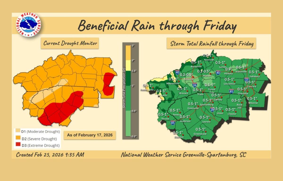
Storm totals are forecast to range from 1 to 2 inches across the mountains and from 0.5 to 1.25 inches in areas outside the mountains. Despite the steady rainfall, forecasters say the flooding threat remains minimal due to ongoing drought conditions, with the precipitation expected to provide beneficial moisture.
Some weak instability could develop south of the Interstate 85 corridor, and an isolated rumble of thunder cannot be ruled out. However, no severe storms are expected. Gusty winds are possible ahead of and behind the front, particularly in higher elevations, but are forecast to remain below advisory levels.
In Asheville, showers are expected mainly after 11 p.m. Wednesday, with a low around 42 degrees. Rain will continue Thursday morning, with patchy fog possible before noon and a high near 57 degrees. Showers should diminish Thursday night, with mostly cloudy skies and a low around 45.
Drier weather returns Friday, with partly sunny skies and a high near 60. A warming trend is expected through the weekend, with sunny conditions Saturday and highs in the mid-60s, followed by partly sunny skies Sunday and highs in the upper 60s.
Rain chances are expected to return early next week, along with cooler temperatures, according to the weather service.