
ASHEVILLE, N.C. (828newsNOW) — Western North Carolina is enjoying a stretch of mild, sunny weather this week, but forecasters say a sharp blast of winter air is on the way early next week.
According to the National Weather Service in Greenville-Spartanburg, dry conditions and seasonably warm temperatures will continue through the end of the week, with highs in the upper 60s to low 70s and mostly clear skies.
A weak cold front is expected to bring scattered rain showers over the weekend, followed by a stronger front on Sunday that could drop temperatures dramatically.
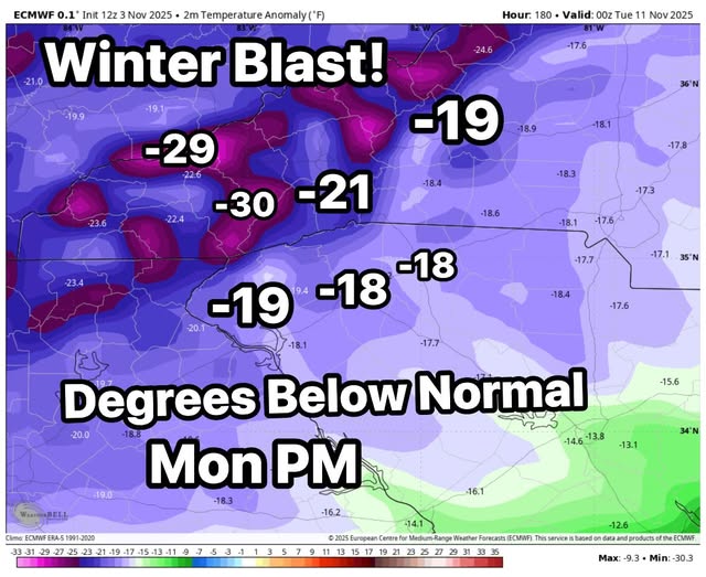
The National Weather Service in Raleigh reports that the 6- to 10-day forecast is trending cooler than normal, with “some of the coldest air thus far this season” expected early next week.
Local meteorologists said they expect the temperature drop will be significant, with Monday’s readings running 20 to 30 degrees below average. The incoming front could bring strong winds and snow showers in the higher elevations north of Interstate 40.
For now, Asheville’s forecast remains pleasant: sunny skies and highs near 67 on Tuesday, warming to the mid-70s on Wednesday before cooling again toward the weekend. Rain is likely Friday night, with a 70 percent chance of precipitation.