
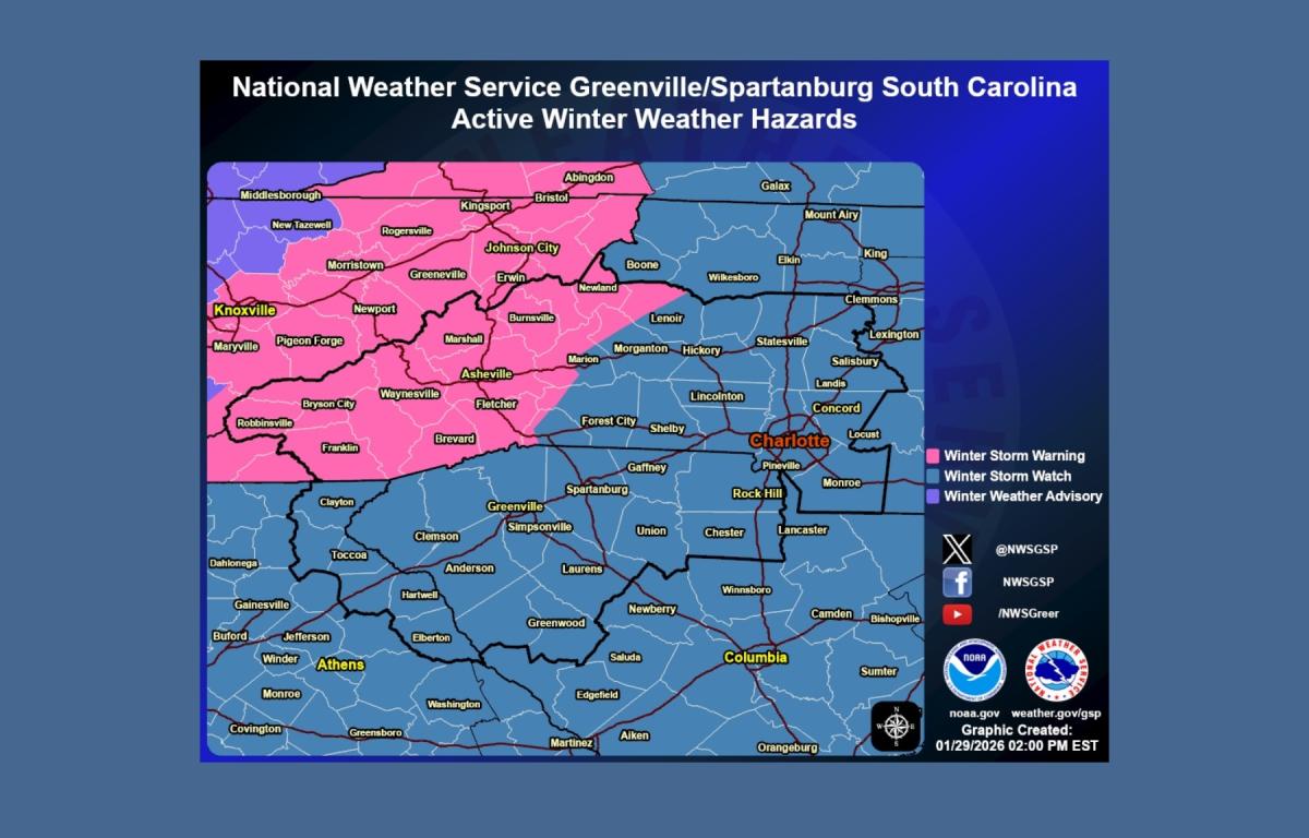
ASHEVILLE, N.C. (828newsNOW) — The National Weather Service has upgraded a winter weather advisory for the Asheville area and the North Carolina mountains to a winter storm warning as a significant storm is expected to bring heavy snow, strong winds and dangerously cold temperatures from Friday into Saturday night.
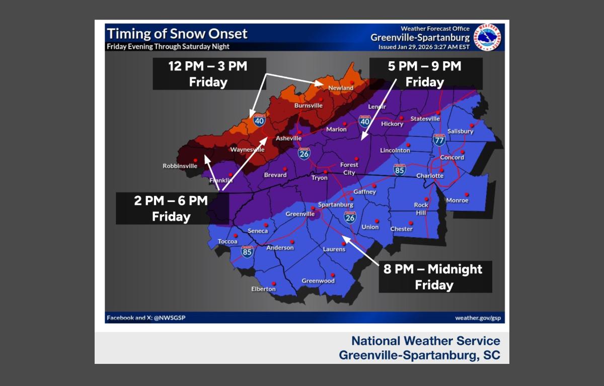
The weather service in Greenville-Spartanburg said the storm is forecast to begin Friday afternoon and continue through Saturday night, with snow as the primary precipitation type and travel conditions expected to deteriorate quickly.
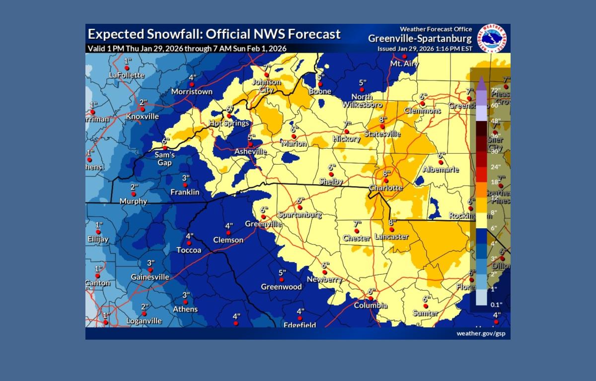
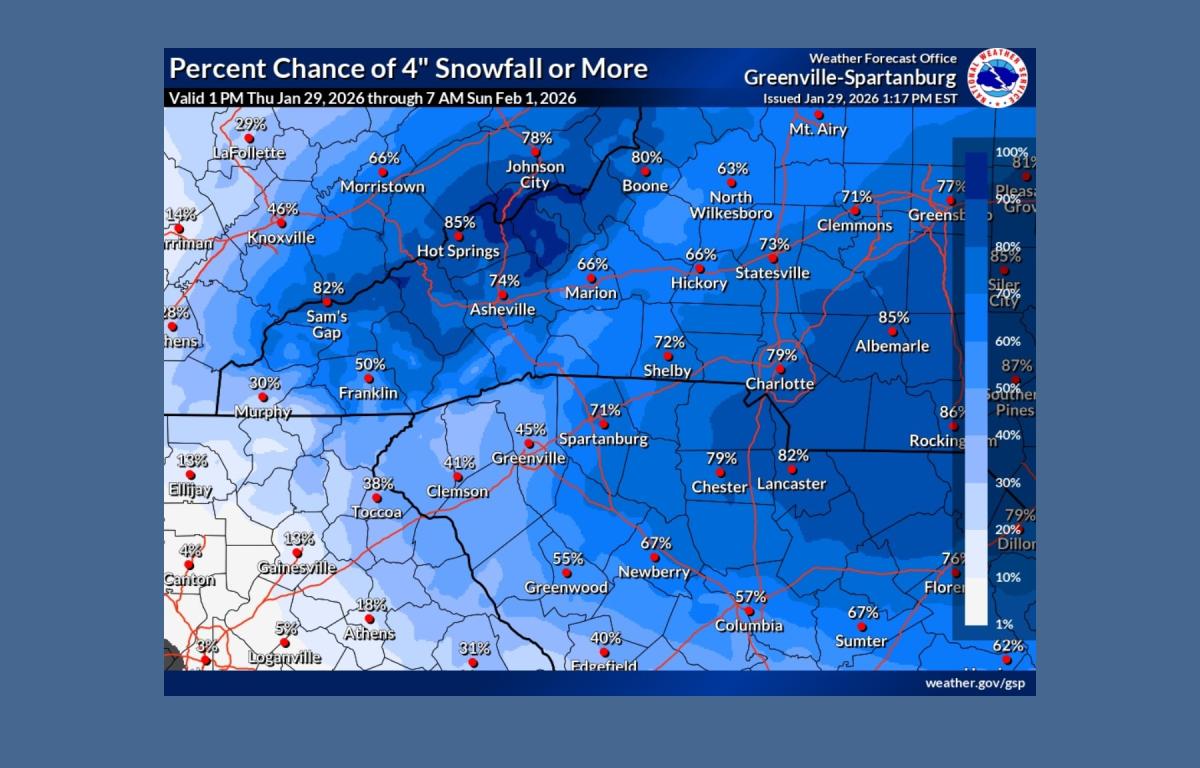
Forecasters said at least 2 to 4 inches of snow is expected across much of the area, with locally higher totals of 8 to 12 inches possible where bands of heavier snow develop. The exact location of the heaviest snowfall remains uncertain, though some models indicate the axis could shift southwest toward the Interstate 26 corridor.
Strong winds combined with dry, powdery snow could create blowing snow and reduced visibility. Brief, isolated blizzard-like conditions cannot be ruled out, the weather service said.
Cold temperatures before and during the storm are expected to allow snow to stick rapidly to roadways, leading to significant travel impacts through the weekend.
An extreme cold watch has also been issued for the entire region as very cold air moves in during and after the storm. In the mountains, the watch is in effect from Saturday afternoon through Sunday afternoon. East of the mountains, it runs from Saturday evening through Sunday morning.
Overnight lows are forecast to fall into the single digits and low teens Saturday night. Combined with gusty winds, wind chill values could range from 10 to 20 degrees below zero in the mountains and from zero to 10 below east of the mountains.
The weather service warned that wind chills of that magnitude could lead to hypothermia or frostbite if precautions are not taken.
The forecast calls for increasing clouds and a low around 21 degrees Thursday night. A chance of snow begins late Friday, with steadier snowfall expected Friday night into Saturday. Conditions are expected to turn drier and gradually warmer early next week, with precipitation chances returning by midweek.