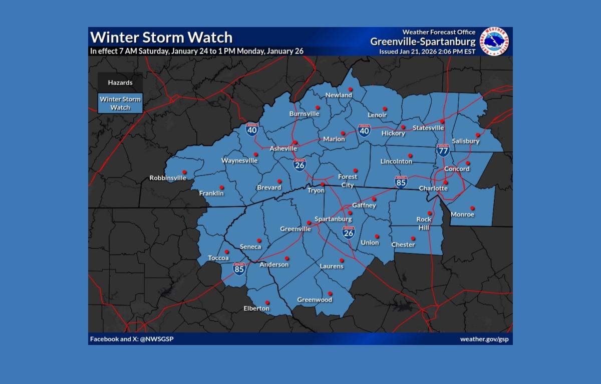

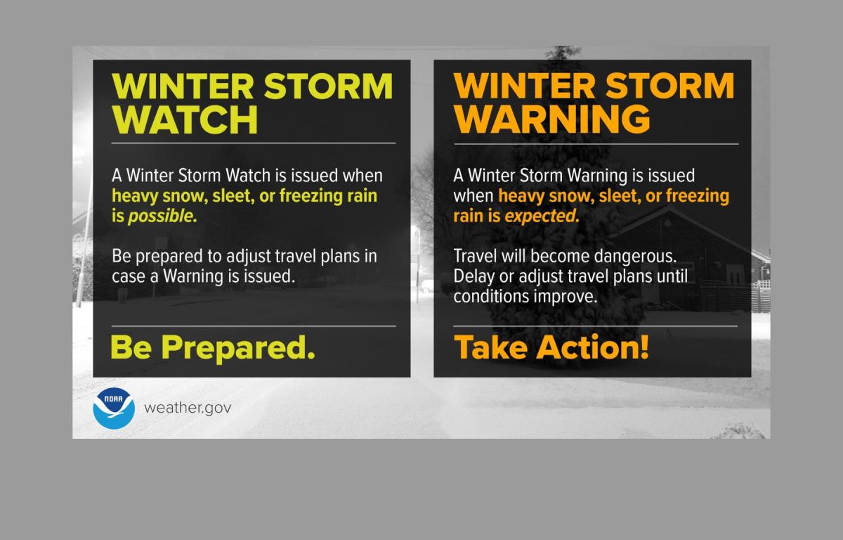
ASHEVILLE, N.C. (828newsNOW) — A Winter Storm Watch is in effect from Saturday morning through Monday afternoon for much of Western North Carolina, northeast Georgia and South Carolina’s Upstate, with forecasters warning of hazardous travel, heavy ice and snow, and the potential for widespread, long-lasting power outages.
The National Weather Service in Greenville-Spartanburg said the storm could bring a mix of snow, sleet and freezing rain beginning Saturday morning. Total snow and sleet accumulations of 1 to 6 inches are possible, along with ice accumulations ranging from four-tenths of an inch to as much as 1 inch in some areas.
Forecasters said the heaviest snow and sleet are most likely north of Interstate 40, while the greatest ice accumulations are expected across the southern North Carolina mountains, northeast Georgia mountains and parts of the South Carolina mountains.
Ice buildup on trees and power lines could lead to widespread outages that may last for several days, the weather service said. Roads could become treacherous or impassable, and hazardous conditions may impact the Monday morning commute.
Gov. Josh Stein on Wednesday declared a State of Emergency for North Carolina and urged residents to complete preparations and avoid unnecessary travel.
“A winter storm is approaching, and now is the time to prepare,” Stein said in a statement. “Get everything you need in advance of the storm and have a plan in case your power goes out. I encourage all North Carolinians to stay home and off the roads this weekend unless absolutely necessary so first responders can do their jobs safely and effectively.”
The State Emergency Response Team has been activated, and transportation officials said crews have been pre-treating roads, bridges and overpasses with brine, restocking salt supplies and preparing equipment. NCDOT crews are expected to work around the clock through the weekend as conditions deteriorate.
Transportation regulations have also been temporarily waived for vehicles supporting emergency response efforts to improve coordination, state officials said.
Road conditions are expected to worsen early Saturday and may remain hazardous for several days due to prolonged subfreezing temperatures. Officials warned that storm impacts could linger into next week as snowpack, ice accumulation and dangerously cold wind chills persist.
Emergency management officials urged residents to closely monitor forecasts, limit travel, charge electronic devices and use NOAA weather radios or alert apps for updates. Drivers are encouraged to carry winter emergency kits in their vehicles, and residents are asked to check on neighbors, especially the elderly.
Officials also reminded residents to use generators outdoors, avoid burning charcoal indoors, properly vent kerosene heaters and rely on battery-powered lighting instead of candles to reduce fire risk.