

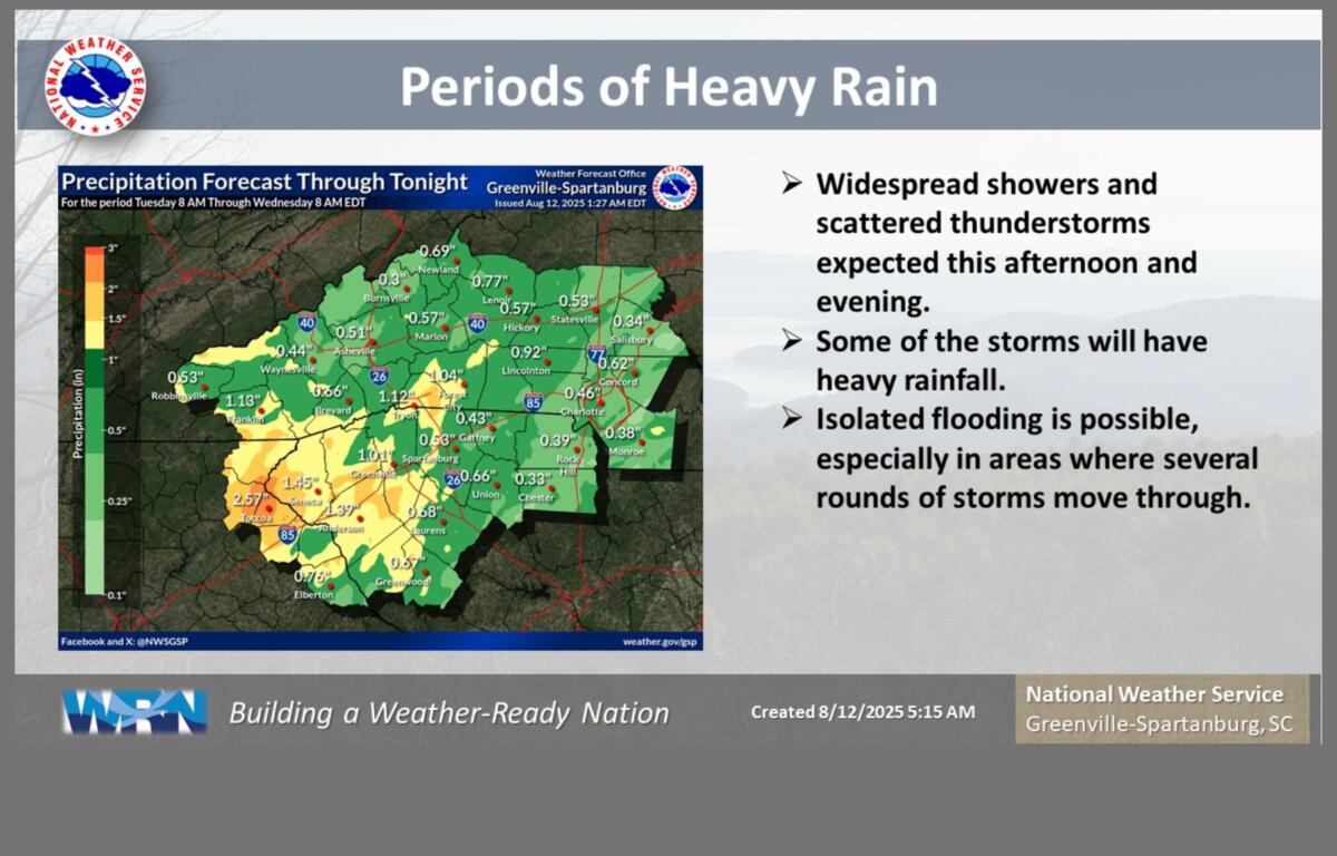
ASHEVILLE, N.C. (828newsNOW) — Widespread showers and scattered thunderstorms are expected across Western North Carolina this afternoon and evening, with heavy rainfall likely in some areas, forecasters said.
Rainfall totals of 1 to 3 inches are possible, especially along and west of the Interstate 26 corridor, according to the National Weather Service in Greenville-Spartanburg. The heaviest amounts are expected in the North Carolina Foothills, where already saturated ground could increase the risk of isolated flooding in low-lying or poor-drainage areas.
Multiple rounds of storms are forecast to continue into tonight, with muggy conditions and high temperatures struggling to reach the low 80s.
Rain chances remain high through midweek, with an 80 percent chance of showers and thunderstorms Wednesday and a 60 percent chance Thursday.
Meanwhile, in the Atlantic, Tropical Storm Erin formed Monday off the coast of Africa. Forecasters expect gradual strengthening into a hurricane over the next week but say there is no immediate threat to the Carolinas or northeast Georgia.