
ASHEVILLE, N.C. (828newsNOW) — An ice storm warning has been issued for the Asheville area and much of Western North Carolina, with hazardous winter weather expected to begin Saturday afternoon and last through early Monday, according to the National Weather Service.
Forecasters say Buncombe County and surrounding mountain communities could see significant icing, along with sleet and snow, beginning around 1 p.m. Saturday and continuing until about 7 a.m. Monday. Snow and sleet accumulations could reach up to 2 inches, while ice accumulation may approach 1 inch. Wind gusts could reach 40 mph.
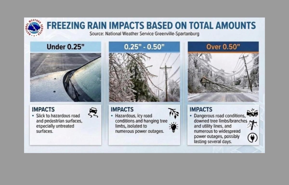
The combination of ice, snow and wind is expected to make road conditions dangerous or impassable across the Asheville area, particularly Saturday night and early Sunday. Officials warn that widespread power outages are likely as ice-laden tree limbs and power lines snap under the weight, with some outages potentially lasting for several days.
The most intense period of icing is expected between Saturday evening and midnight Sunday, when accumulations are forecast to increase rapidly. While ice buildup is expected to taper off Sunday evening, light snow could linger into Sunday night and early Monday, possibly affecting the Monday morning commute.
Residents are urged to avoid travel if possible and to prepare for prolonged power outages. Those who must travel are advised to carry emergency supplies, including food, water and a flashlight. State road conditions can be checked by calling 511.
An ice storm warning means severe winter weather is expected, with conditions that can severely disrupt travel and daily activities.