
ASHEVILLE, N.C. (828newsNOW) — After a brief break from winter precipitation, another round of unsettled weather is expected to move into the Asheville area Friday afternoon, bringing rain, snow, strong winds and dangerously cold temperatures.
Forecasters say a strong cold front and fast-moving system will arrive later Friday, following a short warm-up earlier in the day. High temperatures are expected to reach the 40s across much of the region, with some areas briefly climbing into the low 50s before temperatures fall sharply Friday night.
Rain and snow are expected to develop in the mountains after lunchtime, with snow more likely at higher elevations. Farther east, precipitation is expected to fall mainly as rain, though a brief mix with snow cannot be ruled out in northern areas. Winds will increase throughout the day and become strong and gusty Friday night into Saturday.
The National Weather Service has issued a Winter Weather Advisory for all elevations in Avery, Mitchell, Yancey and Madison counties from Friday afternoon through early Saturday. Light snow accumulations are expected outside the highest elevations, with travel impacts possible.
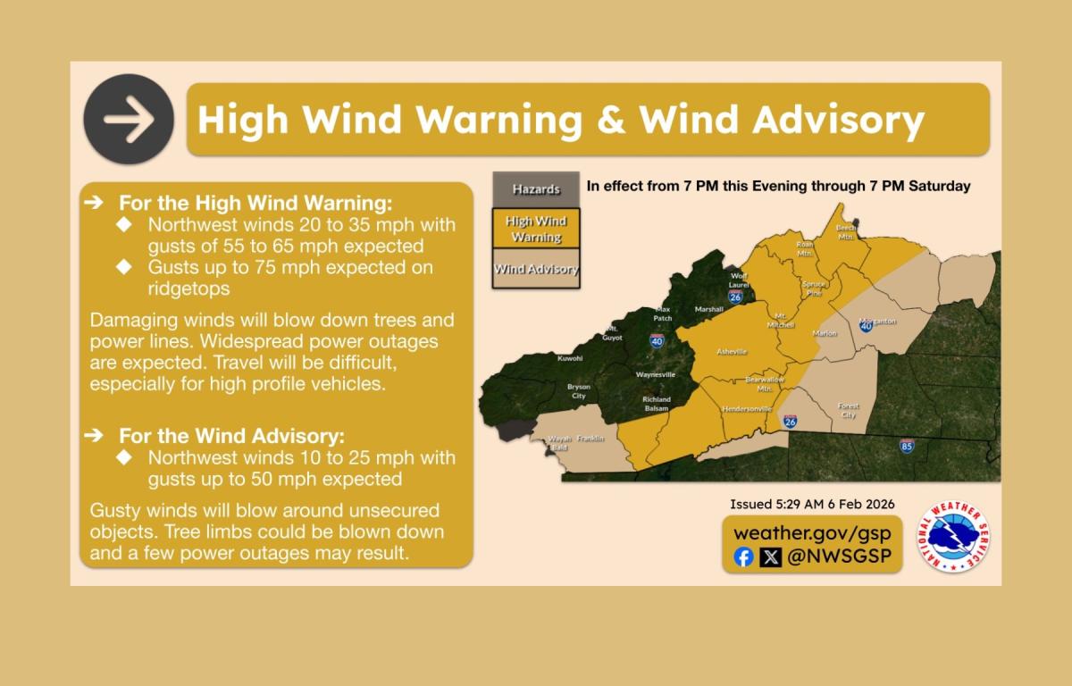
A High Wind Warning is in effect for portions of the North Carolina mountains along and west of the Blue Ridge Escarpment, with a Wind Advisory in effect for nearby foothill areas. Wind gusts of 55 to 65 mph are possible in warning areas, with gusts of 45 to 55 mph elsewhere. Officials warn the winds could bring down tree limbs, cause power outages and result in minor structural damage.
A Cold Weather Advisory has also been issued for parts of the mountains late Friday night through Sunday morning. Wind chills could drop to dangerous levels, increasing the risk of hypothermia or frostbite.
Forecasters also cautioned that if conditions dry out ahead of Saturday, areas along and east of the Blue Ridge could approach critical fire weather conditions due to low humidity and strong winds.
Conditions are expected to remain windy and cold through Saturday, with sunny skies but highs only near freezing. Temperatures are forecast to moderate by Sunday, with calmer conditions and highs returning to the 40s.