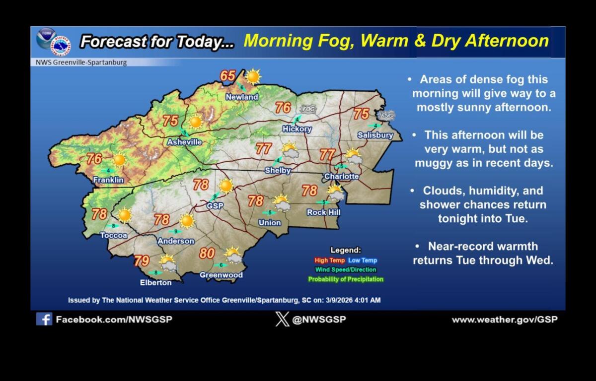

ASHEVILLE, N.C. (828newsNOW) — Areas of dense fog are expected across Western North Carolina on Monday morning before skies gradually clear, giving way to a mostly sunny and unseasonably warm afternoon, according to the National Weather Service.
Forecasters with the National Weather Service office in Greenville-Spartanburg said fog and low clouds could linger through much of the morning before drier conditions develop later in the day. High temperatures are expected to reach the mid-70s in the Asheville area, well above normal for early March.
Humidity will also be slightly lower Monday compared with the past several days, though forecasters say the warm pattern will continue.
Clouds and moisture are expected to increase overnight, bringing a chance of showers early Tuesday morning. A 30 percent chance of showers is forecast late Monday night, with temperatures falling to around 52 degrees.
Showers and possible thunderstorms could develop Tuesday afternoon as temperatures climb near 80 degrees. The warm conditions are expected to continue Wednesday, with highs around 81 degrees and gusty southwest winds.
Forecasters say near-record warmth is possible Tuesday and Wednesday before a strong cold front moves through the region Wednesday night.
The front could bring widespread showers and isolated thunderstorms, with a low-end threat for severe weather. Rain chances increase to about 80 percent Wednesday night into early Thursday.
Much cooler and drier conditions are expected behind the front. Thursday’s high is forecast near 53 degrees, with clearing skies and overnight lows dropping to around 31 degrees. Sunshine is expected to return Friday with a high near 66.
Weather officials say the stretch of warmth early this week will feel more like May than early March before temperatures return closer to seasonal norms later in the week.