


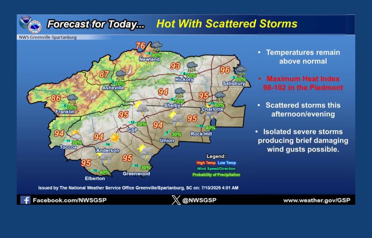

ASHEVILLE, N.C. (828newsNOW) — After a stretch of hot, dry weather, Western North Carolina is headed into a more active weather pattern with several chances for showers and thunderstorms through early next week.
The National Weather Service office in Greenville-Spartanburg said Friday marks the beginning of a wetter period, with the best chances for rain arriving during the afternoon and evening hours. Storm activity could continue overnight and into Saturday morning.
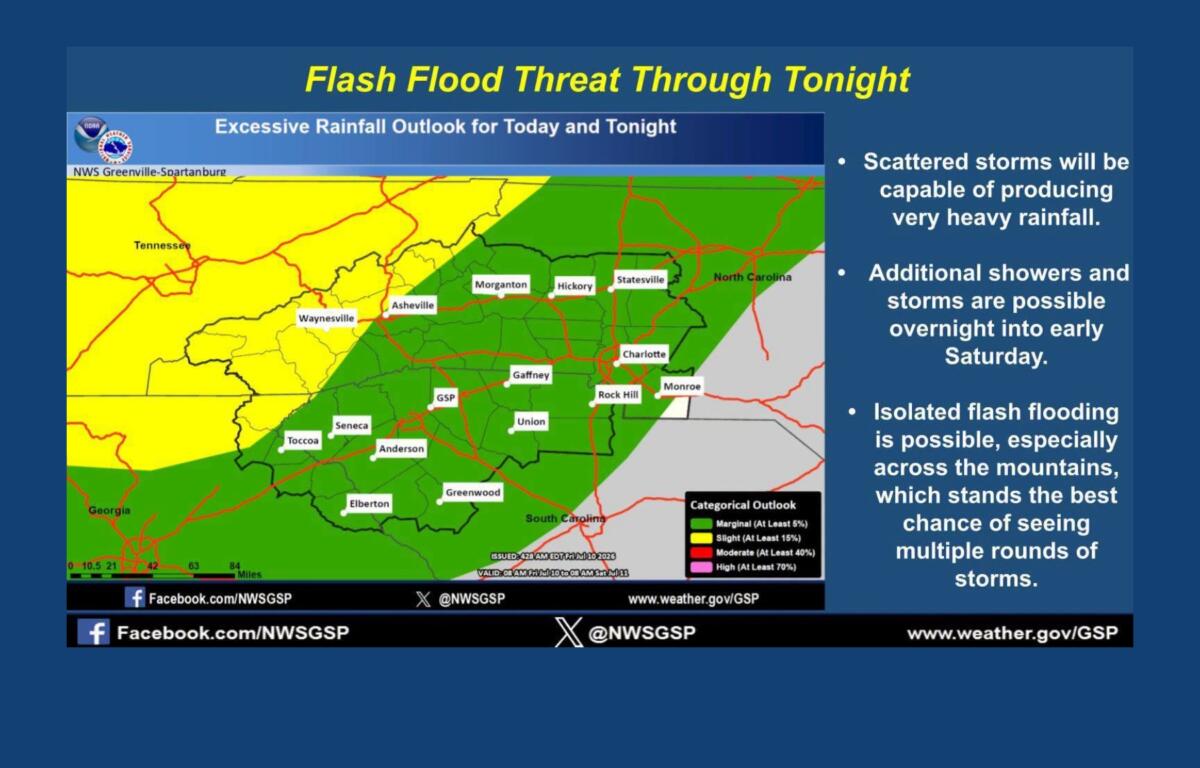
Forecasters say isolated strong storms are possible, with the main threats being gusty winds and localized flooding, especially in the mountains, where repeated rounds of rain could develop.
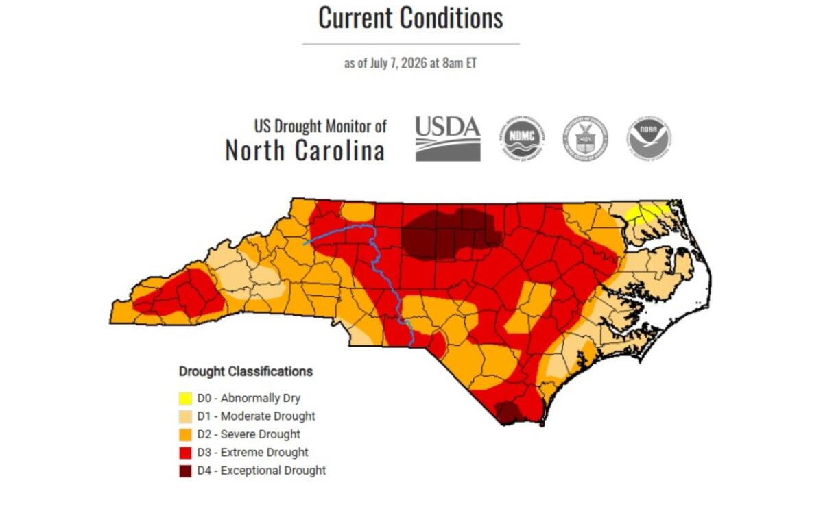
Despite the incoming rain, drought conditions continue across much of Western North Carolina.
According to the North Carolina Drought Management Advisory Council’s latest update, several mountain counties remain in drought categories ranging from moderate to extreme. Haywood, Jackson, Macon, Swain and Transylvania counties are listed in extreme drought, while Henderson, Polk, Rutherford, Yancey, Mitchell and other nearby counties are experiencing severe drought.
Buncombe and Madison counties are currently classified as being in moderate drought.
State officials say recent rainfall in some parts of North Carolina has helped reduce water demand but has not been enough to erase the state’s larger rainfall deficit.
“Localized heavier rainfall may help alleviate demand for water for irrigation or other uses but did not lead to substantial improvements in the state’s drought conditions,” the state Division of Water Resources said.
Officials said the location and timing of rainfall matter. Heavy rain in one area does not necessarily replenish reservoirs, groundwater supplies or soil moisture across a broader region.
Western North Carolina has been among the areas with some of the largest rainfall deficits compared with historical averages. Boone is more than 22 inches below normal rainfall for the year, according to the NC State Climate Office.
Forecasters say the upcoming storms could bring some relief, but the rainfall may be uneven, with some locations receiving significant amounts while others see little accumulation.
Cooler weather arrives after heat
Friday will likely be the last of the hottest days for a while, with Asheville temperatures expected to climb into the upper 80s. The National Weather Service said temperatures are running about 5 degrees above normal.
The forecast calls for a cooling trend beginning this weekend, with highs falling into the low to mid-80s Saturday and Sunday.
By Monday, a push of cooler air is expected to bring much cooler conditions, with highs near 78 degrees — about 10 degrees below normal for this time of year.
The cooler weather will come with additional rain chances.
Asheville-area forecast
- Friday: A 60% chance of showers and thunderstorms, mainly during the afternoon and evening. High near 87.
- Saturday: Showers and thunderstorms likely, with a high near 84.
- Sunday: A wetter day with an 80% chance of showers and storms. High near 83.
- Monday: Showers likely with possible thunderstorms. High near 78.
- Tuesday: Cooler conditions continue before temperatures begin to rebound later in the week.
Meteorologists caution that outdoor plans through the weekend should include preparations for changing conditions, including lightning, heavy rain and the possibility of brief flash flooding.
Residents in drought-affected areas are also encouraged to continue conserving water and follow any restrictions issued by local water systems.