


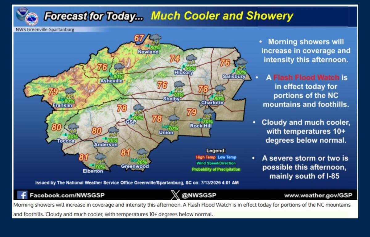

ASHEVILLE, N.C. (828newsNOW) — Rain-soaked roads greeted Asheville and Buncombe County residents Monday morning, and while Buncombe County is not under a Flood Watch, forecasters say the threat of localized flash flooding isn’t over yet.
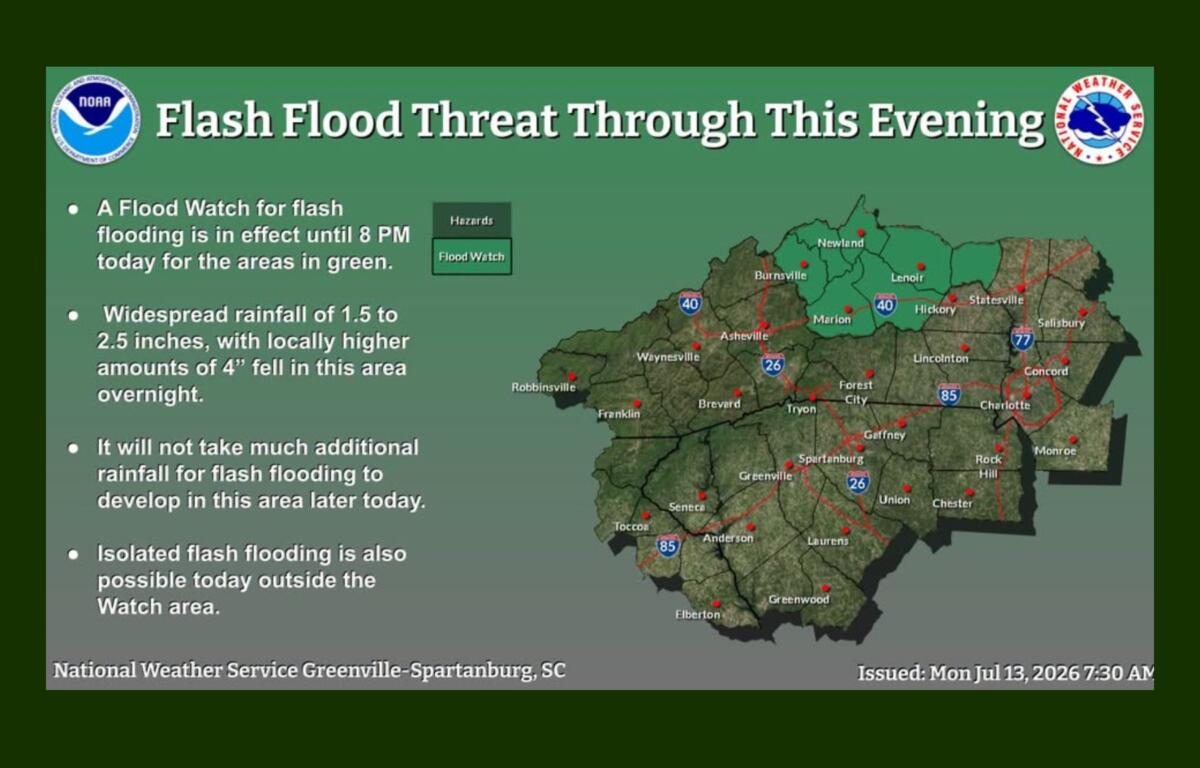
The National Weather Service is warning that additional rounds of showers and thunderstorms could bring heavy rainfall to much of Western North Carolina through Monday evening. While the greatest flood threat is expected north and east of Buncombe County, isolated flash flooding remains possible across the Asheville area wherever slow-moving storms develop.
A Flood Watch remains in effect through 8 p.m. for portions of the northern North Carolina mountains and foothills, including Avery, Yancey, Mitchell and McDowell counties, including communities such as Burnsville, Newland, Spruce Pine, Marion, Morganton and Old Fort, where saturated ground and additional rainfall could quickly lead to dangerous flash flooding.
As of about 7:45 a.m., widespread rainfall totals of 1.5 to 2.5 inches had already fallen across parts of the region, with some locations receiving as much as 4 inches overnight. Forecasters said it won’t take much additional rain to trigger flooding in areas that have already been soaked.
Although the heaviest overnight storms weakened by daybreak, scattered showers lingered across the region Monday morning. Meteorologists expect another round of showers and thunderstorms to develop during the afternoon and evening as warm, moisture-rich air remains in place.
By Monday evening, much of Western North Carolina could receive 2 to 4 inches of rain over a 24-hour period, with isolated areas seeing 5 inches or more.
For Asheville and Buncombe County, the primary concern will be localized flooding in low-lying areas, along creeks and streams, and on roads with poor drainage if heavy rain repeatedly moves over the same locations.
“Excessive runoff may result in flooding of rivers, creeks, streams and other low-lying and flood-prone locations,” the weather service said.
Residents living near the French Broad River, Swannanoa River and smaller waterways should remain alert for rapidly changing conditions during periods of heavy rainfall. Drivers should also be prepared for ponding on roads, reduced visibility and brief street flooding, particularly during the afternoon commute.
Forecasters also say a few strong to severe thunderstorms could develop Monday afternoon, mainly across the southern part of the forecast area. While widespread severe weather isn’t expected, a few storms could produce damaging wind gusts.
The clouds and steady rainfall will also keep temperatures unusually cool for mid-July. Highs in Asheville are expected to remain in the 70s through Tuesday — about 10 degrees below normal for this time of year.
Conditions are expected to gradually improve Tuesday as drier air moves into the region. While a few showers may linger along the eastern mountain slopes and near the Tennessee border, much of Buncombe County and the rest of Western North Carolina should see fewer storms by Tuesday afternoon.
Looking ahead, forecasters expect a return to more typical summer weather later this week as high pressure builds over the Southeast. Hotter temperatures and fewer afternoon thunderstorms are expected from Wednesday through next weekend.
The National Weather Service encourages residents to monitor forecasts throughout the day, as localized flooding can develop quickly even outside the Flood Watch area. Drivers should never attempt to cross flooded roadways and should be prepared to move to higher ground if a Flash Flood Warning is issued.