
ASHEVILLE, N.C. (828newsNOW) — Western North Carolina could see a little bit of everything heading into Thanksgiving, with temperatures near 70 degrees Friday giving way to weekend rain chances, a sharp cooldown and even the possibility of snow by the holiday.
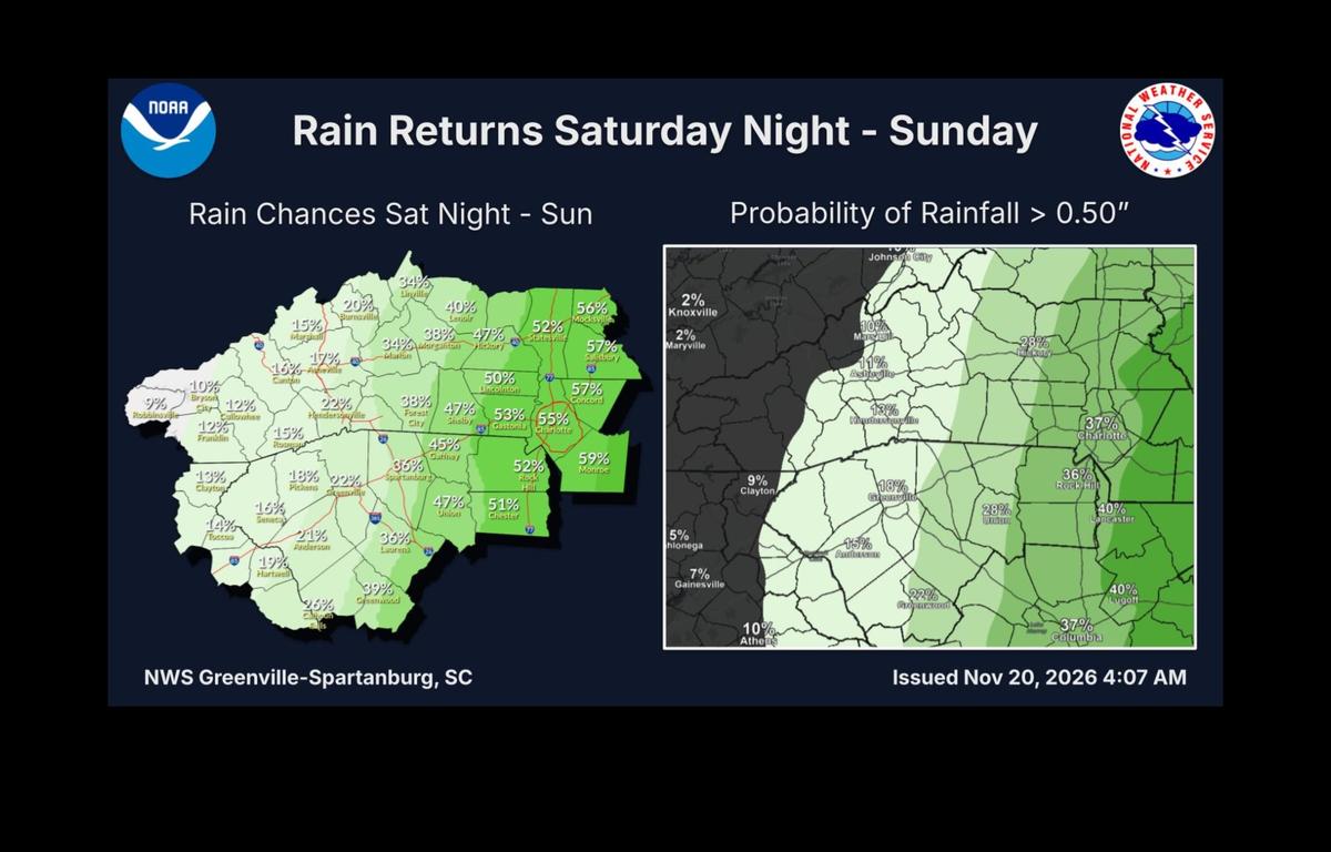
The National Weather Service in Greenville-Spartanburg says a developing coastal storm could bring rain to parts of the Carolinas late Saturday into Sunday. But forecasters are still uncertain about where the storm will track and how much rain it might bring.
For Asheville, the chance of rain Saturday night is just 20 percent, with mostly sunny skies and a high near 66 expected Sunday.
Areas east of the mountains have a better chance of seeing rain. The Weather Service puts the probability at about 38 percent in Morganton, 47 percent in Hickory and 55 percent in Charlotte.
How much rain falls will depend on the path of a storm system expected to move northward along the Southeast coast.
If the storm tracks farther west, more rain could reach the Carolinas. A track farther east would keep much of it offshore.
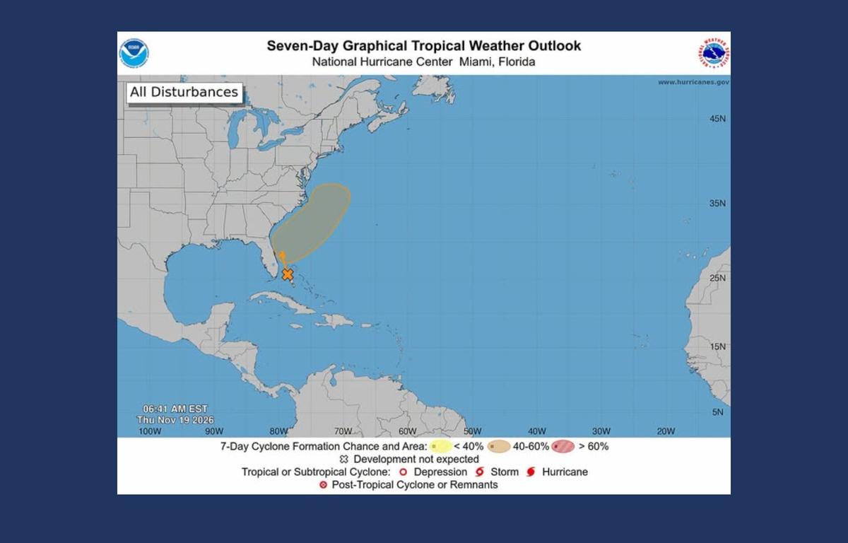
The system could also become a subtropical or tropical cyclone, although forecasters expect the greatest impacts, including gusty winds, dangerous surf and coastal flooding, to remain closer to the coast.
Little impact from the coastal storm is expected in Western North Carolina.
Colder weather arrives before Thanksgiving
The bigger change for the mountains could come early next week.
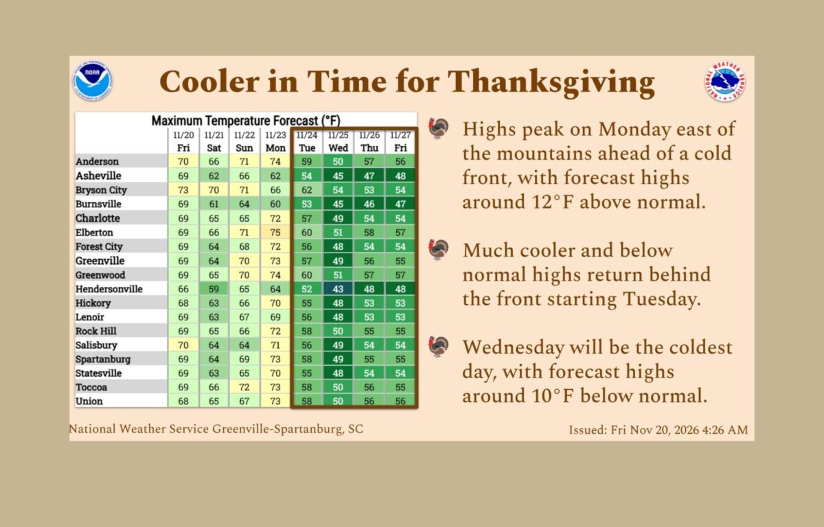
After a mild weekend, a cold front is expected to move through Monday, bringing a chance of light rain to the mountains and sending temperatures sharply lower.
Asheville’s forecast high of 62 degrees Monday is expected to drop to 54 Tuesday and just 45 Wednesday.
Wednesday could be the coldest day of the week, with afternoon temperatures running about 10 degrees below normal across the region.
And with colder air moving in, some of the precipitation could fall as snow.
The Weather Service is forecasting a 30 percent chance of rain and snow in Asheville Tuesday night, with temperatures dropping to around freezing.
Rain and snow are likely Wednesday, when the chance of precipitation increases to 60 percent.
The possibility of wintry weather continues into Thanksgiving Day, Thursday, Nov. 26, with a 30 percent chance of rain and snow and a high near 47 degrees in Asheville.
Another storm system could develop off the Southeast coast around the middle of next week, bringing a better chance of widespread precipitation.
Forecasters aren’t yet sure whether the mountains will see much snow, if any. For now, the forecast does not include snowfall accumulation estimates for Asheville.
Rain could help dry conditions
The possibility of rain comes as drought conditions continue across parts of North Carolina.
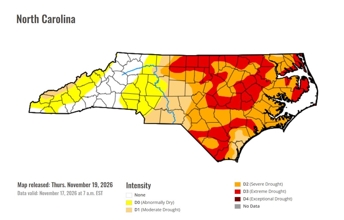
The latest U.S. Drought Monitor, released Thursday, Nov. 19, shows portions of Western North Carolina experiencing abnormally dry conditions or moderate drought. Much of central and eastern North Carolina is dealing with more serious drought conditions, including areas classified as being in extreme drought.
The dry weather is also raising some wildfire concerns. The National Weather Service says low humidity will create somewhat elevated wildfire danger in the mountains Friday, although winds are expected to remain relatively light.
Rain would be welcome in unusually dry areas, but forecasters aren’t yet sure how much will fall this weekend or next week.
For people traveling over Thanksgiving, Wednesday and Thursday are the days to watch. Colder temperatures could bring snow to parts of the mountains, although forecasters say it’s too early to know whether it will cause any problems.